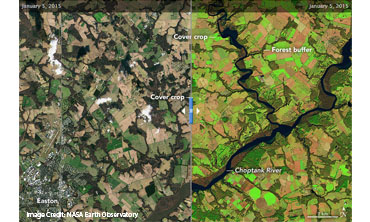
International Archives of the Photogrammetry Remote Sensing and Spatial Information Science. 2020. Vol. XLII-3/W11, 125-130. Julio Peredo, Callum Wayman, Benjamin Whong, Alison Thieme, Logan R. Kline, Sunita Yadav, Bryan Eder, Victor Lenske, Diane Portillo, Sean McCartney, John Fitz, Perry Oddo, Jason Keppler, Dean Hively, John Bolten, Greg McCarty, and Adam Lyon. Utilizing Landsat and Sentinel-2 to Remotely Monitor and Evaluate the Performance of Winter Cover Crops Throughout Maryland.
Remote Sensing of Environment. April 2020. Vol 240, 111682. Xiaohe Zhang, Cedric G. Fichot, Carly Baracco, Ruizhe Guo, Sydney Neugebauer, Zachary Bengtsson, Neil Ganju, Sergio Fagherazzi. Determining the Drivers of Suspended Sediment Dynamics in Tidal Marsh-influenced Estuaries using High-resolution Ocean Color Remote Sensing.
Weed Technology. 2019. Vol. 33. Issue 3, 518-529. Abhishek Kumar; Christopher Cooper; Caren M. Remillard; Shuvankar Ghosh; Austin Haney; Frank Braun, Zachary Conner; Benjamin Page; Kenneth Boyd; Susan Wilde; Deepak R. Mishra; Spatiotemporal monitoring of hydrilla [Hydrilla verticillata (L. f.) Royle] to aid management actions.
Remote Sensing. 2019. Vol. 11. Issue 3, 283. Katherine Hess; Cheila Cullen; Jeanette Cobian-Iniguez; Jacob Ramthun; Victor Lenske; Dawn Magness; John Bolten; Adrianna Foster; Joseph Spruce; Satellite-based Assessment of Grassland Conversion and Related Fire Disturbance in the Kenai Peninsula, Alaska. Remote Sensing.
International Journal of Applied Earth Observation and Geoinformation. Feb. 2019. Vol. 74. Shanti Shrestha; Isabel Miranda; Abhishek Kumar; Maria Lusia Escobar Pardo; Subash Dahal; Taufiq Rashid; Caren Remillard; Deepak R. Mishra; Identifying and forecasting potential biophysical risk areas within a tropical mangrove ecosystem using multi-sensor data.
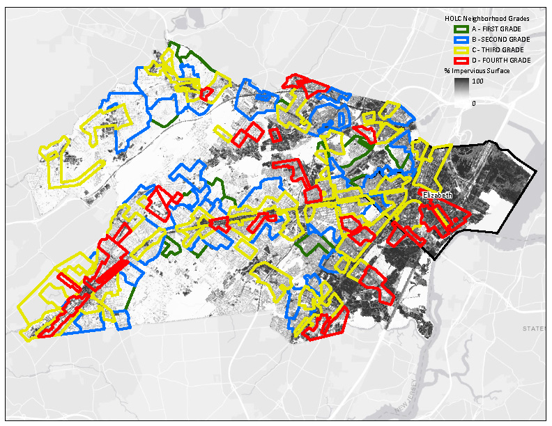
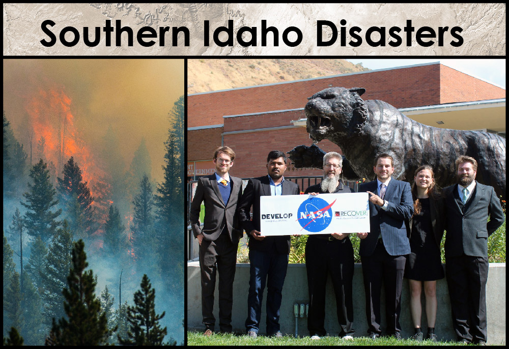
Perpetua. Fall 2018. Vol 3. Issue 1. Pp. 1-8. Olivia Buchanan; Man Kumari; Nicholas McVey; Mercedes Bartkovich; Identifying Optimal Regions within New Jersey’s Pine Barren Forest for Urban Development Based on Wildfire Risk and the Wildland-Urban Interface Theory..
Environmental Research Letters. Jan. 17, 2018. Vol 13. Number 1. Daniel Jensen; John T Reager; Brittany Zajic; Nick Rousseau; Matthew Rodell; Everett Hinkley; The Sensitivity of US Wildfire Occurrence to Pre-season Soil Moisture Conditions across Ecosystems..
Perpetua. Apr. 20, 2018. Vol. 2. Issue 2. pp 1-8 Helen Baldwin; Emily Kinkle; Nicholas McVey; North Alabama Ecological Forecasting: Spatial Modeling of the Fragmentation of Local Species Habitat from Increasing Urbanization in North Alabama.
Earth System Science Data. Mar. 28, 2018. Vol. 10. Valerie Carranza; Talha Rafiq; Isis Frausto-Vicencio; Francesca M. Hopkins; Kristal R. Verhulst; Preeti Rao; Riley M. Duren; Charles E. Miller; Vista-LA: Mapping methane-emitting infrastructure in the Los Angeles megacity.
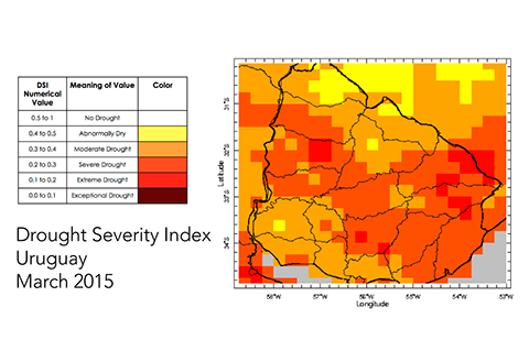
Remote Sensing. Feb. 15, 2018. Vol. 10, Issue 2, pp 301. Yaping Xu; Lei Wang; Kenton Ross; Cuiling Liu; Kimberly Berry; Standardized Soil Moisture Index for Drought Monitoring Based on Soil Moisture Active Passive Observations and 36 Years of North American Land Data Assimilation System Data: A Case Study in the Southeast United States.
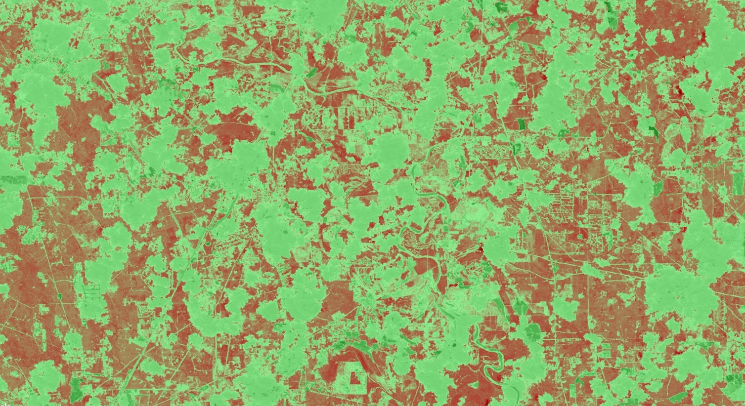
Science Direct. Dec. 2017. Vol. 14, pp 724-727. Woodward, B.; Engelsta, P.; Vorster, A.; Beddow, C.; Krail, S.; Vashisht, A.; Evangelista, P. Forest harvest dataset for northern Colorado Rocky Mountains (1984–2015) generated from a Landsat time series and existing forest harvest records.
Proceedings of the National Academy of Sciences, India Section A: Physical Sciences. 22 Nov. 2017. pp 1-22. Abhishek Kumar, Patricia Stupp, Subash Dahal, Caren Remillard, Roger Bledsoe, Austin Stone, Christopher Cameron, Gurdeep Rastogi, Rabindro Samal, Deepak R. Mishra A Multi-Sensor Approach for Assessing Mangrove Biophysical Characteristics in Coastal Odisha, India.
Environmental Research Letters. 2017. Daniel Jensen, John Reager, Brittany Zajic, Nick Rousseau, Matthew Rodell, Everett Hinkley. The sensitivity of US wildfire occurrence to pre-season soil moisture conditions across ecosystems.
Frontiers in Marine Science. Vol. 4, Art. 329, 26 October 2017. Trinh RC, Fichot CG, Gierach MM, Holt B, Malakar NK, Hulley G, Smith J. Application of Landsat 8 for Monitoring Impacts of Wastewater Discharge on Coastal Water Quality.
Agriculture, Forestry and Fisheries. Mar 2017. Vol. 6, No. 1, pp. 34-44. Marco Allain, Andrew Nguyen, Evan Johnson, Emily Williams, Stephanie Tsai, Susan Prichard, J. W. Skiles. A Geospatial Analysis of Bark Beetle-Induced Wildfire Risk Zones in the Okanogan Wenatchee National Forest.
Marine Pollution Bulletin. May 2017. Vol. 118, pp. 141-154. Benjamin Holt, Rebecca Trinh, Michelle Gierach. Stormwater Runoff Plumes in the Southern California Bight: A Comparison Study with SAR and MODIS Imagery.
Estuarine, Coastal and Shelf Science. Feb 2017. Vol 186, pp. 171-182. Michelle Geirach, Benjamin Holt, Rebecca Trinh, Jack Pan, Christine Rains. Satellite Detection of Wastewater Diversion Plumes in Southern California.
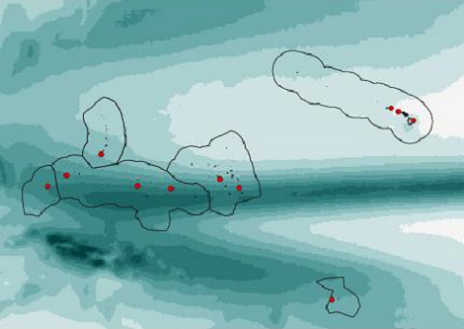
Bulletin of American Meteorological Society. Dec 2016. Vol. 97, No. 12, pp. 2249-2255. Nicholas Luchetti, Jessica Sutton, Ethan Wright, Michael Kruk, John Marra. When El Nino Rages: How Satellite Data Can Help Water-Stressed Islands.
Remote Sensing. July 2015. Vol. 7, Issue 8, pp.9822-9843. Stephen Chignell, Ryan Anderson, Paul Evangelista, Melinda Laituri, David Merritt. Multi-Temporal Independent Component Analysis and Landsat 8 for Delineating Maximum Extent of the 2013 Colorado Front Range Flood.
Geocarto International. June 2013. Volume 29, No. 4, pp. 451-467. Michelle Newcomer, Amber Kuss, Tyler Ketron, Alex Remar, Vivek Choksi, Joseph Skiles. Estuarine sediment deposition during wetland restoration: A GIS and remote sensing modeling approach
The Geographical Bulletin. May 2013. Volume 54, No. 1, pp. 1-23. Jason Jones, Marco Allain.
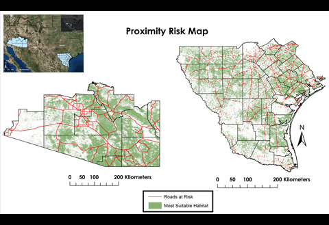
Nonpoint Source Pollution Risk Mapping for Alabama’s Big Creek Lake
Journal of Virginia Science Education. Fall/Winter 2010. Volume 4, Number 1. Anup Myneni, James Myers.
Applied, Interdisciplinary Approach to Student STEM Training and Development
IEEE Geoscience and Remote Sensing Letters. October 2009. Volume 6, No. 4.D.J. Lary, L.A. Remer, D. MacNeill, B. Roscoe, and S. Paradise.
Machine Learning and Bias Correction of MODIS Aerosol Optical Depth
Inquiro. 2009. Volume 3. Nathan Renneboog, Emily Capilouto, Stephen Firsing, Kyle Levy, Marilyn McAllister, Kathryn Roa, Shveta Setia, Lili Xie, Jeff Luvall, Donna Burnett.
Spatial Analysis of Environmental Factors Related to Lyme Disease in Alabama Using NASA Earth Observation Systems
SPIE-IS&T. January 2008. Visualization and Data Analysis 2008, Volume 6809. Jessica Crouch, Chris Weigle, Jonathan Gleason, Yuzhong Shen. Polar Stratospheric Cloud Visualization: Volume Reconstruction from Intersecting Curvilinear Cross Sections
*Underlined names signify DEVELOP participant authors