NASA DEVELOP Hosts Session at AAG 2019
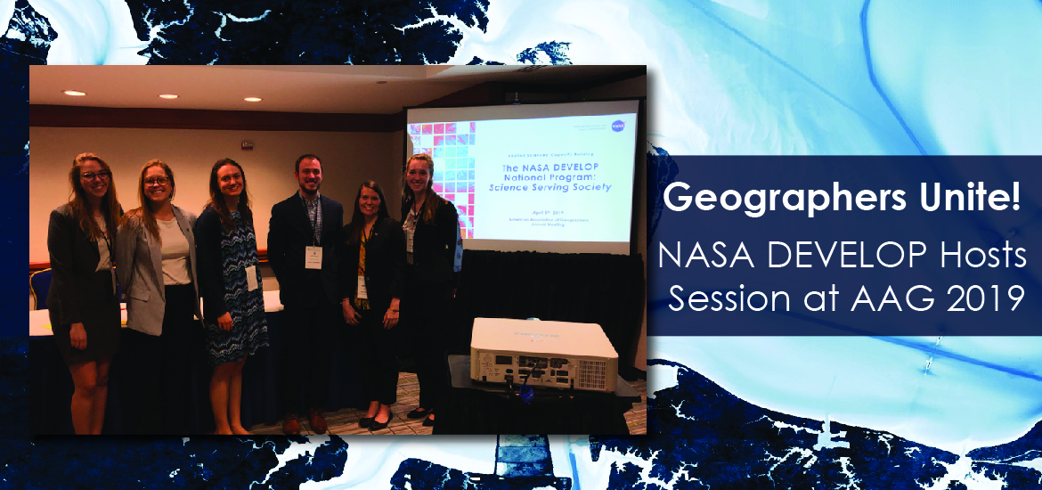
Amidst the emergence of the cherry blossoms during the first week of April, geographers from all of the U.S. made their way to the American Association of Geographers (AAG) Annual Meeting in Washington DC. AAG hosted over 6,000 geographers to discuss the relationship between humans and the environment. Among these bright minds were six DEVELOPers who took the stage and showcased their project work in the Applications of NASA Earth Observations session on Friday, April 5th.
Amanda Clayton, NASA DEVELOP’s Projects Manager led the session with an overview of DEVELOP and an overall perspective of how NASA Earth observations can be used in unique and innovative applications. In her role, Amanda leads the program’s diverse project portfolio and coordinates operations throughout DEVELOP’s 12 locations. Presenting The NASA DEVELOP National Program: Science Serving Society, Amanda highlighted NASA DEVELOP’s unique approach to cultivating the next generation of scientists and enhancing environmental management and public policy decision making around the globe through the use of NASA Earth observations. Learn more about how DEVELOP uses the lens of NASA Earth observations to impact societies around the globe here.
Following Amanda’s introduction, Claire Nauman began the presentations of DEVELOP’s 10-week feasibility projects. Claire is a DEVELOP Alumni from NASA’s Marshall Space Flight Center and is currently a NASA SERVIR graduate research assistant, pursuing her Master’s in Earth System Science from the University of Alabama in Huntsville. In her presentation, Chao Phraya Water Resources: Assessing Water Quality in Thailand’s Chao Phraya Watershed through Modeling Sediment Concentration and Urban Footprint, she explained how the team used NASA satellite data to assess water quality, and model sediment concentrations to benefit the city of Bangkok, Thailand. Working with several end users, her team identified areas contributing to poor water quality. These results aided end users in the development of strategies for future watershed management.
Kate Hess, two-time DEVELOPer at NASA’s Goddard Space Flight Center, and current graduate student at the University of Maryland, College Park in the Department of Geographical Sciences presented her team’s project, Satellite-Based Assessment of Grassland Conversion and Related Fire Disturbance in the Kenai Peninsula, Alaska. Kate spoke to how increased local wildfire risk in the Kenai Peninsula of Alaska can be linked to forest mortality. This information is useful to land managers at the US Fish and Wildlife Service as they seek strategies to address wildfire risk on the peninsula.
Holly Gould, two term DEVELOP Alumni from NASA’s Langley Research Center, presented her team’s work on Enhancing Coastal Management by Monitoring Hampton’s Coastline and Barrier Island Transgression with the Aid of NASA Earth Observations. Holly discussed how the use of NASA Earth observations assisted the coastal town of Hampton, Virginia in their understanding of coastal changes over the past 30 years and assessed flood and erosion risk. These results are helping the local municipality raise public awareness of the changing coastal environment of their community.
Meg Fredericks, DEVELOP alumni from NASA’s Langley Research Center, discussed her summer project, Synthesizing Temperature, Reflectance, and Socioeconomic Data to Provide Spatial and Temporal Temperature Analyses in Richmond, Virginia. Studying neighborhoods across the city of Richmond, VA, Meg and her team used NASA satellite data to analyze health risks and heat vulnerability pertaining to the urban heat island effect. The data used in this project spanned a 20-year timeframe to help project partners, Groundwork RVA and the Science Museum of Virginia, identify changes in the city’s infrastructure that increase heat risk and determine ways to mitigate the urban heat island effect.
The final DEVELOP presentation was led by Henrik Westerkam, a DEVELOP alumni from the Massachusetts – Boston node and current graduate student at Clark University. In Henrik’s presentation, Employing Remote Sensing Techniques to Quantify Sediment Supply and Evaluate Marsh Vulnerability in the Plum Island Estuary, he explained how his team used NASA Earth observations to help the USGS - Woods Hole Marine Science Center better understand sediment flow in the Plum Island Estuary. Salt marshes offer important ecosystem services, such as natural water filtration to nearby populations, making sediment a very important parameter to measure and understand for the USGS.
The DEVELOP projects presented at the AAG Annual Meeting show the diverse application of NASA Earth observations, as well as the feasibility of assessing environmental issues from space. These presentations represent only five projects from our vast project portfolio. Please visit our online project archive to learn more about these projects as well as our rich variety of projects highlighting the impact of NASA Earth observations for societal benefit.