Employing Remote Sensing Techniques to Quantify Sediment Supply and Evaluate Marsh Vulnerability in the Plum Island Estuary
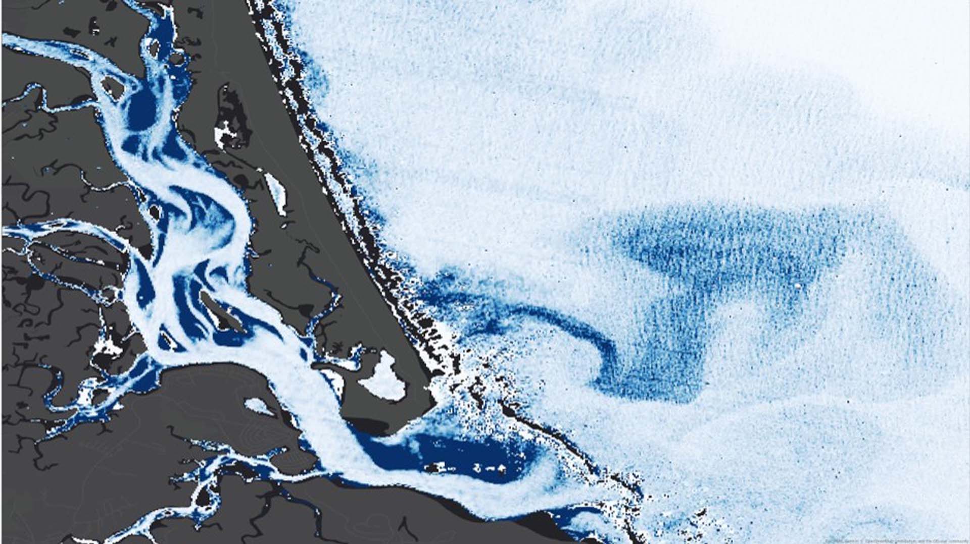
The Plum Island Estuary (PIE) in Massachusetts is New England's largest salt marsh. This dynamic ecosystem plays an important role in the surrounding communities by providing ecosystem services and acting as a center for education, research, and recreation. However, marshes around the world are threatened by sea level rise. As the equilibrium between sediment supply, erosion rates, and vegetation growth is unbalanced by rising waters, marshes are liable to recede, or even drown. Because sediment is so crucial, researchers use sediment budgets as a metric to assess the Plum Island Estuary's vulnerability to rising seas; however, established data collection methods are limited in scope. The project employed five years of imagery from Landsat 8 Operational Land Imager (OLI) and three years of imagery from Sentinel-2 Multispectral Instrument (MSI), in conjunction with in situ data, to generate and refine a local algorithm that derives suspended sediment concentration from remote sensing reflectance. This information was applied to a flux model to analyze transport patterns and possible sediment sources, particularly the Merrimack River. The use of remote sensing techniques will provide our partners at the US Geological Survey, US Fish and Wildlife Service, and Plum Island Ecosystems Long Term Ecological Research Network with higher spatial and temporal resolution data, which will allow for the development of more effective management practices.
Project Video:
Particulate Matters
- Location
- Massachusetts - Boston
- Term
- Summer 2018
- Partner(s)
- USGS, Woods Hole Coastal and Marine Science Center
US Fish and Wildlife Service, Parker River National Wildlife Refuge
Long Term Ecological Research Network, Plum Island Ecosystems LTER - NASA Earth Observations
- Landsat 8, OLI
Sentinel-2, MSI - Team
- Henrik Westerkam (Project Lead)
Ruizhe Guo
Sydney Neugebauer
Linnea Smith - Advisor(s)
- Cedric Fichot (Boston University)
Sergio Fagherazzi (Boston University) - Project Materials Poster PDF