DEVELOPing Connections
“Rice”-ing to the Challenge of Food Security: Detecting Crop Plants from Space to Conserve Genetic Diversity
By Neda Kasraee | Former Fellow, NASA DEVELOP, JPL location
Edited by Cecil Byles | Senior Fellow, DEVELOP National Program Office
May 27, 2021

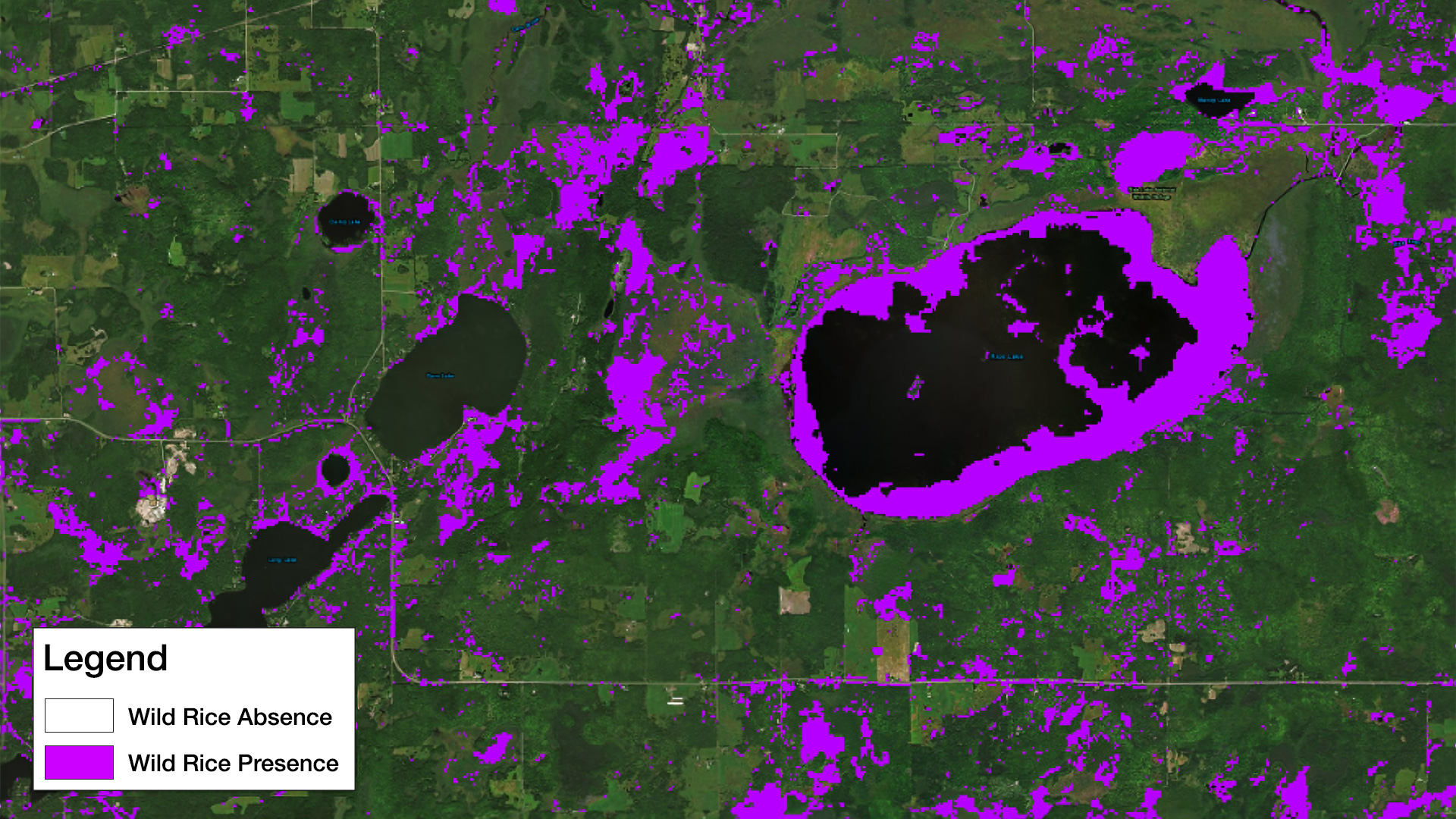
Map created by the Minnesota & Texas Agriculture & Food Security team depicting the presence or absence of wild rice. Image credit: NASA DEVELOP

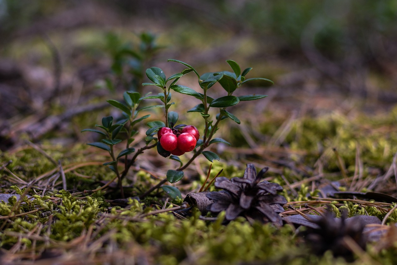
Wild cranberries growing in their natural habitat. Image credit: fotoblend on Pixabay
Food and nutritional security stands out as one of the most critical priorities society faces today. Maintaining crop genetic resources, or the genetic diversity of crop plants and their wild relatives, is vital to meeting global agriculture and food security needs. To safeguard crop diversity, the United States Department of Agriculture (USDA) Agricultural Research Service’s National Plant Germplasm System (NPGS) has a mission to acquire, conserve, and characterize crop germplasm.
Colin Khoury, a researcher at the NPGS describes his work as “trying to map and understand where diversity is and what to do about it. The big question is… how complete is our national collection in seed banks? … That collection is primarily agricultural species, but it also includes wild plants. Are we doing a good job at adequately conserving genetic diversity?” He first teamed up with the NASA DEVELOP Colorado – Fort Collins location for a project during the spring 2018 term to study northern wild rice (Zizania palustris) and Texas wild rice (Zizania texana). Northern wild rice is a wild grain native to North America, which is important for food security and cultural purposes in many Native American cultures of the Great Lakes region. Texas wild rice, endemic to the state of its namesake, is a Federally and State-listed endangered species.
The project aimed to use NASA Earth observations to detect the distributions of both species in order to effectively plan out targeted field collections and make strategic plans for habitat conservation. Khoury stated that DEVELOP gave the NPGS an opportunity to work with new methods since it typically works “with relatively orthodox and standard methodologies that don’t currently incorporate satellite [or] remotely sensed information. They instead use environmental predictors, [like] climatic information or soil information, [which] don’t tend to be high enough resolution for some of our conservation needs.”
The spring 2018 DEVELOP team used Landsat 5 Thematic Mapper (TM), Landsat 8 Operational Land Imager (OLI), Sentinel-1 C-band Synthetic Aperture Radar (C-SAR), and National Agricultural Imagery Program imagery in conjunction with the Variable Selection using Random Forest (VSURF) library in R Studio to find significant spectral signature values. They used these values as training data for their random forest model. Their geospatial methods were then used to estimate where diversity differs in the study area.

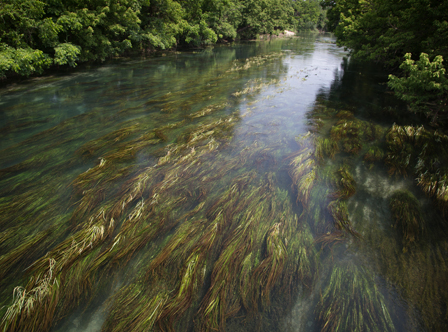
Texas wild rice growing in the San Marcos River in Texas. Image credit: Ryan Hagerty, US Fish and Wildlife Service
Given the success of this spring 2018 project, the NPGS partnered with NASA DEVELOP again in fall 2018 to study wild cranberries (Vaccinium macrocarpon) in Wisconsin. This project used modeling techniques in tandem with NASA Earth observations from Landsat 5 TM, Landsat 7 Enhanced Thematic Mapper Plus (ETM+), Landsat 8 OLI, Sentinel-2 Multispectral Imager (MSI), and the Shuttle Radar Topography Mission.
The second term DEVELOP team was able to map the distributions of wild cranberries in Google Earth Engine, provide the partners with a distribution map, and deliver a distribution modeling and mapping tutorial. The team studied wild cranberries since they are the progenitor of the domesticated crop species and may contain important traits for the improvement of the crop in the future. Ultimately, Khoury said the work done for this project was distributed “to two agricultural research service labs that are interested, and then to the forest service land managers that actually manage land in the focal area... [the data were] to be distributed immediately.”
Khoury continued working with DEVELOP at its Colorado – Fort Collins location for the third time as a project partner for the Minnesota Agriculture & Food Security project in spring 2019. This time around, the DEVELOP team returned to the main question of the study: is it feasible for crop wild relatives to be detected from space? The project returned to northern wild rice, which grows in shallow lakes in the upper Midwest. As Khoury states, “The task this time was to engage intensively with conservation stakeholders, including not only [the] USDA, but also the Minnesota Department of Natural Resources and the University of Minnesota, to determine how well the open access NASA information and related geospatial tools and methodologies could be combined to accurately detect these useful wild plants.”
The third term utilized optical and radar sensors from both previous iterations of the project: Landsat 8 OLI, Sentinel-1 C-SAR, and Sentinel-2 MSI. By focusing on validation of the previous model and refining their modeling process, the study found great success. As Khoury stated, “employing a variety of validation tools, including field data collected by the first term, the team was able to detect wild rice with high accuracy.” The results were published in an open access journal, Remote Sensing, in a peer-reviewed article entitled “Improved Remote Sensing Methods to Detect Northern Wild Rice (Zizania palustris L.).”
The work done by NASA DEVELOP at the Colorado – Fort Collins location has provided the NPGS with methodologies for incorporating remotely sensed data to further assist their monitoring and field collection efforts. In addition, utilization of NASA Earth observations allows for a larger study area since analysis and assessments are overall no longer reliant on field data collection. Khoury says that the work done by DEVELOP will not only help the people that work at the NPGS, but the whole Department of Agriculture network. Khoury shared the results and end products with the US Forest Service, another organization under the USDA, with the aim of eventually increasing and securing plants’ genetic diversity on Forest Service lands.