Fall 2021 Preview

Fall 2021 Preview

DEVELOP’s fall 2021 term began on September 13th and will conclude on November 19th. Ninety-three participants are working virtually from 32 states and Washington, DC. The participants are working on 20 projects in the areas of Agriculture, Disasters, Ecological Forecasting, Energy, Health & Air Quality, Urban Development, and Water Resources. The tentative project impacts and partners are shown below on the fall portfolio overview. This term, four Bhutanese scholars studying in the United States are continuing work on a DEVELOP project studying agricultural community concerns in Bhutan through a multi-year Interagency Agreement with the U.S. Department of State.
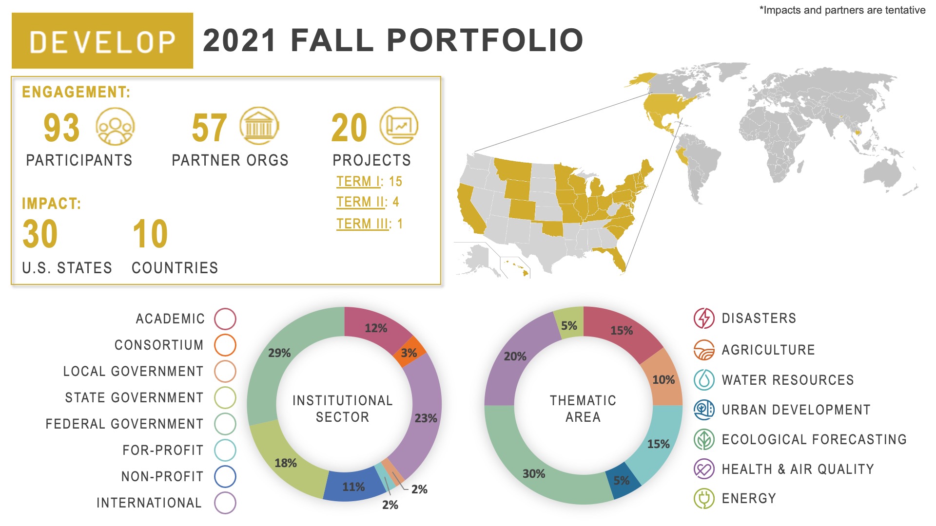
2021 Fall Portfolio

 Engagement:
• 93 participants
• 57 partner organizations
• 20 projects (15 first term, 4 second term, 1 third term)

Impact:
• 30 U.S. States
• 10 Countries

Institutional sector:
• 12% Academic
• 3% Consortium
• 2% Local government
• 18% State government
• 29% Federal government
• 2% For-profit
• 11% Non-profit
• 23% International

Thematic area:
• 15% Disasters
• 10% Agriculture
• 15% Water resources
• 5% Urban development
• 30% Ecological forecasting
• 20% Health & Air quality
• 5% Energy

Learn more about the fall 2021 projects being conducted below!

Disasters icon

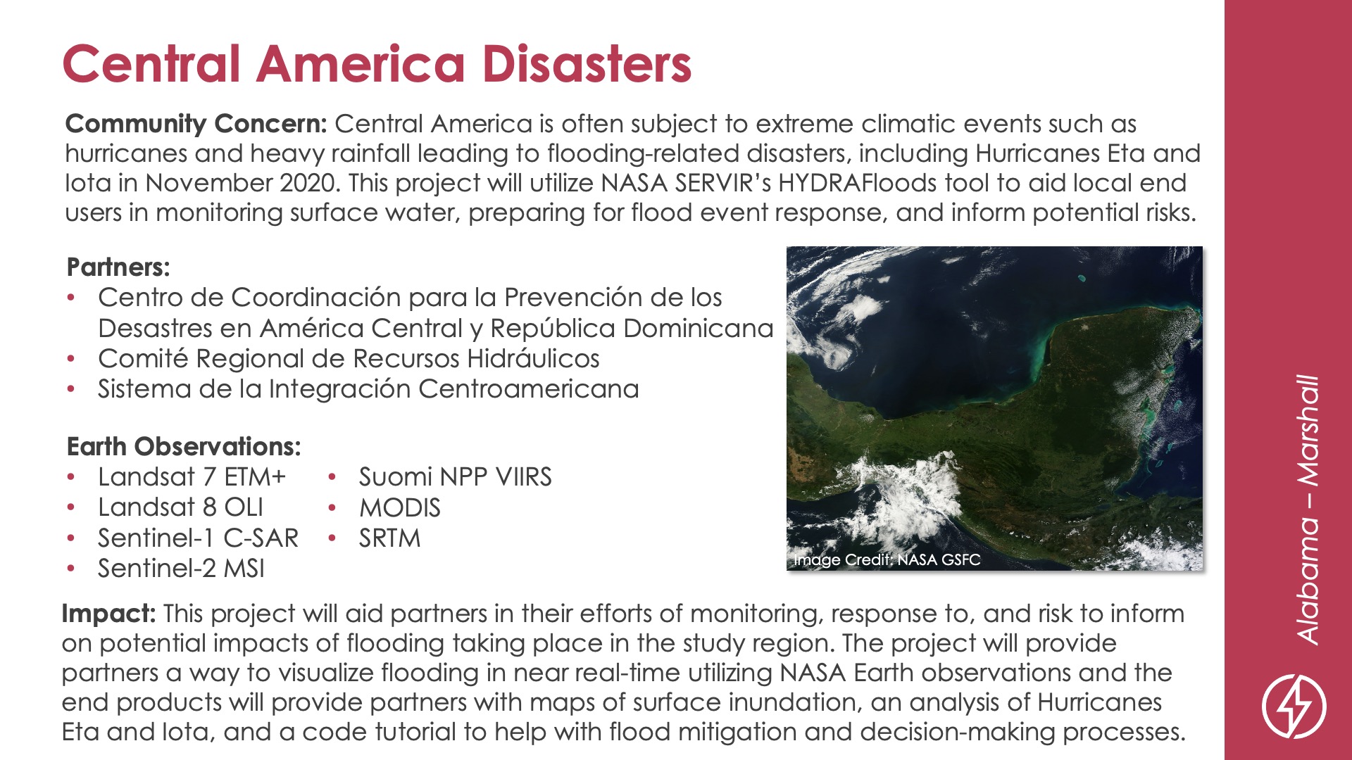
Central America Disasters
DEVELOP Node: Alabama - Marshall

Community Concern: Central America is often subject to extreme climatic events such as hurricanes and heavy rainfall leading to flooding-related disasters, including Hurricanes Eta and Iota in November 2020. This project will utilize NASA SERVIR’s HYDRAFloods tool to aid local end users in monitoring surface water, preparing for flood event response, and inform potential risks.

Impact: This project will aid partners in their efforts of monitoring, response to, and risk to inform on potential impacts of flooding taking place in the study region. The project will provide partners a way to visualize flooding in near real-time utilizing NASA Earth observations and the end products will provide partners with maps of surface inundation, an analysis of Hurricanes Eta and Iota, and a code tutorial to help with flood mitigation and decision-making processes.

Partners: Centro de Coordinación para la Prevención de los, Desastres en América Central y República Dominicana, Comité Regional de Recursos Hidráulicos, Sistema de la Integración Centroamericana

Earth Observations: Landsat 7 ETM+, Landsat 8 OLI, Sentinel-1 C-SAR, Sentinel-2 MSI, Suomi NPP VIIRS, MODIS, SRTM

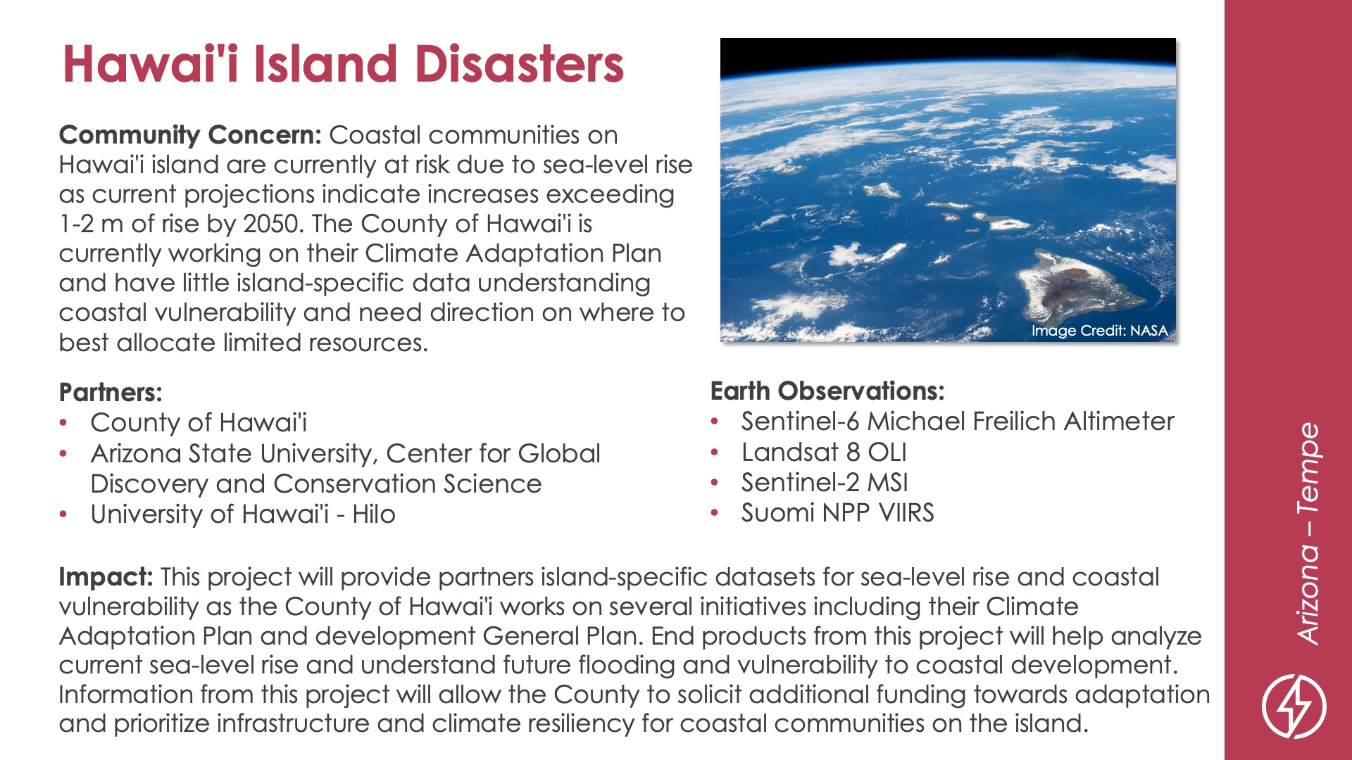
Hawai'i Island Disasters
DEVELOP Node: Arizona - Tempe

Community Concern: Coastal communities on Hawai'i island are currently at risk due to sea-level rise as current projections indicate increases exceeding 1-2 m of rise by 2050. The County of Hawai'i is currently working on their Climate Adaptation Plan and have little island-specific data understanding coastal vulnerability and need direction on where to best allocate limited resources.

Impact: This project will provide partners island-specific datasets for sea-level rise and coastal vulnerability as the County of Hawai'i works on several initiatives including their Climate Adaptation Plan and development General Plan. End products from this project will help analyze current sea-level rise and understand future flooding and vulnerability to coastal development. Information from this project will allow the County to solicit additional funding towards adaptation and prioritize infrastructure and climate resiliency for coastal communities on the island.

Partners: County of Hawai'i, Arizona State University Center for Global Discovery and Conservation Science, University of Hawai'i at Hilo

Earth Observations: Sentinel-6 Michael Freilich Altimeter, Landsat 8 OLI, Sentinel-2 MSI, Suomi NPP VIIRS

Ecological forecasting icon

Carolina Coastal Plain Ecological Forecasting
DEVELOP Node: Georgia - Athens

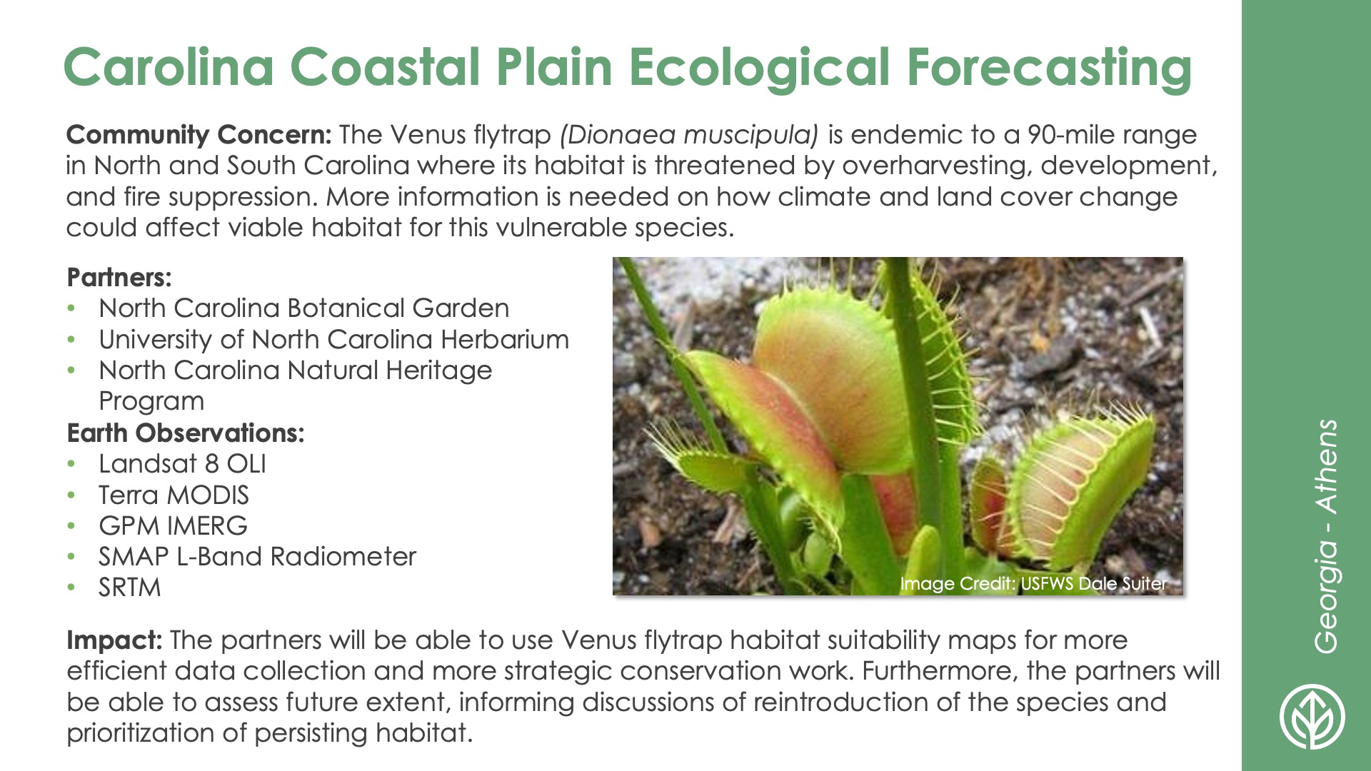
Community Concern: The Venus flytrap (Dionaea muscipula) is endemic to a 90-mile range in North and South Carolina where its habitat is threatened by overharvesting, development, and fire suppression. More information is needed on how climate and land cover change could affect viable habitat for this vulnerable species.

Impact: The partners will be able to use Venus flytrap habitat suitability maps for more efficient data collection and more strategic conservation work. Furthermore, the partners will be able to assess future extent, informing discussions of reintroduction of the species and prioritization of persisting habitat.

Partners: North Carolina Botanical Garden, University of North Carolina Herbarium, North Carolina Natural Heritage Program

Earth Observations: Landsat 8 OLI, Terra MODIS, GPM IMERG, SMAP L-Band Radiometer, SRTM

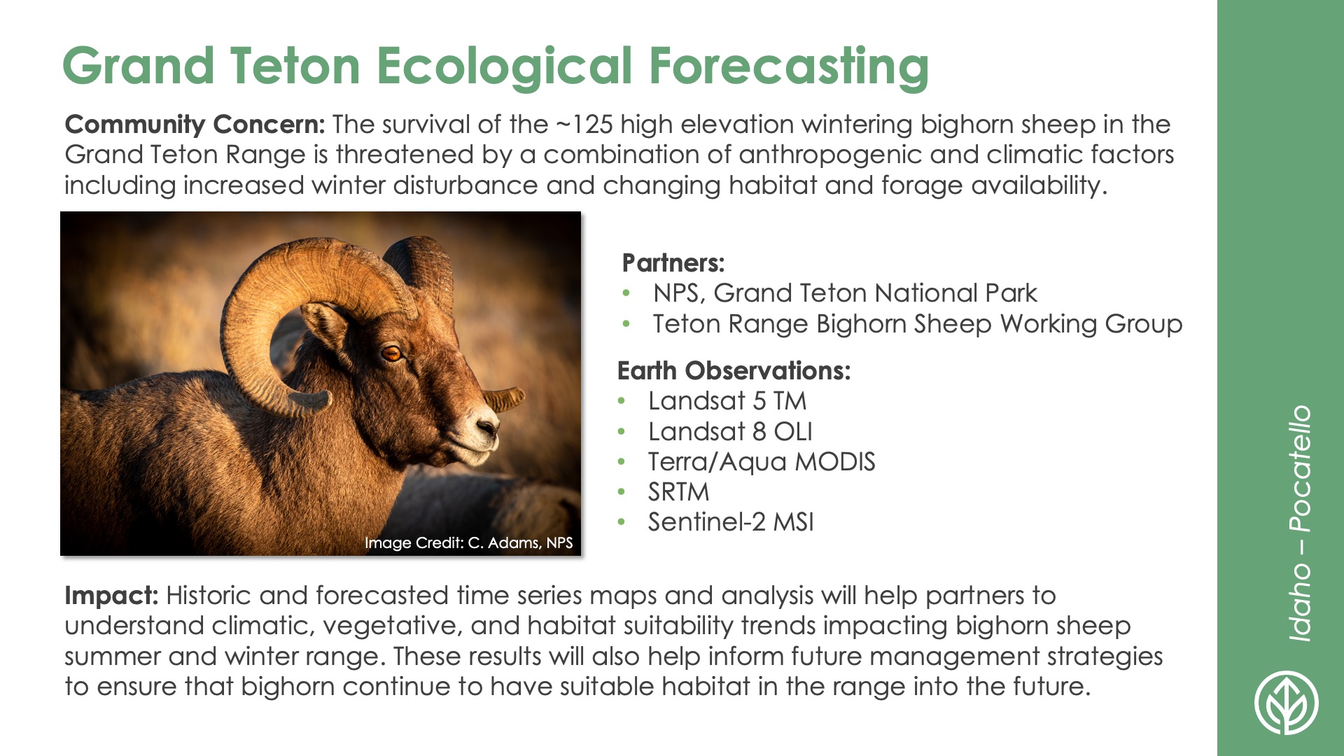
Grand Teton Ecological Forecasting
DEVELOP Node: Idaho - Pocatello

Community Concern: The survival of the ~125 high elevation wintering bighorn sheep in the Grand Teton Range is threatened by a combination of anthropogenic and climatic factors including increased winter disturbance and changing habitat and forage availability.

Impact: Historic and forecasted time series maps and analysis will help partners to understand climatic, vegetative, and habitat suitability trends impacting bighorn sheep summer and winter range. These results will also help inform future management strategies to ensure that bighorn continue to have suitable habitat in the range into the future.

Partners: NPS–Grand Teton National Park, Teton Range Bighorn Sheep Working Group

Earth Observations: Landsat 5 TM, Landsat 8 OLI, Terra/Aqua MODIS, SRTM, Sentinel-2 MSI

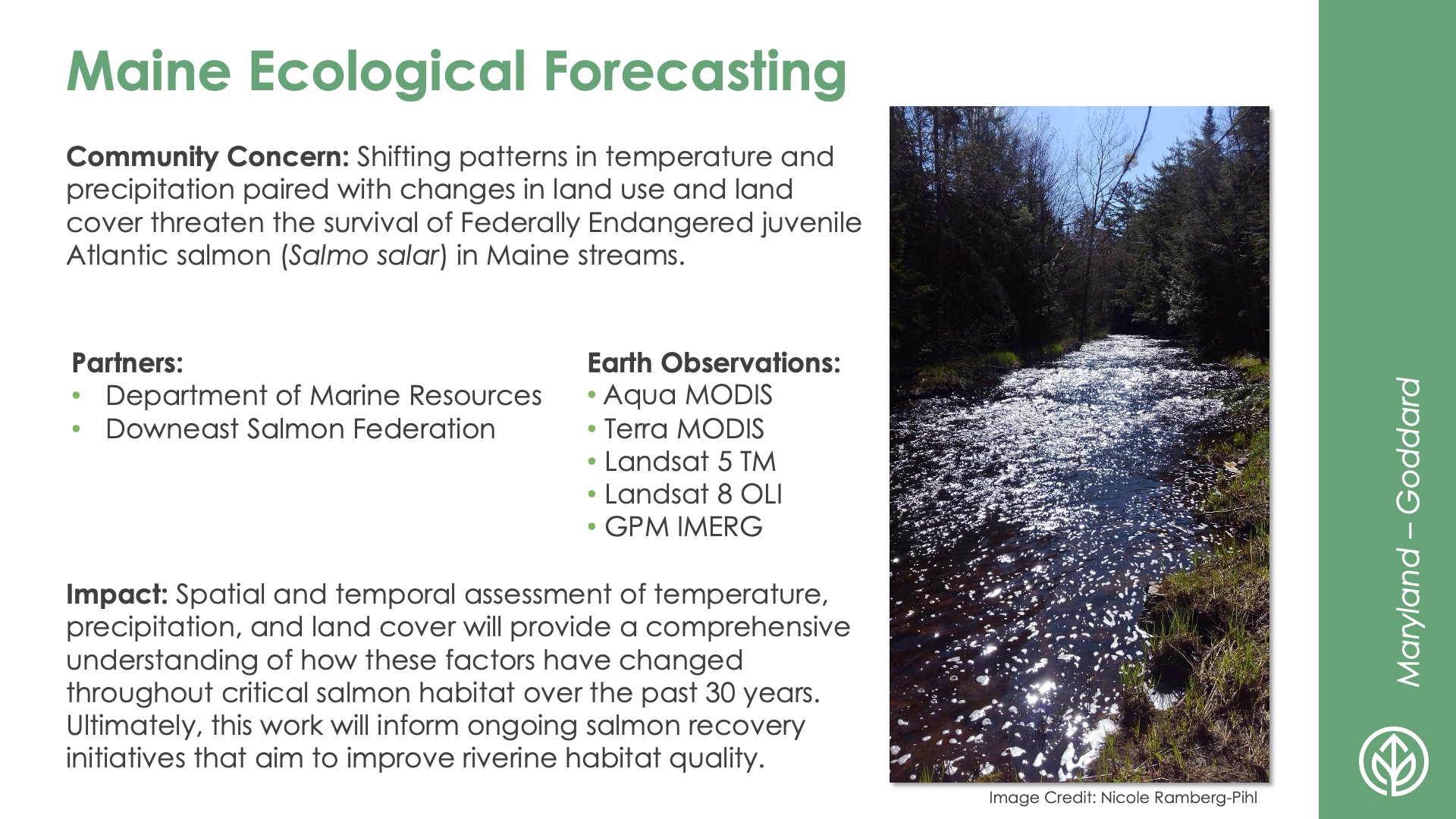
Maine Ecological Forecasting
DEVELOP Node: Maryland - Goddard

Community Concern: Shifting patterns in temperature and precipitation paired with changes in land use and land cover threaten the survival of Federally Endangered juvenile Atlantic salmon (Salmo salar) in Maine streams.

Impact: Spatial and temporal assessment of temperature, precipitation, and land cover will provide a comprehensive understanding of how these factors have changed throughout critical salmon habitat over the past 30 years. Ultimately, this work will inform ongoing salmon recovery initiatives that aim to improve riverine habitat quality.

Partners: Department of Marine Resources, Downeast Salmon Federation

Earth Observations: Aqua MODIS, Terra MODIS, Landsat 5 TM, Landsat 8 OLI, GPM IMERG

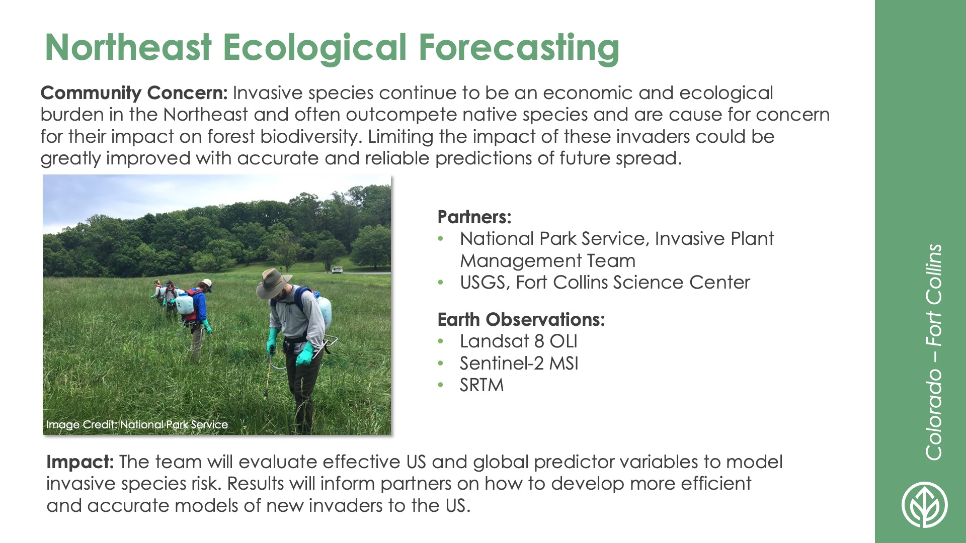
Northeast Ecological Forecasting
DEVELOP Node: Colorado - Fort Collins

Community Concern: Invasive species continue to be an economic and ecological burden American in the Northeast and often outcompete native species and are cause for concern for their impact on forest biodiversity. Limiting the impact of these invaders could be greatly improved with accurate and reliable predictions of future spread.

Impact: The team will evaluate effective US and global predictor variables to model invasive species risk. Results will inform partners on how to develop more efficient and accurate models of new invaders to the US.

Partners: National Park Service—Invasive Plant Management Team, USGS–Fort Collins Science Center

Earth Observations: Landsat 8 OLI, Sentinel-2 MSI, SRTM

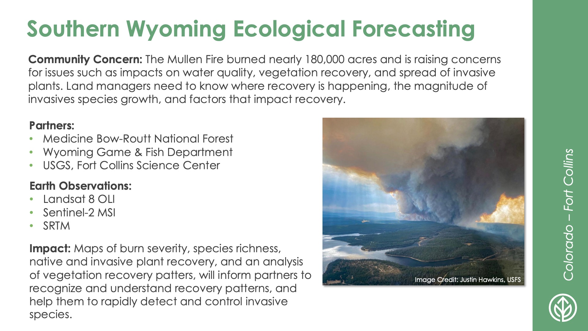
Southern Wyoming Ecological Forecasting
DEVELOP Node: Colorado - Fort Collins

Community Concern: The Mullen Fire burned nearly 180,000 acres and is raising concerns for issues such as impacts on water quality, vegetation recovery, and spread of invasive plants. Land managers need to know where recovery is happening, the magnitude of invasives species growth, and factors that impact recovery.

Impact: Maps of burn severity, species richness, native and invasive plant recovery, and an analysis of vegetation recovery patters, inform partners to recognize and understand recovery patters, and help them to rapidly detect and control invasive species.

Partners: Medicine Bow-Routt National Forest, Wyoming Game & Fish Department, USGS–Fort Collins Science Center

Earth Observations: Landsat 8 OLI, Sentinel-2 MSI, SRTM

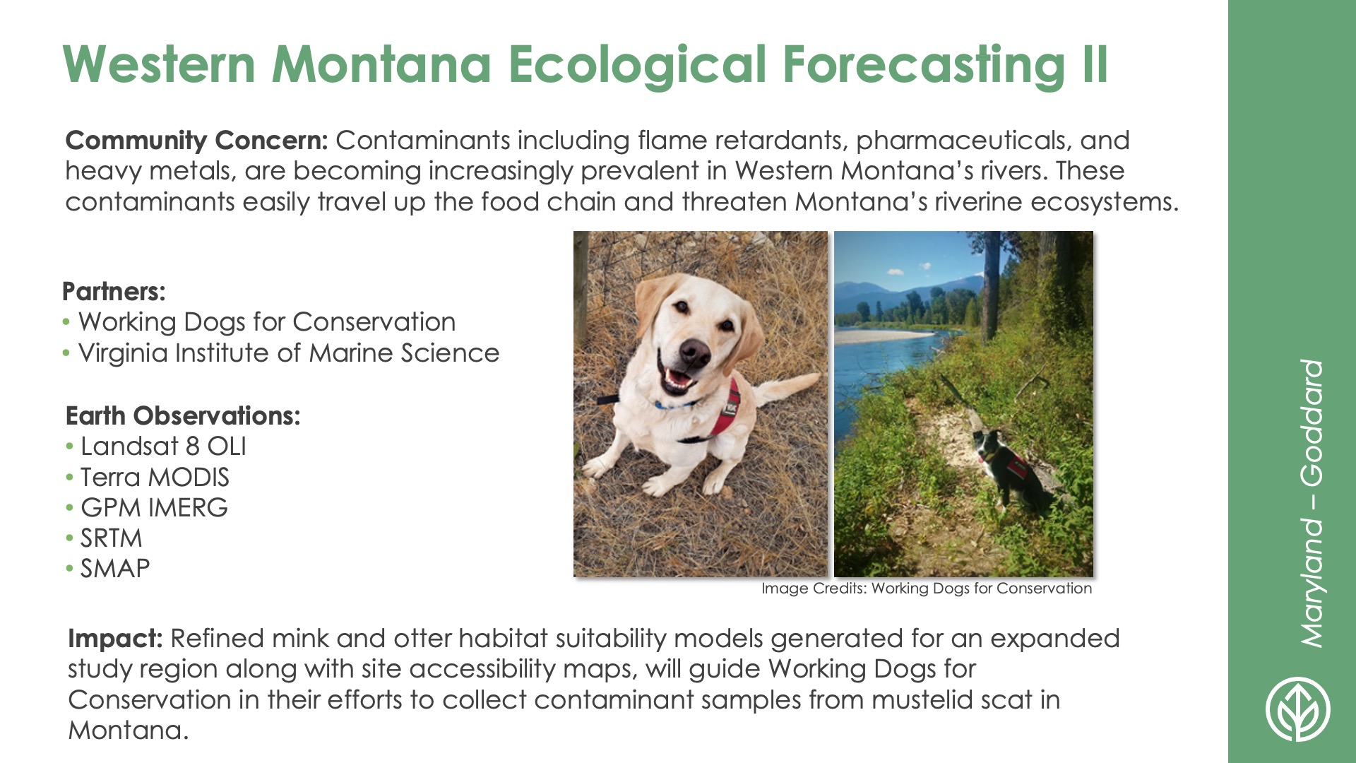
Western Montana Ecological Forecasting II
DEVELOP Node: Maryland - Goddard

Community Concern: Contaminants including flame retardants, pharmaceuticals, and heavy metals, are becoming increasingly prevalent in Western Montana’s rivers. These contaminants easily travel up the food chain and threaten Montana’s riverine ecosystems.

Impact: Refined mink and otter habitat suitability models generated for an expanded study region along with site accessibility maps, will guide Working Dogs for Conservation in their efforts to collect contaminant samples from mustelid scat in Montana.

Partners: Working Dogs for Conservation, Virginia Institute of Marine Science

Earth Observations: Landsat 8 OLI, Terra MODIS, GPM IMERG, SRTM, SMAP

Energy icon

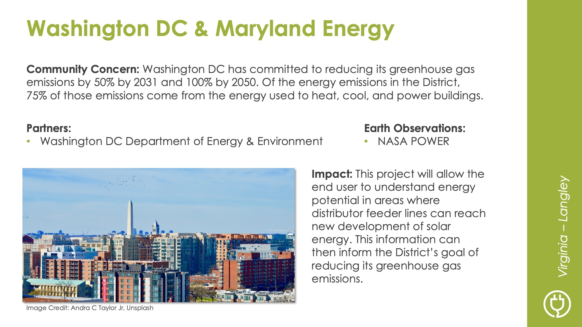
Washington DC & Maryland Energy
DEVELOP Node: Virginia - Langley

Community Concern: Washington DC has committed to reducing its greenhouse gas emissions by 50% by 2031 and 100% by 2050. Of the energy emissions in the District, 75% of those emissions come from the energy used to heat, cool, and power buildings.

Impact: This project will allow the end user to understand energy potential in areas where distributor feeder lines can reach new development of solar energy. This information can then inform the District’s goal of reducing its greenhouse gas emissions.

Partners: Washington DC Department of Energy & Environment

Earth Observations: NASA POWER

Agriculture icon

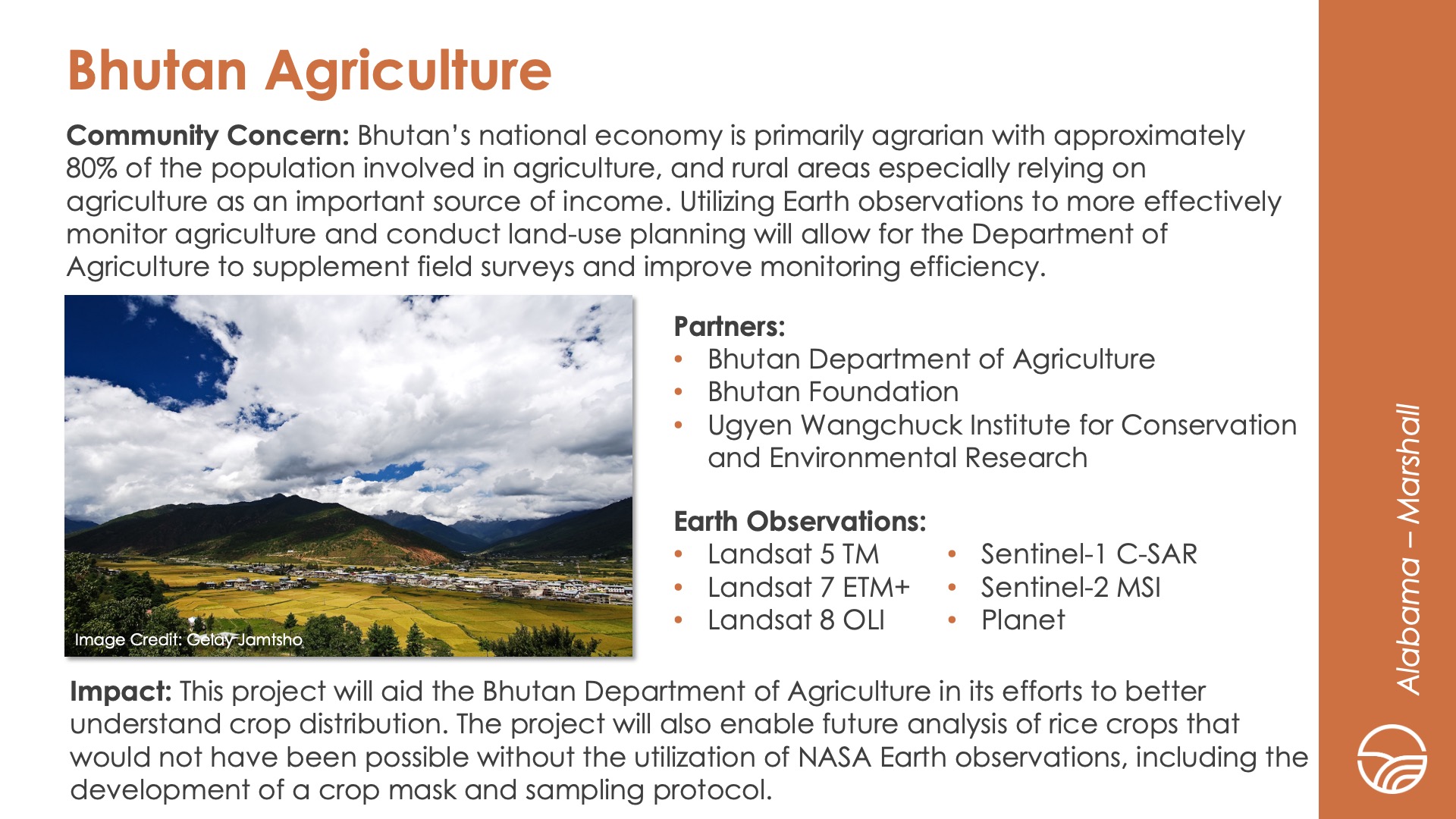
Bhutan Agriculture
DEVELOP Node: Alabama - Marshall

Community Concern: Bhutan’s national economy is primarily agrarian with approximately 80% of the population involved in agriculture, and rural areas especially relying on agriculture as an important source of income. Utilizing Earth observations to more effectively monitor agriculture and conduct land-use planning will allow for the Department of Agriculture to supplement field surveys and improve monitoring efficiency.

Impact: This project will aid the Bhutan Department of Agriculture in its efforts to better understand crop distribution. The project will also enable future analysis of rice crops that would not have been possible without the utilization of NASA Earth observations, including the development of a crop mask and sampling protocol.

Partners: Bhutan Department of Agriculture, Bhutan Foundation, Ugyen Wangchuck Institute for Conservation and Environmental Research

Earth Observations: Landsat 5 TM, Landsat 7 ETM+, Landsat 8 OLI, Sentinel-1 C-SAR, Sentinel-2 MSI, Planet

Tonlé Sap Agriculture III
DEVELOP Node: Virginia - Langley

Community Concern: Tonlé Sap, located in Cambodia’s Lower Mekong Basin, is the largest freshwater lake in Southeast Asia and provides fisheries and freshwater to nearby agricultural communities. Increased pumping and shifts in global climate threaten the ecosystem’s water quality and fish habitat.

Impact: The third and final term of this project will provide partners with a comprehensive methodology to calculate the Freshwater Health Index using remote sensing data and allow partners to determine resource allocation in the basin.

Partners: Conservation International, Ministry of Water Resources and Meteorology–Tonlé Sap Authority

Earth Observations: Landsat 5 TM, Landsat 7 ETM+, Landsat 8 OLI, Terra MODIS, Aqua MODIS, GRACE, GPM IMERG

Health & air quality icon

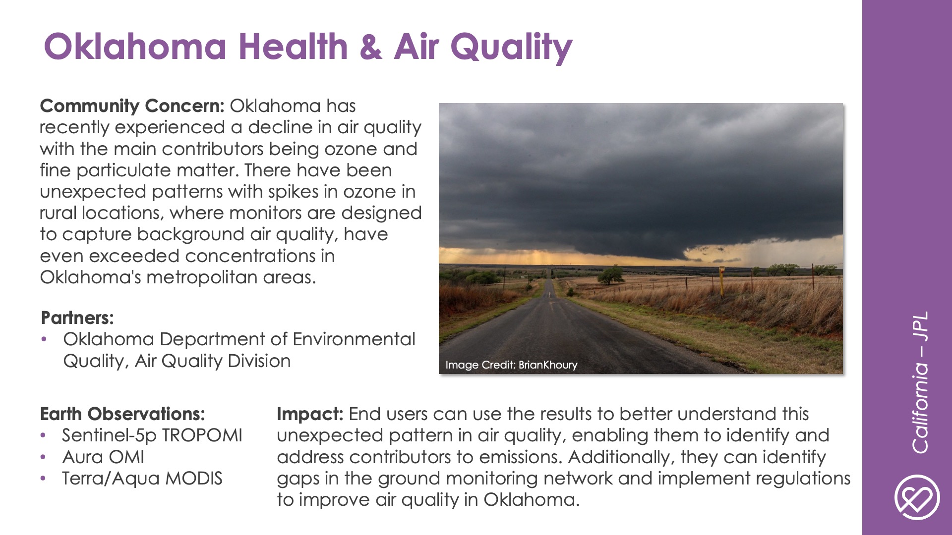
Oklahoma Health & Air Quality
DEVELOP Node: California - JPL

Community Concern: Oklahoma has recently seen a decline in air quality with the main contributors being ozone and fine particulate matter. There has been unexpected patterns with spikes in ozone in rural locations, where monitors are designed to capture background air quality, have even exceeded concentrations in Oklahoma's metropolitan areas.

Impact: End-users can use the results to better understand this unexpected pattern in air quality, allowing them to identify and address contributors to emissions. Additionally, they can identify gaps in the ground monitoring network and implement regulations to improve air quality in Oklahoma.

Partners: Oklahoma Department of Environmental Quality—Air Quality Division

Earth Observations: Sentinel-5p TROPOMI, Aura OMI, Terra/Aqua MODIS

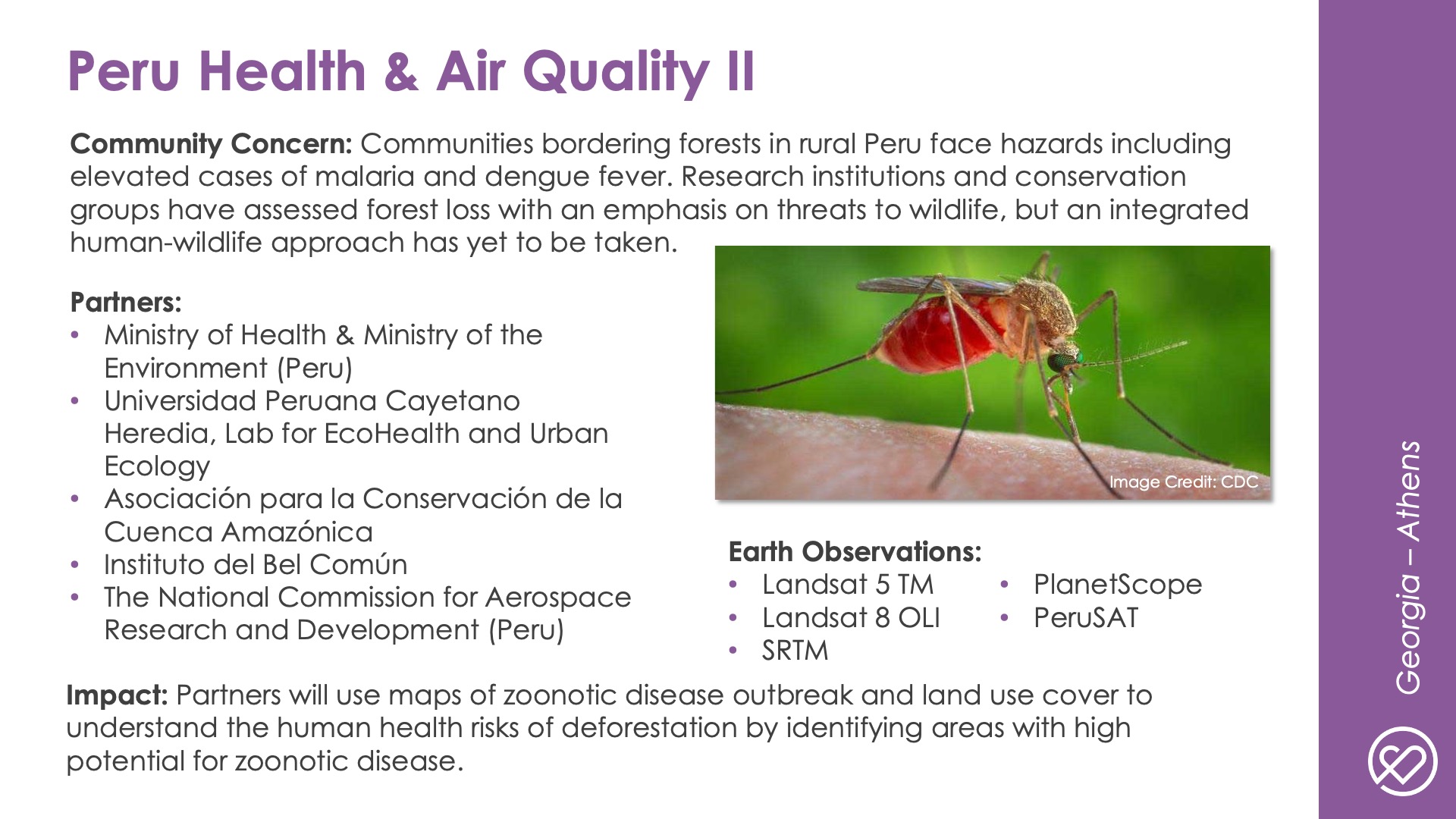
Peru Health & Air Quality II
DEVELOP Node: Georgia - Athens

Community Concern: Communities bordering forests in rural Peru face hazards including elevated cases of malaria and dengue fever. Research institutions and conservation groups have assessed forest loss with an emphasis on threats to wildlife, but an integrated human-wildlife approach has yet to be taken.

Impact: Partners will use maps of zoonotic disease outbreak and land use cover to understand the human health risks of deforestation by identify areas with high potential for zoonotic disease.

Partners: Ministry of Health & Ministry of the Environment (Peru), Universidad Peruana Cayetano Heredia–Lab for EcoHealth and Urban Ecology, Asociación para la Conservación de la Cuenca Amazónica, Instituto del Bel Común, The National Commission for Aerospace Research and Development (Peru)

Earth Observations: Landsat 5 TM, Landsat 8 OLI, SRTM, PlanetScope, PeruSAT

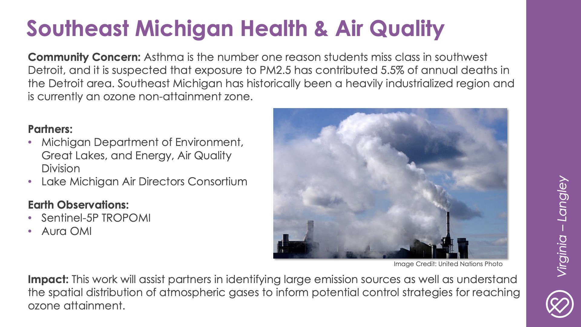
Southeast Michigan Health & Air Quality
DEVELOP Node: Virginia - Langley

Community Concern: Asthma is the number one reason students miss class in southwest Detroit, and 5.5% of annual deaths in the Detroit area are due to exposure to PM 2.5. Southeast Michigan has historically been a heavily industrialized region and is currently an ozone non-attainment zone.

Impact: This work will assist partners in identifying large emission sources as well as understanding the spatial distribution of atmospheric gases to inform potential control strategies for reaching ozone attainment.

Partners: Michigan Department of Environment, Great Lakes, and Energy–Air Quality Division, Lake Michigan Air Directors Consortium

Earth Observations: Sentinel-5P TROPOMI, Aura OMI

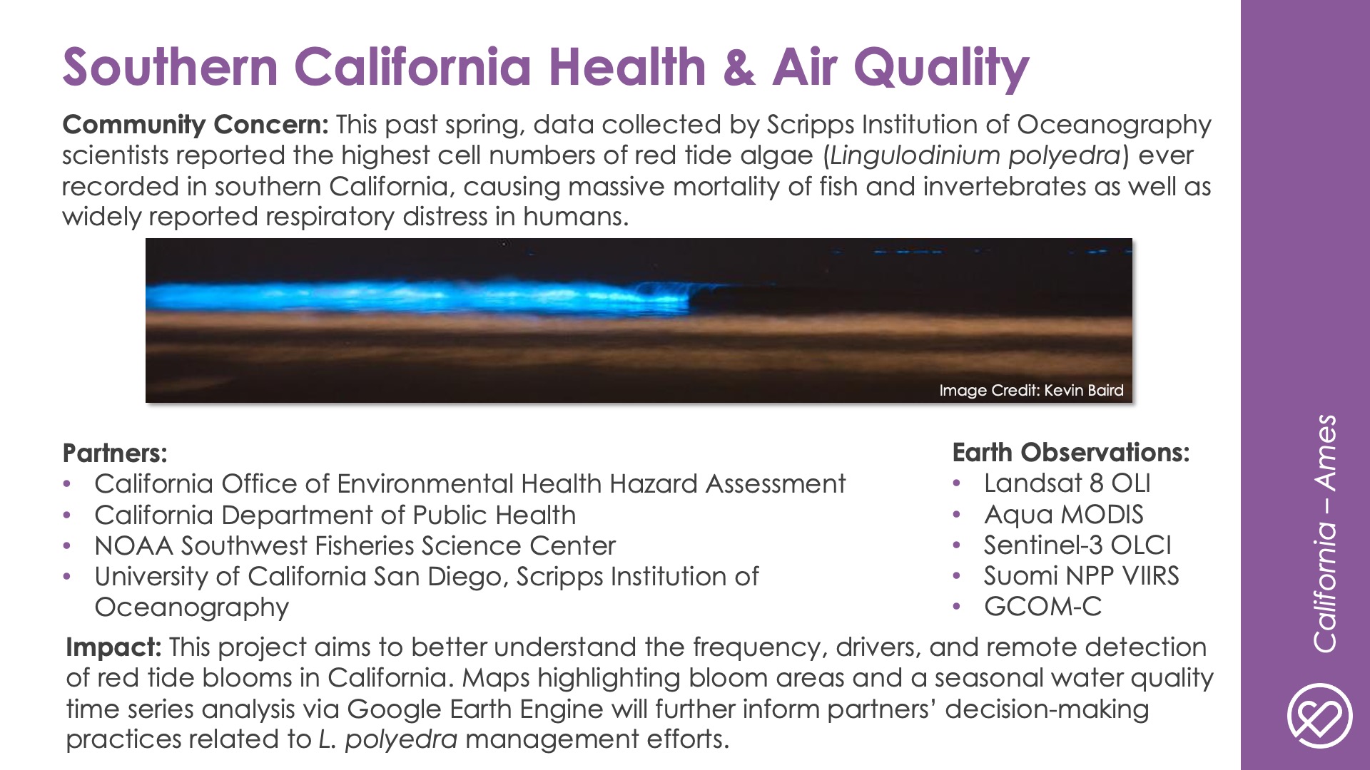
Southern California Health & Air Quality
DEVELOP Node: California - Ames

Community Concern: This past spring, data collected by Scripps Institution of Oceanography scientists reported the highest cell numbers of red tide algae (Lingulodinium polyedra) ever recorded in southern California, causing massive mortality of fish and invertebrates as well as widely reported respiratory distress in humans.

Impact: This project aims to better understand the frequency, drivers, and remote detection of red tide blooms in California. Maps highlighting bloom areas and a seasonal water quality time series analysis via Google Earth Engine will further inform partners’ decision-making practices related to L. polyedra management efforts.

Partners: California Office of Environmental Health Hazard Assessment, California Department of Public Health, NOAA Southwest Fisheries Science Center, University of California San Diego—Scripps Institution of Oceanography

Earth Observations: Landsat 8 OLI, Aqua MODIS, Sentinel-3 OLCI, Suomi NPP VIIRS, GCOM-C

Urban development icon

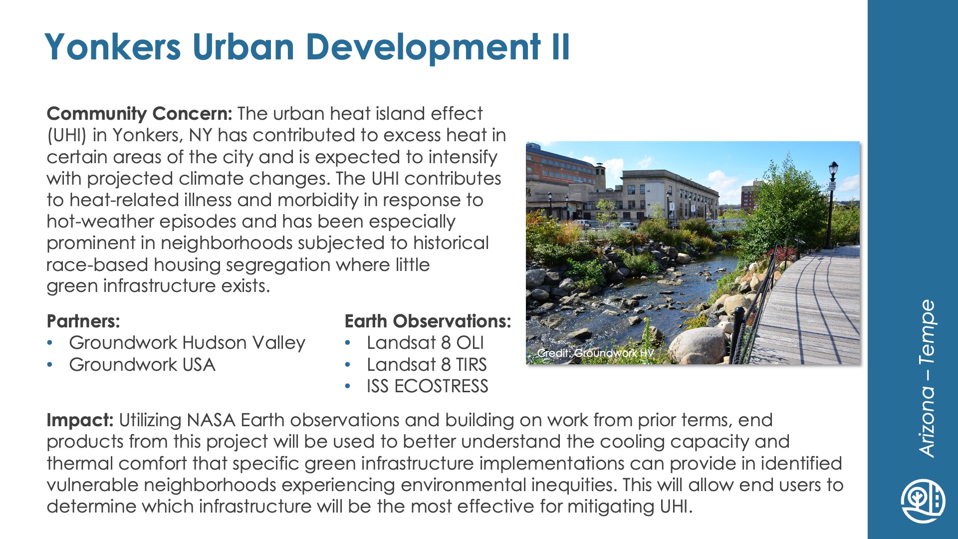
Yonkers Urban Development II
DEVELOP Node: Arizona - Tempe

Community Concern: The urban heat island effect (UHI) in Yonkers, NY has contributed to excess heat in certain areas of the city and is expected to intensify with projected climate changes. The UHI contributes to heat-related illness and morbidity in response to hot-weather episodes and has been especially prominent in neighborhoods subjected to historical race-based housing segregation where little green infrastructure exists.

Impact: Utilizing NASA Earth observations and building on prior terms, end products from this project will be used to better understand the cooling capacity and thermal comfort that specific green infrastructure implementations can provide in identified vulnerable neighborhoods experiencing environmental inequities. This will allow end users to determine which infrastructure will be the most effective for mitigating UHI.

Partners: Groundwork Hudson Valley, Groundwork USA

Earth Observations: Landsat 8 OLI, Landsat 8 TIRS, ISS ECOSTRESS

Water resources icon

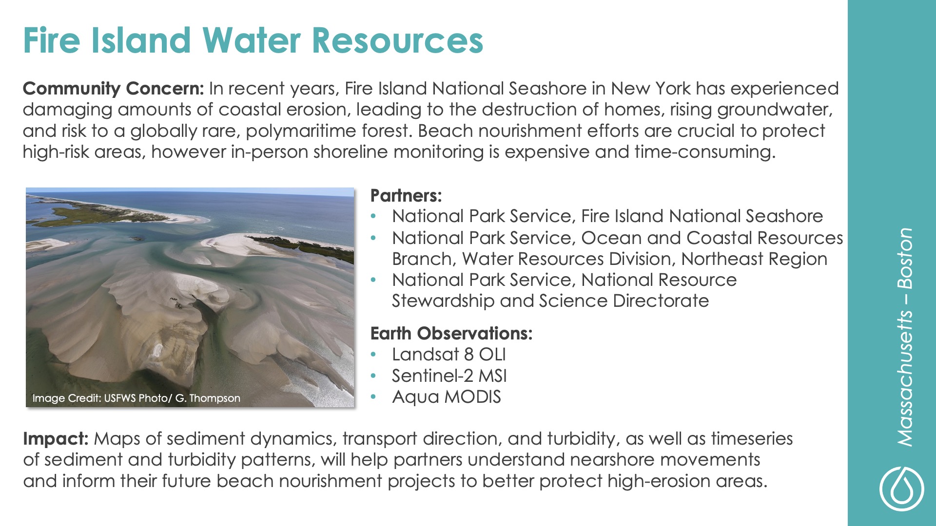
Fire Island Water Resources
DEVELOP Node: Massachusetts - Boston

Community Concern: In recent years, Fire Island National Seashore in New York has experienced damaging amounts of coastal erosion, leading to the destruction of homes, rising groundwater, and risk to a globally rare, polymaritime forest. Beach nourishment efforts are crucial to protect high-risk areas, however in-person shoreline monitoring is expensive and time-consuming.

Impact: Maps of sediment dynamics, transport direction, and turbidity, as well as timeseries of sediment and turbidity patterns, will help partners understand nearshore movements and inform their future beach nourishment projects to better protect high-erosion areas.

Partners: National Park Service–Fire Island National Seashore, National Park Service–Ocean and Coastal Resources Branch–Water Resources Division–Northeast Region, National Park Service–National Resource Stewardship and Science Directorate

Earth Observations: Landsat 8 OLI, Sentinel-2 MSI, Aqua MODIS

Maya Forest Water Resources II
DEVELOP Node: California - JPL

Community Concern: Extreme weather events in relation to climate change are impacting wetland ecosystems, altering the frequency and levels of inundation which threaten water resource availability and land stability in these systems. These changes have negative impacts for surrounding community infrastructure and agriculture that rely on forested wetlands in the Maya Tri-National Forest.

Impact: End users can use these products to identify areas prone to highly variable inundation, monitor forested wetland extent, and evaluate sustainable forest management activities and/or agricultural practices.

Partners: Forest Department (Belize), Land Information Center (Belize), Center for Monitoring and  Evaluation (Guatemala), El Colegio de la Frontera Sur (Mexico), UCSB MesoAmerican Research Center, Boles Environmental Consulting, SICA

Earth Observations: ICESat GLAS, ICESat-2 ATLAS, ISS GEDI, ALOS PALSAR, ALOS PALSAR-2

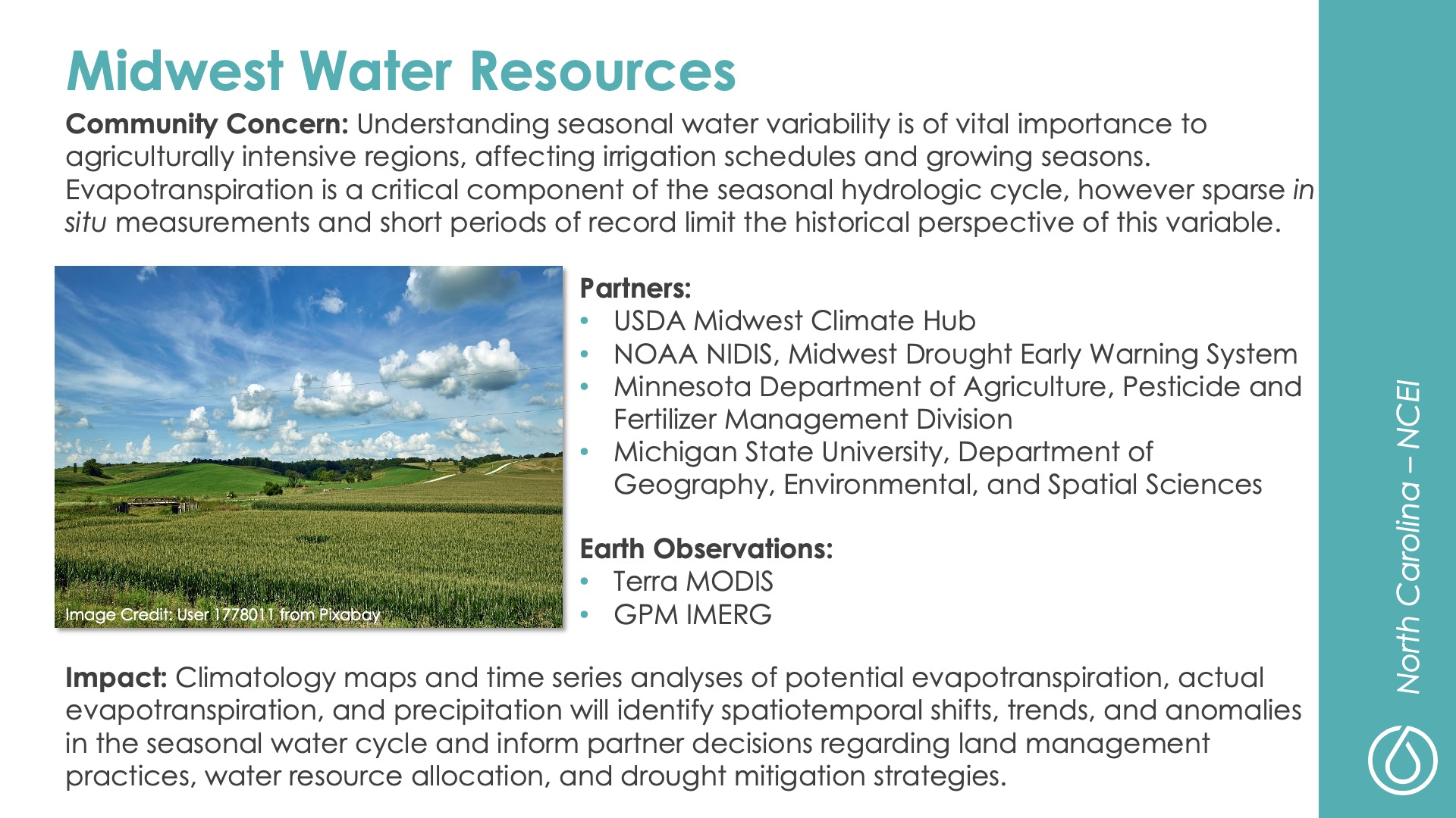
Midwest Water Resources
DEVELOP Node: North Carolina - NCEI

Community Concern: Understanding seasonal water variability is of vital importance to agriculturally intensive regions, affecting irrigation schedules and growing seasons. Evapotranspiration is a critical component of the seasonal hydrologic cycle, however sparse in  situ measurements and short periods of record limit the historical perspective of this variable.

Impact: Climatology maps and time series analyses of potential evapotranspiration, actual evapotranspiration, and precipitation will identify spatio-temporal shifts, trends, and anomalies in the seasonal water cycle and inform partner decisions regarding land management practices, water resource allocation, and drought mitigation strategies.

Partners: USDA Midwest Climate Hub, NOAA NIDIS–Midwest Drought Early Warning System, Minnesota Department of Agriculture–Pesticide and Fertilizer Management Division, Michigan State University, Department of Geography, Environmental and Spatial Sciences

Earth Observations: Terra MODIS, GPM IMERG