DEVELOPing Connections
Analyzing Health and Air Quality from Space: How NASA DEVELOP used Earth Observations to Build Capacity with the Central American Integration System
by Andrew Shannon | Former Fellow, NASA DEVELOP, NCEI location
April 1, 2021

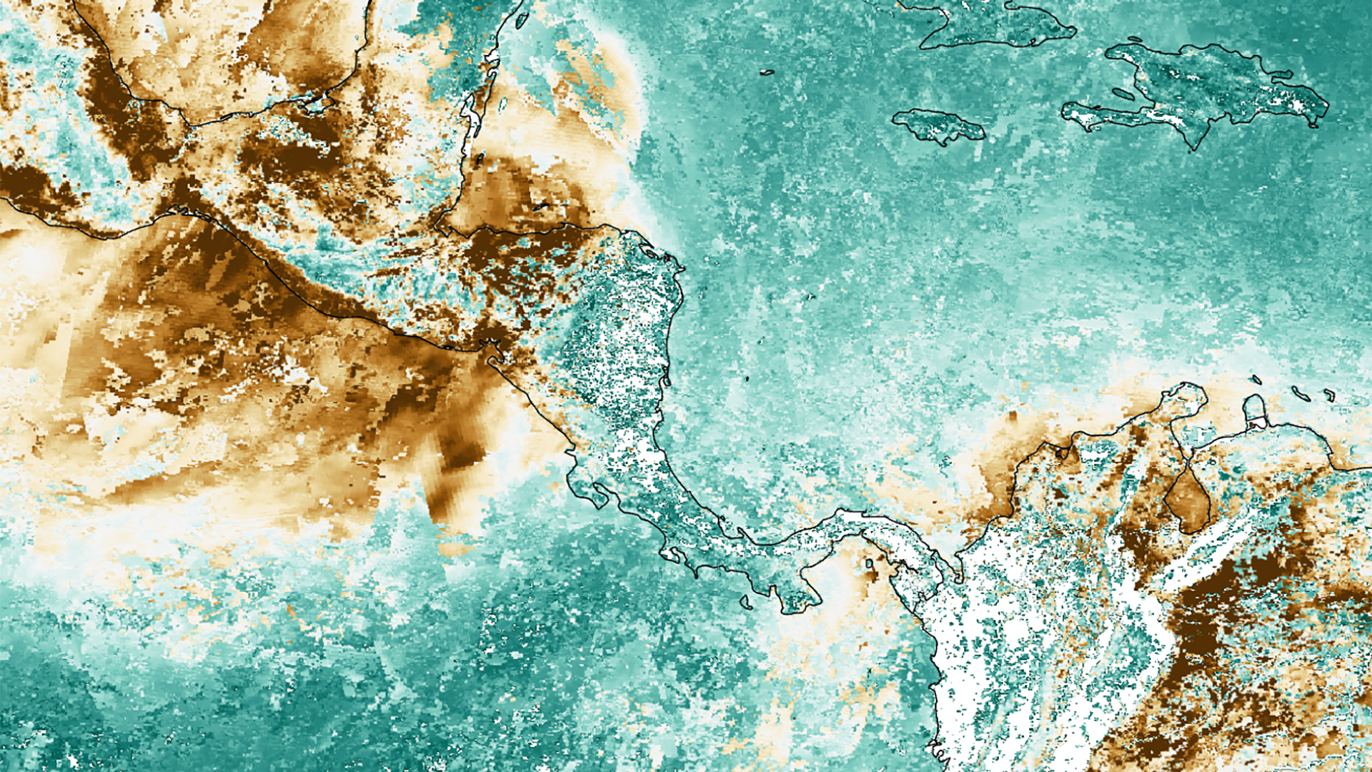
Website image of the Central America Health & Air Quality project from fall 2019 depicting aerosol optical depth derived from NASA Earth observations. Image credit: NASA DEVELOP

Panorama photograph taken of Panama from the International Space Station in 2018. Image credit: NASA Earth Observatory
In 2019, NASA signed a Joint Statement with the Central American Integration System (Spanish: Sistema de la Integración Centroamericana, or SICA), the organizational framework for economic and political cooperation between eight Central American member states. This statement facilitated partnerships between the NASA Earth Science Division and SICA-affiliated agencies seeking to address their social and environmental concerns through the use of NASA Earth observations.
As part of a SICA initiative during the fall 2019 term, a DEVELOP team at NASA Langley Research Center worked with agencies and universities in El Salvador, Guatemala, and Panama interested in expanding their resources to monitor environmental public health concerns. Agencies included the Ministry of Environment and Natural Resources (MARN) of El Salvador and the Ministry of Environment and Natural Resources of Guatemala. Universities included the Technological University of Panama, the Autonomous University of Chiriquí, and the University of Panama Specialized Institute of Analysis.
The objective of this project was to compute air quality measurements for regions across Central America that experienced air pollution events between 2008 and 2019. One of the project partners, Telma Chávez, Remote Sensing Specialist from El Salvador’s MARN, assisted the DEVELOP team by describing anthropogenic and natural causes of regional pollution events, such as biomass burning, pyrotechnics, and wildfires. Chávez noted how wildfire risk increases from October to March, the dry season throughout most of Central America. These wildfire events degrade air quality through the release of aerosols into the atmosphere, specifically fine particulate matter with a diameter of 2.5μm or less (PM2.5). Degraded air quality and long-term exposure to PM2.5 pose public health risks of respiratory harm and other illnesses, especially for individuals with pre-existing heart and lung conditions.
Currently, teams from MARN in El Salvador monitor air quality using three ground stations, which are all located in an urban area of the country that comprises 70% of the population. Chávez noted that this distribution of stations leaves gaps in air quality monitoring for other parts of the country. With this context in mind, the Langley DEVELOP team connected Chávez and the other partners to remote sensing resources for air quality analysis that address the spatial and temporal data gaps of ground stations.

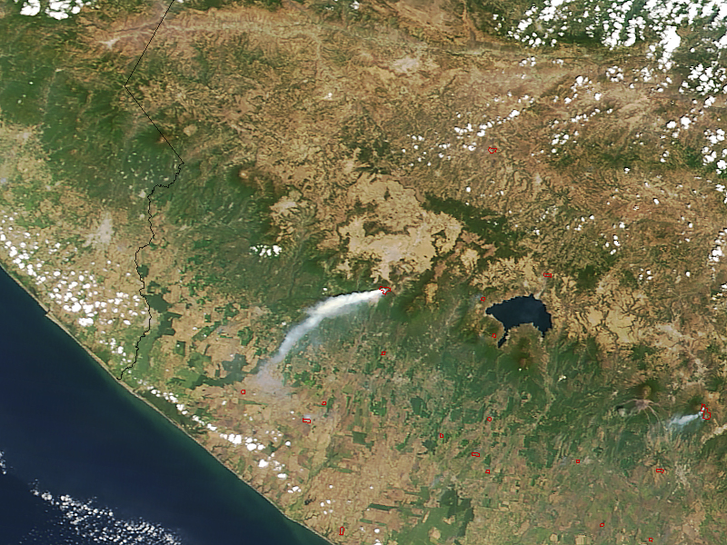
Image of a smoke plume from a wildfire near the Santa Maria volcano in Guatemala in 2018 captured with imagery from Terra MODIS. Image credit: Jeff Schmaltz, NASA Earth Observatory
Several of the NASA Earth-observing instruments provide proxy measurements for global air quality. The DEVELOP team highlighted data from the Aqua and Terra Moderate Resolution Imaging Spectroradiometer (MODIS) and the Cloud-Aerosol Lidar and Infrared Pathfinder Satellite Observation Cloud-Aerosol Lidar with Orthogonal Polarization (CALIPSO CALIOP). These instruments measure aerosol optical depth (AOD), an optical property which is related to the aerosol column concentration in the atmosphere. MODIS-derived AOD measures the total atmospheric column, whereas CALIOP measures AOD in the lower parts of the atmosphere. MODIS-derived AOD measurements can be converted into values of PM2.5 through regression analysis with PM2.5 data from ground stations and validation with CALIOP measurements.
Throughout the 10-week project, the team developed methods to quantify the relationship between satellite-derived AOD measurements and PM2.5 observations at the ground stations in El Salvador. With this relationship, the team computed several analyses of air quality over the region, including monthly and seasonal trends of PM2.5 and AOD values. Additionally, the team generated air quality index maps that provide a standardized scale of health risks related to air quality. Through case studies of air pollution events, the team highlighted the strengths and limitations of these products to capture the impacts of air quality degradation and the associated health risks. The project culminated in a virtual workshop, in which the Langley DEVELOP team organized a tutorial of its data acquisition and analysis methods and reviewed a geodatabase package of MODIS-derived AOD distribution provided to the partners. The tutorial provided a workflow the partners can replicate for continued analysis.
After the completion of the project, Chávez reflected upon the results and how MARN in El Salvador can integrate the information into its work. For many of her colleagues, using Earth observations and AOD measurements to monitor air quality is a new experience. She noted, “When you learn something new, then you want to know many more things… [The project] gives us ideas to perform analysis in areas where we don’t have ground stations.”
When discussing how MARN can use the Earth observation data products in the future, Chávez described that while there are uncertainties in the methods, the results are of interest to researchers and policymakers who had not previously used remote sensing data. “What we see is a long way to go. For now, we have captured attention, and we have people interested in using this data… We [are thinking] how to incorporate [the data] into the day-to-day processes we have,” explained Chávez.