DEVELOPing Connections
Fighting Fire with Forecasting: Predicting Woodland Habitat Suitability in the Santa Monica Mountains
Cecil Byles | Senior Fellow, DEVELOP National Program Office
October 6, 2020

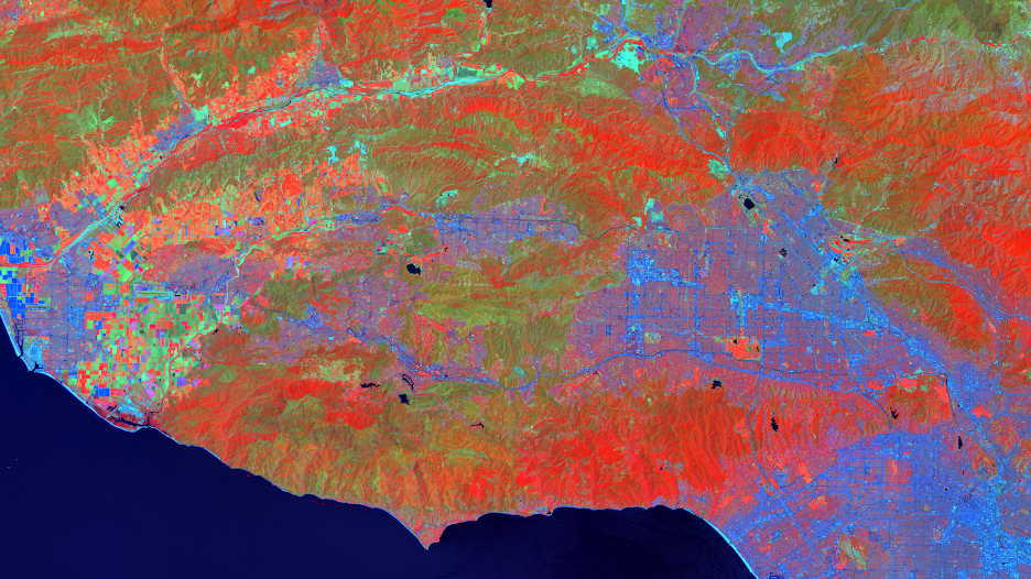
False color composite of the Santa Monica Mountains. Brighter red hues are associated with more vigorous vegetation canopies, green hues are associated with less vegetated areas, and deeper blues are associated with built-up areas and impervious surfaces. Image credit: Santa Monica Mountains Ecological Forecasting III team, NASA DEVELOP

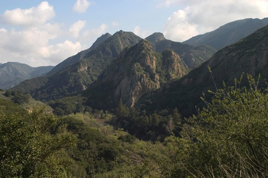
View of Malibu Creek State Park, Santa Monica Mountains National Recreation Area. Image credit: National Park Service (https://www.nps.gov/im/vmi-samo.htm)
In 2018, the destructive Woolsey Fire tore through Los Angeles and Ventura County in California. In addition to widespread damage to structures, the fire also caused massive harm to California’s ecosystems, including a vast woodland area in the Santa Monica Mountains. In the dry Mediterranean climate of Southern California, key woodland species provide aesthetic, monetary, and ecological value to the landscape through a number of critical ecosystem services.
After the fire, landowners and organizations, such as the Santa Monica Mountains National Recreation Area and the Resource Conservation District of the Santa Monica Mountains, needed to replant trees to make up for the ecosystem services lost to the fire. However, they had no methods to accurately estimate the best location to plant these trees. The new trees would need to be planted in a habitat where they would both thrive and avoid damage from future droughts and fires. Restoration efforts traditionally focus on replanting trees in their current distributions without considering how a changing climate may shift the distribution of suitable habitats. Seeking to incorporate this climatic effect into traditional restoration efforts, NASA DEVELOP partnered with a number of locally-based organizations to tackle the issue.
DEVELOP, at its Jet Propulsion Laboratory location in Pasadena, CA, conducted previous projects looking at habitats and tree cover in the Santa Monica Mountains, but focused more on analyzing areas where trees died rather than where trees lived. As Rosi Dagit of the Resource Conservation District of the Santa Monica Mountains explained, “[Analyzing where trees recently lived] can help us better understand tree fitness, especially in response to stressful conditions like the Woolsey Fire.”
“[Analyzing where trees recently lived] can help us better understand tree fitness, especially in response to stressful conditions like the Woolsey Fire.”The NASA DEVELOP team used remote sensing techniques to consider the impact of current and future climatic effects on woodland habitat suitability in the Santa Monica Mountains. They utilized a suite of NASA and non-NASA Earth observations, including Landsat 8 Operational Land Imager, NASA ER-2 Airborne Visible InfraRed Imaging Spectrometer, Shuttle Radar Topography Mission, and RapidEye (distributed by Planet.com). Using these remote sensing datasets, the NASA DEVELOP team modeled conditions where trees are currently living and where those conditions will be found in the future based on climate projections. Specifically, they modeled which locations are most likely to establish trees and support tree survival in the next 100 years.
Prior to their partnership with DEVELOP, the Resource Conservation District had little experience using remote sensing techniques to supplement their decision-making efforts. How they managed issues addressed by the project can be summed up simply: “We couldn’t, and we didn’t. We had no tools to address the issues,” explains Ms. Dagit. “For the majority of the partners involved in the project, they did not understand what could be done [with NASA Earth observation data].”
The Resource Conservation District utilized the team’s results and conclusions as inputs to their “Priority Planting Plan,” an extensive report made in collaboration with other local and statewide environmental agencies. Major park landowners use this document to write grants and provide exact plans for planting. The team also created a web-based map that is now published on the Los Angeles County Regional Planning GIS portal. “Anyone can go on and say ‘this is my property -- what should I plant here?’” says Ms. Dagit. “But the biggest help was being able to learn how to navigate some of those [remote sensing datasets] and knowing exactly what is out there to help.”