DEVELOPing Connections
Connecting the Dots of Conservation: Mapping Wildlife Corridors in Costa Rica with NASA Earth Observations
Andrew Shannon | Fellow, NASA DEVELOP, NCEI location
November 23, 2020

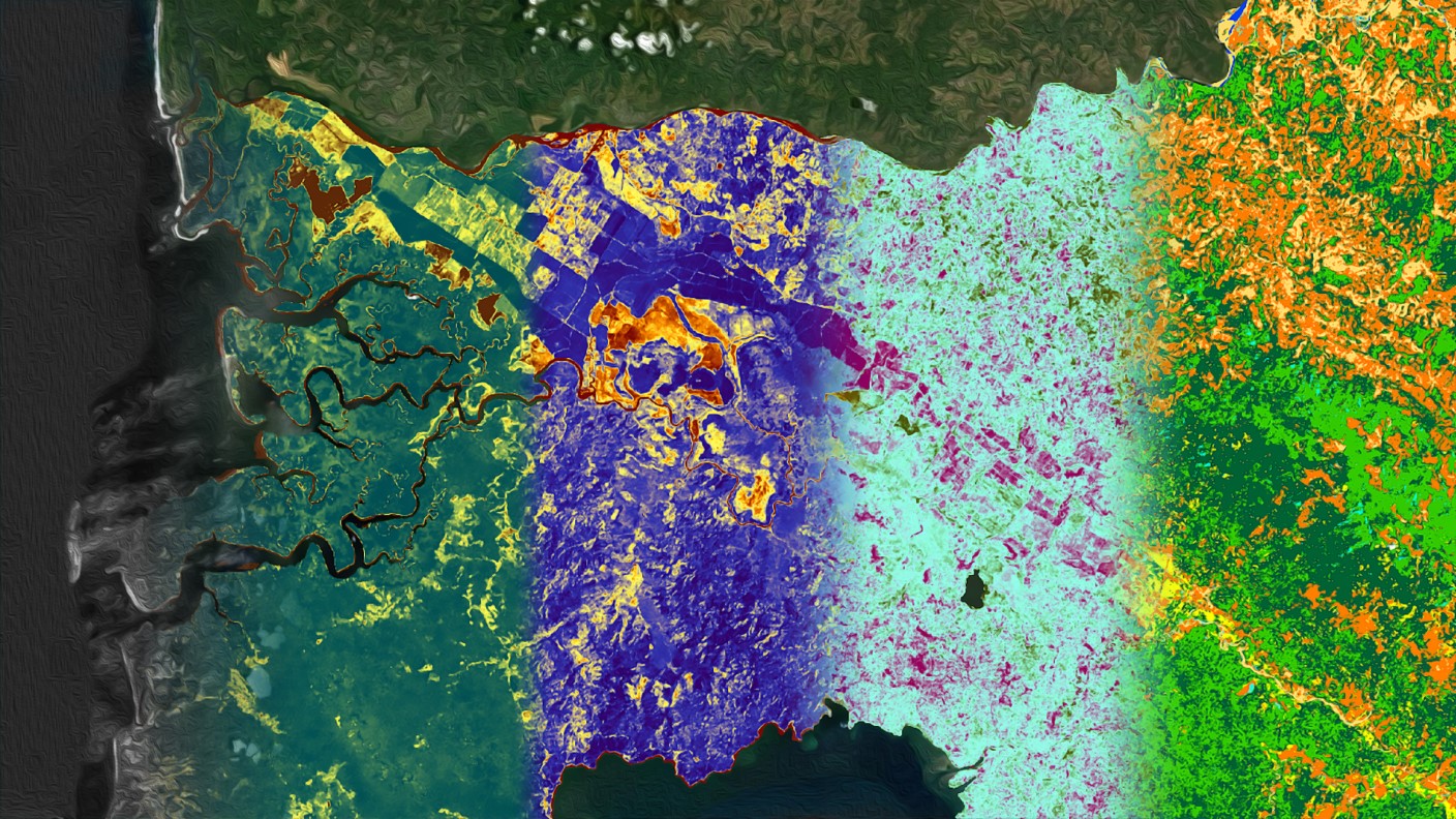
Website image of the Talamanca-Osa Ecological Forecasting project from spring 2019 depicting various spectral indices used in the project methods. Image credit: NASA DEVELOP

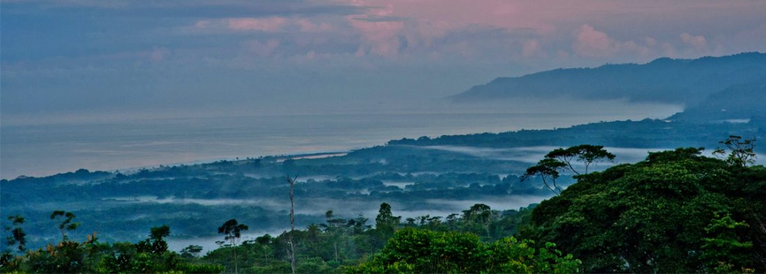
View of the landscape of the Osa Peninsula. Image credit: Osa Conservation (https://osaconservation.org/)
Osa Conservation is a nonprofit organization dedicated to promoting science and community-based conservation practices in the Osa Peninsula of Costa Rica. Located along the Pacific coast of Costa Rica, the Osa Peninsula houses one of the largest lowland rainforests in Mesoamerica and contains one of the world’s most biodiverse regions. This impressive biodiversity and variety of ecosystems, including rainforest and mangrove environments, are integral to the ecological health of the area, as well as the economic livelihoods tied to ecotourism and natural resources. Deforestation and agricultural development in the twentieth century have presented conservation threats, such as the degradation of water quality in riparian environments and incidents of human-wildlife conflict.
In an effort to expand their science-based strategies to address these threats, Osa Conservation began its first of five projects with the NASA DEVELOP Program in the spring of 2018. This first project was conducted at the NASA DEVELOP Georgia node, the University of Georgia Center for Geospatial Research. The project team explored changes in land cover and land use in the Osa Peninsula between 1987 and 2017 using Landsat 5 Thematic Mapper (TM), Landsat 8 Operational Land Imager (OLI), and Terra Advanced Spaceborne Thermal Emission and Reflection Radiometer (ASTER) data. Hilary Brumberg, Lowland Ridge to Reef Program Manager for Osa Conservation, was one of the target end-users for the deliverables of this project. She described how her successful experience as a partner led to more research questions, which opened the door to a series of partnerships with the DEVELOP teams at the University of Georgia. For example, in the fall 2018, the NASA DEVELOP team assed how land use change affects turbidity and sea surface temperature in the Golfo Dulce, the gulf that separates the Osa Peninsula from mainland Costa Rica. Hilary commented on the impacts of these projects in helping Osa Conservation inform cross-sectoral conservation in the region:
“The maps we created in collaboration with NASA DEVELOP are the first to show land use change 1987-2017 across the entire Osa Conservation Area and to distinguish between old growth and secondary forest. These maps are a key tool to inform research and conservation in the region. By sharing them with local government agencies, community organizations, local researchers, and international researchers, we are able to catalyze the conservation and generation of knowledge about diverse ecosystems and species, including native vanilla, endangered spider monkeys, and endemic tree species. We emphasize that conservation is a collaborative, cross-sectoral process and exemplify that by always being very open to share maps, ideas and other resources.”

Image of jaguar (Panthera onca). Image credit: Arizona Center for Nature Conservation, with written permission.
The land use change maps created in the first two DEVELOP terms indicated that forest cover is increasing in the region. In order to conserve the Osa Peninsula long term, Osa Conservation began investigating the potential to connect the peninsula with the nearest large tract of forest: La Amistad International Peace Park in the Talamanca Mountains. These mountains are found further inland and contain higher elevation rainforests. In early 2019, Osa Conservation and the Arizona Center for Nature Conservation at the Phoenix Zoo, which manages a wildlife monitoring station in the Talamanca mountains, proposed a project with the DEVELOP teams at the University of Georgia to advance a wildlife corridor to connect isolated populations of jaguars (Panthera onca) between the Osa Peninsula and the Talamanca Mountains.
Over the course of two Osa-Talamanca ecological forecasting projects in the spring and summer of 2019, the teams created products to aid in the data-driven planning efforts for the wildlife corridor. They produced maps of optimal paths for the corridor that minimize the risk of human-wildlife conflict based on a risk matrix and projected land use classifications derived from the NASA Earth observations. Hilary described not only how the historic and projected land use changes helped them identify priority areas for conservation action in the corridor, but also how the end products served as important communication pieces:
“We’ve been able to use those maps in presentations, workshops and grant applications. Some of the maps show really well how the Enhanced Vegetation Index and Normalized Difference Vegetation Index has increased in Osa Peninsula and in La Amistad Park in the past few decades since the implementation of the forestry law, Payment for Ecosystem Services program, and conservation initiatives in the region, but in the corridor between those two regions, the vegetation indexes have decreased. Whenever I show that map in a presentation to the community, government, and other stakeholders, the sea of red in the corridor that indicates a decrease in vegetation stands out in comparison to the blue indicating an increase in vegetation in the Osa and La Amistad. These maps are useful tools to help stakeholders see visually why conservation in that corridor is key. It is a call to action.”
In 2020, Osa Conservation launched the Ridge to Reef program after a successful year of strategic planning, which started with the creation of the maps with NASA DEVELOP. Ridge to Reef expands the geographic extent of Osa Conservation’s work from La Amistad Park, through the Talamanca Mountains, into the Osa Peninsula, and down to the ocean floor. Osa Conservation is working closely with the local government, national and international non-profits, farmers’ cooperatives, universities, and other key stakeholders to develop this initiative. It is a model for cross-sectoral biological corridor conservation that can be scaled-up internationally. This planning not only involved enhancing the data resources available to Osa Conservation for prioritizing conservation areas and paths with the NASA DEVELOP Program, it also involved communicating this information to stakeholders. Hilary noted how the outcomes of the collaboration with DEVELOP supported this communication:
“As we are developing the strategic plan for Ridge to Reef, the maps of land use and least cost paths created in collaboration with NASA have been instrumental. The maps allow us to highlight priority areas for ecological restoration and rewilding, including the installation of underpasses and overpasses to facilitate wildlife movement. We used the maps to determine the number of trees needed to reforest the degraded rivers in the Ridge to Reef corridor region, allowing us to plan native tree production and identify fundraising targets. Moreover, in 2019 as we were brainstorming the Ridge to Reef initiative, we were able to show the maps to national and international organizations and potential donors to highlight the importance of conservation in the region. People were especially excited to collaborate once they saw that we’d already taken this crucial first step to map the current, past, and future land use in the region. We could show that we had already made progress working in the corridor and already had a good sense of where the priority areas were.”

View of the coastal landscape of the Osa Peninsula with overhead rainbows. Image credit: Osa Conservation (https://osaconservation.org/)
Having received several grants for the implementation of Ridge to Reef, Osa Conservation is proceeding with initiatives to accomplish their goals in collaboration with national and international partners. These initiatives include the largest altitudinal camera trap assessment ever completed in Central America, reforestation along rivers prioritized by proximity to the least cost path and agricultural areas, outreach to communities to minimize wildlife poaching, and development of incentives to promote conservation practices with local landowners. Since the completion of the NASA DEVELOP project, Osa Conservation has continued its communication with DEVELOP leadership at the University of Georgia to report updates on project outcomes. Hilary, other Osa Conservation staff members, former DEVELOP team members, the University of Costa Rica, UGA and are working on two peer-reviewed manuscripts to communicate the results of the Osa Water Resources terms. What began as a ten-week long project, spurred into a multi-year partnership that has provided innovative applications to conservation and strengthened community relationships with the help of NASA Earth observations.