Using NASA Earth Observations to Improve Detection Systems for Harmful Algal Events in the Highland Lakes in Central Texas
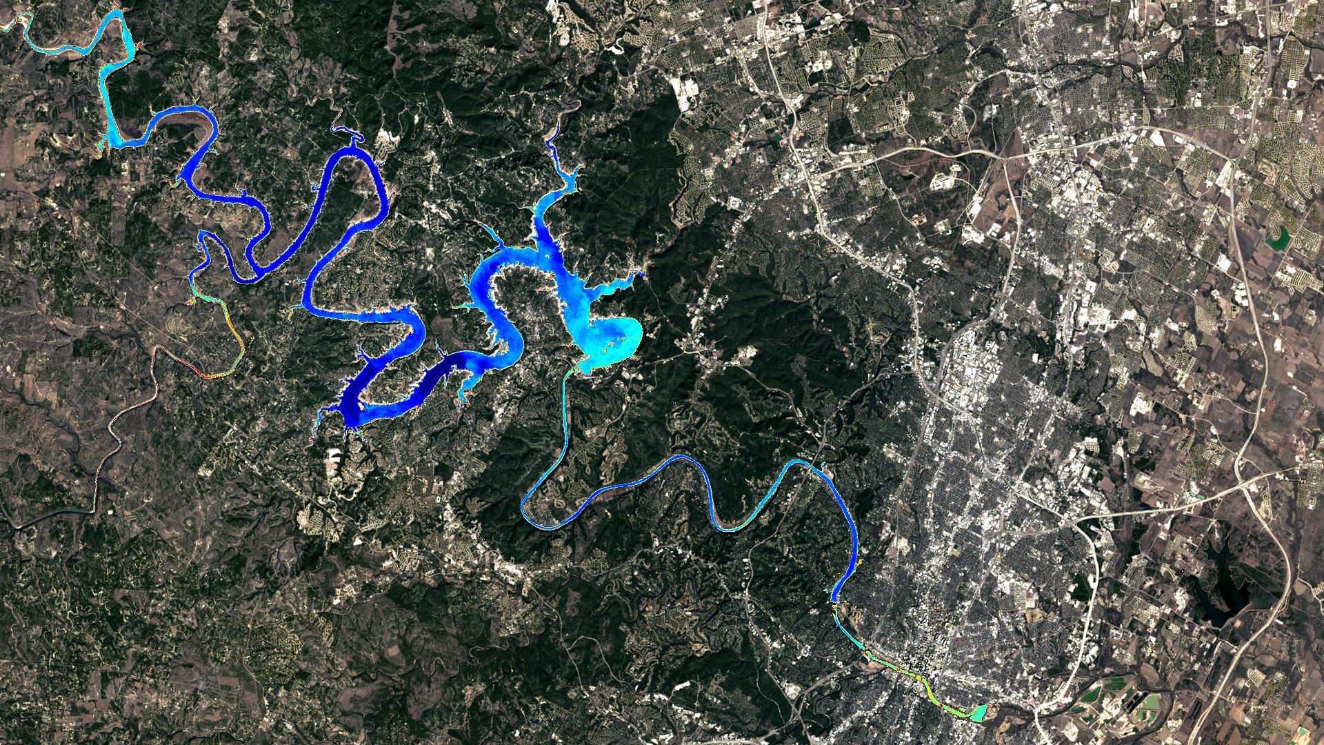
Beginning in 2019, harmful algal events in Austin, Texas, caused canine deaths in the Lady Bird Lake and Lake Travis reservoirs. These reservoirs are part of the larger Highland Lakes chain, managed by the Lower Colorado River Authority (LCRA) and the City of Austin Department of Watershed Protection (CoA DWP), which fulfill municipal, commercial, and agricultural water demands. Given the recent increase in favorable algal event conditions in central Texas, the LCRA and CoA DWP partnered with NASA DEVELOP to improve algal event early-warning systems through the application of remote sensing and machine learning. An Earth observation-based algal monitoring system will assist the responsible agencies in predicting algal conditions and communicating hazards to the public. The NASA DEVELOP team utilized Landsat 8 Operational Land Imager (OLI) and Sentinel-2 Multispectral Instrument (MSI) data to produce products including chlorophyll-a concentrations, cyanobacteria detections, turbidity, and water surface temperature. Chlorophyll-a concentrations were retrieved with a pre-trained machine learning model (mixture density network) and spectral indices, while the other products were derived from spectral indices. In situ field data were used to validate and quantify uncertainties for each product. The validations show strong correlations for chlorophyll-a and water surface temperature. Time series analyses of chlorophyll-a concentrations show peaks in the severe drought years (2015 and 2016). This project's resulting products enable monitoring of environmental proxies relevant to algal event presence in the Highland Lakes chain and will ultimately support water management, decision making, and risk communication.
- Location
- Arizona - Tempe
- Term
- Summer 2021
- Partner(s)
- City of Austin, Department of Watershed Protection
Lower Colorado River Authority
The University of Texas at Austin, Department of Molecular Sciences
Austin Water Utility - NASA Earth Observations
- Landsat 8 OLI
Sentinel-2 MSI - Team
- Kaitlynn Hietpas (Project Lead)
Shuyu Chang
Addison Pletcher
Mark Radwin
Emma Waugh - Advisor(s)
- Dr. Erin Urquhart (NASA Goddard Space Flight Center, Science Systems and Applications, Inc.)
Dr. Christine Lee (NASA Jet Propulsion Laboratory, California Institute of Technology)
Dr. David Hondula (Arizona State University)