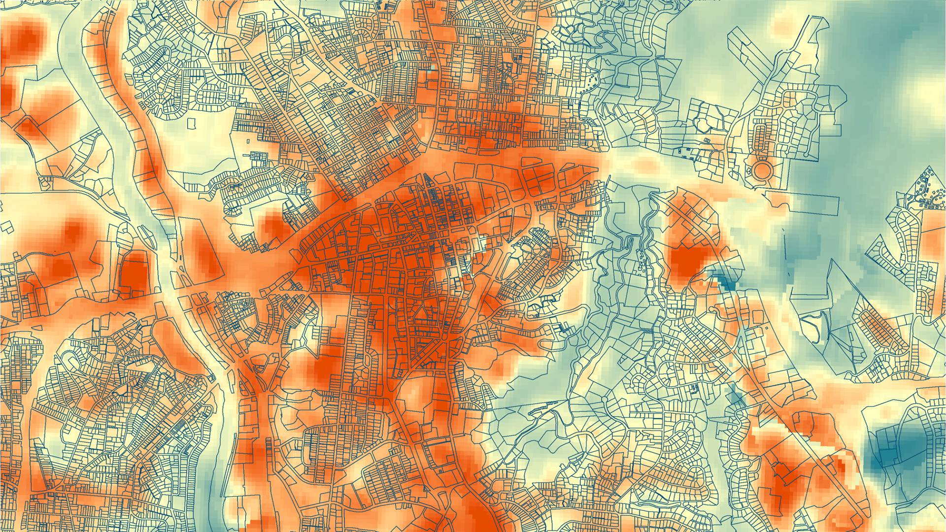
Using NASA Earth Observations to Quantify the Impact of Urban Tree Canopy Cover on Urban Heat and Identify Community Vulnerability in Asheville, North Carolina
Asheville, North Carolina has had a population growth of approximately 10 percent over the past decade, while the city’s tree canopy cover has simultaneously decreased by 6.4 percent. A well-known benefit of urban tree cover is the mitigation of the effects of urban heat islands through factors including shade and evapotranspiration. Thus, as Asheville’s population grows, the presence of trees and their cooling effects is crucial. The Asheville Urban Forestry Commission advises the City Council on issues pertaining to urban development with policies centered on tree cover preservation and growth. The Asheville Urban Development team partnered with the Urban Forestry Commission to complete a study using NASA Earth observations and ancillary datasets to explore relationships between changes in land surface temperature and tree cover over the last 10 years. The team used Landsat 5 Thematic Mapper (TM) and Landsat 8 Operational Land Imager (OLI) to calculate Land Surface Temperature (LST) changes from 1984 to 2018. The team also used socioeconomic data on the census block group level to create a heat vulnerability index in order to identify communities at risk. The team included tree cover and LST data in this index to represent exposure and adaptive capacity as factors in heat vulnerability. The end products illustrated a significant correlation between tree cover and LST in Asheville and identified vulnerable communities to support the Urban Forestry Commission’s decisions about tree planting and preservation.
- Location
- North Carolina — NCEI
- Term
- Fall 2019
- Partner(s)
- City of Asheville, Urban Forestry Commission
- NASA Earth Observations
- Landsat 5 TM
Landsat 8 OLI - Team
- Darcy Gray (Project Lead)
Amiya Kalra
Amy Kennedy - Advisor(s)
- Scott Stevens (North Carolina Institute for Climate Studies, NOAA National Centers for Environmental Information)