Utilizing NASA Earth Observations to Assess Urban Heat Island Reduction Strategies in Washoe County, Nevada
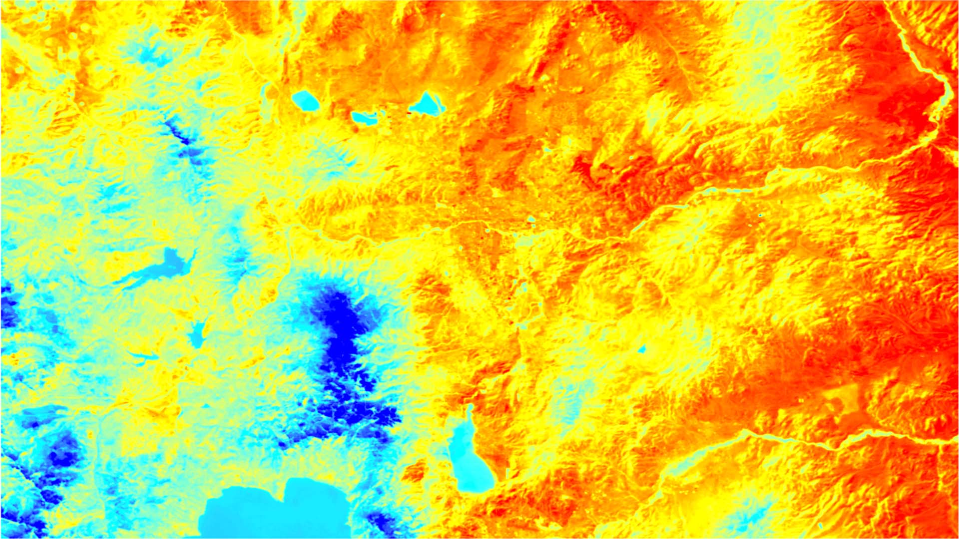
Extreme heat events (EHEs) are one of the leading causes of natural hazard-related deaths in the world. With rising global temperatures, these events will continue to increase in frequency, duration, and magnitude. The urban heat island (UHI) effect exacerbates the consequences of EHEs, discourages active transportation, necessitates greater energy expenditures for air conditioning, and elevates the risk of heat-related and respiratory illness in urban populations. The NASA DEVELOP Washoe County Urban Development Team utilized NASA Earth observations including Landsat 5 Thematic Mapper (TM), Landsat 8 Operational Land Imager (OLI) and Thermal Infrared Sensor (TIRS), and Terra Advanced Spaceborne Thermal Emission and Reflection Radiometer (ASTER) to identify the biophysical characteristics, such as impervious surfaces, vegetation, and tree canopy cover, that contribute to the UHI effect and which ones have the greatest influence on land surface temperature (LST). The team also created a heat vulnerability index (HVI) by combining socioeconomic and health data from the US Census and the Centers for Disease Control and Prevention (CDC), respectively. These processed datasets were integrated onto a web map platform for users to visualize areas of high heat and high vulnerability. Results showed that urbanized areas of the Truckee Meadows region were warmer on average than surrounding suburban areas. Areas that experienced highest temperatures occurred in the northeast portion of the Reno-Sparks districts. The confluence of these highly vulnerable areas and biophysical characteristics will assist the Washoe County Health District's Air Quality Management Division (AQMD) with decision-making related to UHI mitigation strategies in the Truckee Meadows region.
Project Video:
Washoe Away the Heat
- Location
- Arizona - Tempe
- Term
- Summer 2018
- Partner(s)
- Washoe County Health District, Air Quality Management Division
Stantec Consulting Service, Inc. - NASA Earth Observations
- Landsat 5, TM
Landsat 8, OLI/TIRS
Terra, ASTER - Team
- Julia Heslin (Project Lead)
John Dialesandro
Mariah Heck
Chenxi Lin - Advisor(s)
- Dr. David Hondula (Arizona State University)
- Project Materials Poster PDF