Designing a Modeling User Interface Incorporating Landsat to Monitor Changes in Riparian Vegetation and Endangered Fish Habitat
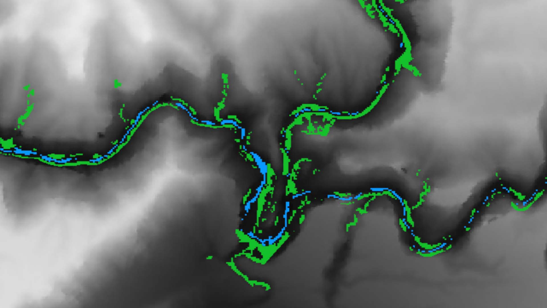
Since the completion of the Flaming Gorge Dam in 1964, artificial flow releases along the Green River have promoted channel narrowing and encouraged non-native vegetation encroachment into the active stream channel. These changes in the Green River's flow regime have reduced the backwater habitat of four native endangered fish species: the Colorado pikeminnow (Ptychocheilus lucius), Razorback Sucker (Xyrauchen texanus), Humpback Chub (Gila cypha), and Bonytail (Gila elegans). To promote population recovery, this project developed the River Morphology Evaluation Toolbox (RMET), a Google Earth Engine (GEE) tool, to more efficiently and cost-effectively monitor changes in vegetation and hydrology across large spatial and temporal scales. Using imagery collected from Landsat 5 Thematic Mapper (TM), Landsat 7 Enhanced Thematic Mapper Plus (ETM+), Landsat 8 Operational Land Imager (OLI) and Thermal Infrared Sensor (TIRS), Shuttle Radar Topography Mission (SRTM), and Sentinel-2 Multi Spectral Instrument (MSI) satellites, the team used the normalized difference vegetation index (NDVI), soil adjusted vegetation index (SAVI), modified normalized difference water index (MNDWI), and normalized difference water index (NDWI) to detect landcover changes. Trends in spectral index changes over user-selected focal years and the magnitudes of those changes were isolated and visualized through RMET. The project partners at the National Park Service and the Upper Colorado River Endangered Fish Recovery Program will use RMET to identify potential sites where changes in riparian vegetation and the active stream channel may have reduced fish habitat to make more informed recommendations for flow releases from the Flaming Gorge Dam.
Project Video:
Gone with the Flow
- Location
- Colorado - Fort Collins
- Term
- Summer 2018
- Partner(s)
- National Park Service, Water Resources Division
National Park Service, Inventory & Monitoring Division, Northern Colorado Plateau Network
Upper Colorado River Endangered Fish Recovery Program - NASA Earth Observations
- Landsat 5, TM
Landsat 7, ETM+
Landsat 8, OLI
Sentinel-2, MSI
SRTM - Team
- Margaret Mulhern (Project Lead)
Daniel Carver
Kristen Dennis
Nathaniel Penrod - Advisor(s)
- Dr. Paul Evangelista, (Colorado State University, Natural Resource Ecology Laboratory)
Nicholas Young, (Colorado State University, Natural Resource Ecology Laboratory)
Tony Vorster, (Colorado State University, Natural Resource Ecology Laboratory)
Brian Woodward, (Colorado State University, Natural Resource Ecology Laboratory) - Project Materials Poster PDF