Estimating Soil Moisture in Semi-arid Sagebrush Steppe Utilizing NASA Earth Observations
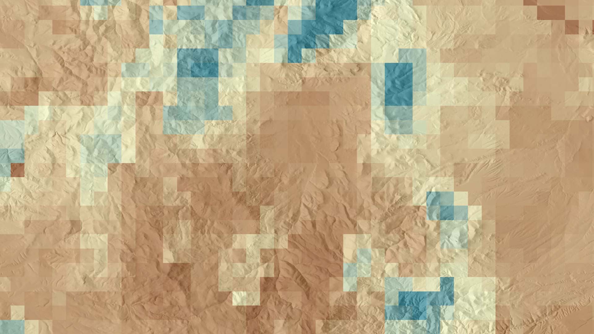
Soil moisture is a critical component of ecosystem health, particularly in semi-arid landscapes where seasonal and infrequent precipitation is one of the primary controls on vegetative health. Current land management practices of soil moisture data collection rely on costly and time-consuming field sampling or on extensive modeling. The introduction of remotely sensed soil moisture measurements from NASA Earth observations will provide low-effort, high spatio-temporal coverage datasets for management agencies such as our primary partners at the US Fish and Wildlife Service (USFWS). Validating remotely-sensed data with field observations from Reynolds Critical Experimental Watershed (RCEW) in Idaho will increase the confidence in remotely sensed soil moisture data. This project evaluated methods for monitoring soil moisture in semi-arid ecosystems using data from NASA Soil Moisture Active Passive (SMAP) sharpened with European Space Agency (ESA) Sentinel-1 C-Band Synthetic Aperture Radar (C-SAR) backscatter, Global Precipitation Measurement (GPM), Terra Moderate Resolution Imaging Spectroradiometer (MODIS) derived Normalized Difference Vegetation Index (NDVI), and modeled soil moisture from TopoFire and Gridded Surface Meteorologic Dataset (GRIDMET) for the period between December 2016 to July 2018. The Idaho NASA DEVELOP team created useful maps and established a workflow to allow land managers to easily access and visualize soil moisture in their area of interest. Linear regression analysis was used to quantify correlations between soil moisture, precipitation, and vegetation health. Preliminary correlation between SMAP and in situ soil moisture were positive at all sites, but results fell into three categories: 60% had a moderate correlation at good confidence, 25% had a high correlation at high confidence, and 15% had a low correlation at low confidence.
Project Video:
RADAR Love
- Location
- Idaho - Pocatello
- Term
- Summer 2018
- Partner(s)
- US Fish and Wildlife Service, Eastern Idaho Field Office
Idaho Department of Fish and Game, Southeast Regional Office
USDA, Natural Resources Conservation Service, Pocatello Field Office
Idaho National Laboratory
USDA, Agricultural Research Service, Northwest Watershed Research Center - NASA Earth Observations
- GPM, GMI
SMAP
Sentinel-1, C-SAR
Terra, MODIS - Team
- Ian Lauer (Project Lead)
Dane Coats
Leah Kucera
Zach Sforzo
Madison Broddle - Advisor(s)
- Keith Weber (Idaho State University, GIS TReC)
- Project Materials Poster PDF