Navajo National Monument Water Resources
Monitoring and Forecasting Precipitation Patterns and Erosion Potential to Enhance Archaeological Preservation and Decision Making
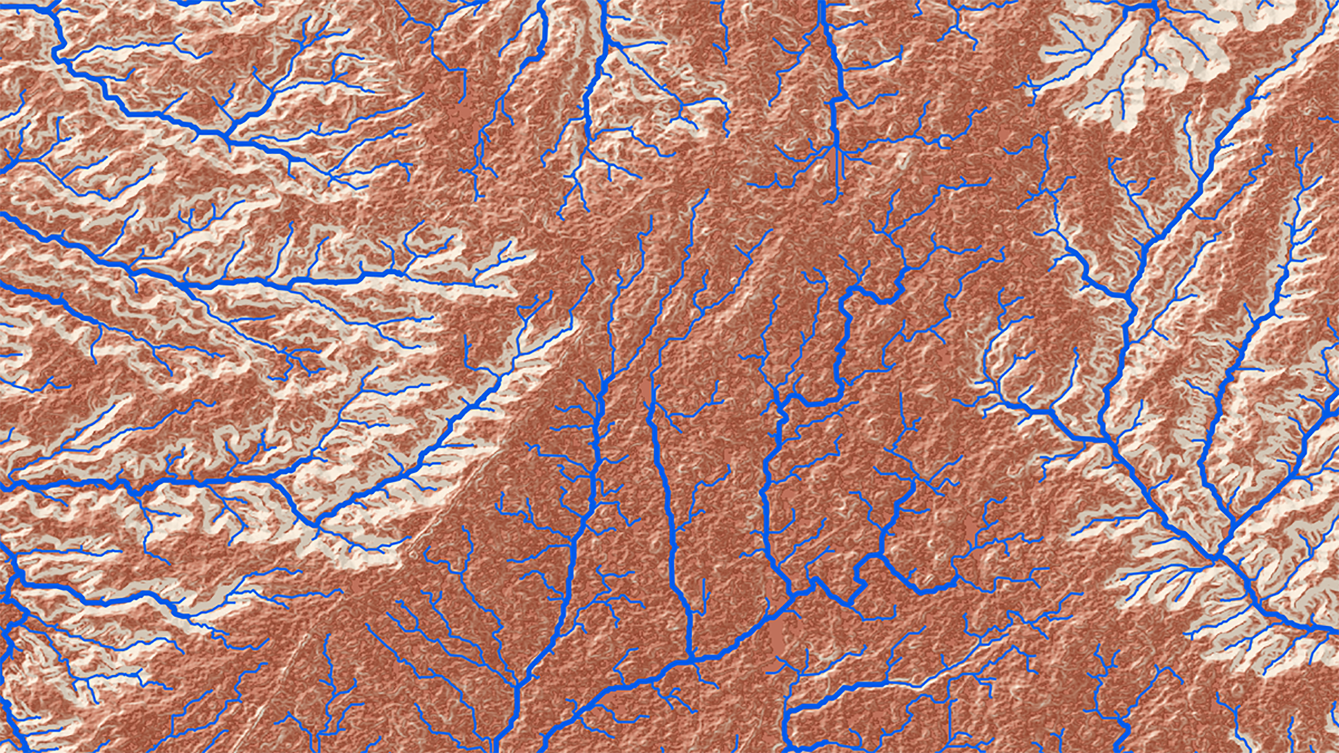
Increasing yearly monsoonal precipitation severity in Navajo National Monument (NAVA) is exacerbating erosion and arroyo cutting, affecting culturally significant archaeological sites in the area. In order to better understand and mitigate erosional processes, land managers at the park would benefit from comprehensive rainfall data and information on areas where erosion hazards are more likely to occur. The Idaho NASA DEVELOP team developed virtual rain gauges and erosion hazard maps that utilize NASA Earth observations to provide a more complete picture of rainfall measurements at the monument. Virtual rain gauges were developed in Google Earth Engine API from Global Precipitation Measurement (GPM) Microwave Imager (GMI) and Tropical Rainfall Measuring Mission (TRMM) Precipitation Radar (PR) satellite data. Values derived from these Earth observations were synthetically validated against each other, PRISM data, and were also compared to ground stations near the monument. The data displayed a weak statistical correlation between satellite derived data and ground based weather stations for the study area. Peaks within the data showed temporal similarities suggesting that the differences within the data were representative of regional variability. In future work, rainfall data from these virtual gauges can be used as temporal and intensity parameters, which combined with Shuttle Radar Topography Mission (SRTM)-derived hazard maps can inform land managers performing erosion mitigation.
Project Video:
Gauge Against the Machine
- Location
- Idaho - Pocatello
- Term
- Spring 2018
- Partner(s)
- National Parks Service, Navajo National Monument
Colorado State University - NASA Earth Observations
- GPM, GMI
TRMM, PR
SRTM - Team
- Dane Coats (Project Lead)
Theresa Condo
Brandon Crawford
Leah Kucera
Zachary Sforzo - Advisor(s)
- Keith Weber (Idaho State University GIS TReC)