Carolinas Disasters
Utilizing Precipitation Estimates from NASA Earth Observations and NOAA Climate Data Records to Enhance Understanding of Extreme Events in the Carolinas
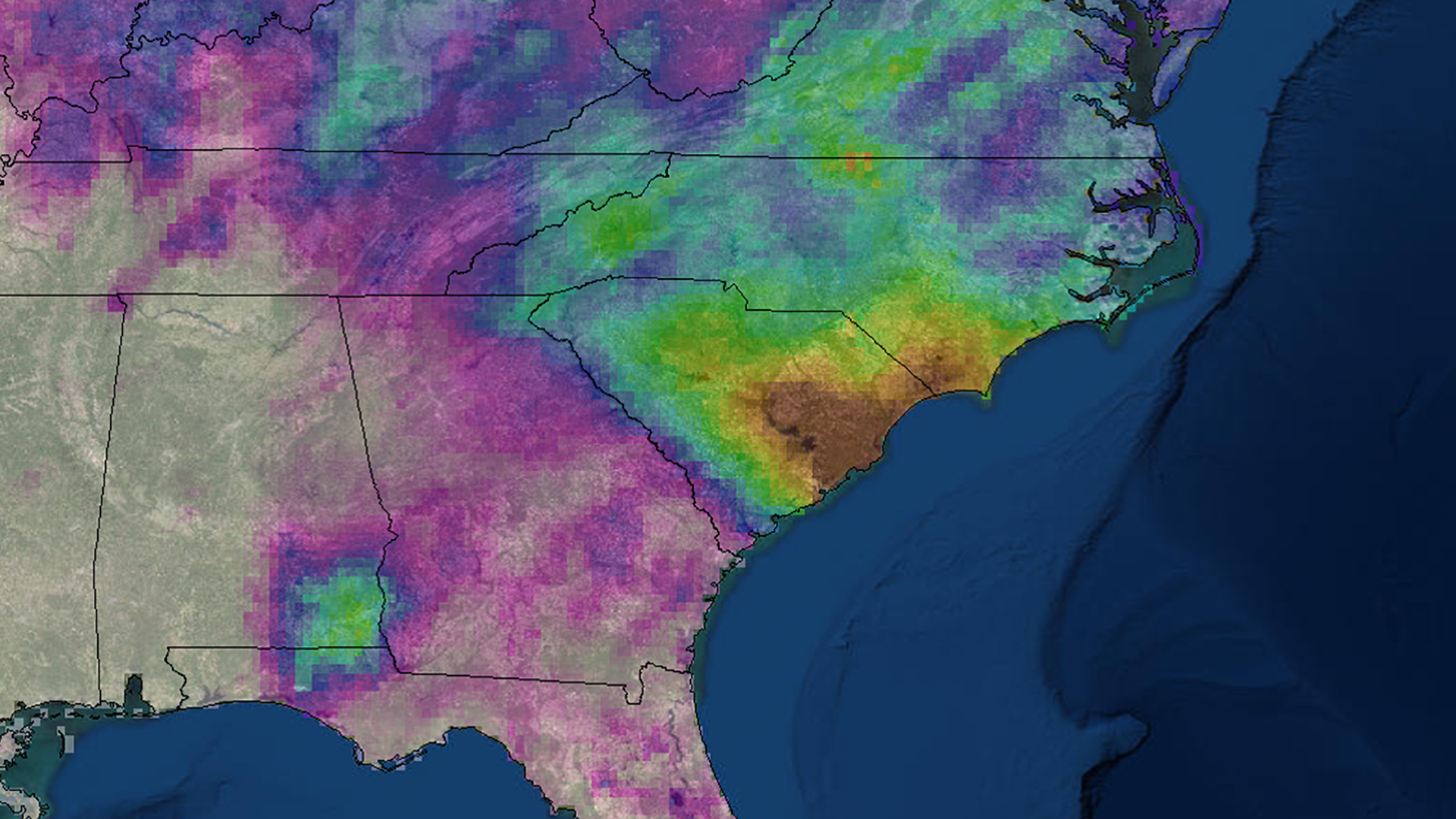
In October 2015, the state of South Carolina experienced a recording-breaking precipitation event leading to detrimental flooding that caused 19 fatalities and over one billion dollars of damages, which has prompted researchers and resource managers to enhance their understanding of extreme precipitation. This project explored multiple satellite-derived Quantitative Precipitation Estimates (QPE) in an effort to capture historical extreme precipitation patterns and risk-prone areas in both South Carolina and the greater southeastern United States. Using NASA Earth observations and NOAA Climate Data Records, we analyzed the benefits of using short-term, high-resolution datasets to measure extreme precipitation patterns compared to surface observations. Satellite observations included NASA's Tropical Rainfall Measuring Mission (TRMM) and Global Precipitation Measurement (GPM) mission, as well as NOAA's Precipitation Estimation from Remotely Sensed Information using Artificial Neural Networks Climate Data Record (PERSIANN-CDR). Surface observation records were retrieved from the Global Historical Climatology Network-Daily (GHCN-D) estimates, a network of global rain gauge stations. We highlighted areas prone to extreme precipitation with bias adjusted precipitation estimates. Results also assessed variability in precipitation measurements for recent years in an effort to integrate high-resolution QPE in NOAA's Climate Resilience Toolkit and to address spatial gaps in surface observation datasets. This project served to provide a better understanding of climate stressors for the Carolinas and to pose a discussion on effective methods of using climate resilience toolkits integrated with satellite-derived datasets.
Project Video:
Extreme Precipitation
- Location
- North Carolina - NCEI
- Term
- Spring 2018
- Partner(s)
- NOAA, Office for Coastal Management
University of North Carolina Asheville, National Environmental Modeling and Analysis Center - NASA Earth Observations
- GPM, IMERG
TRMM, TMPA
PERSIANN-CDR - Team
- Andrew Shannon (Project Lead)
Shelby Ingram
Michael VonHegel - Advisor(s)
- Olivier Prat (Cooperative Institute for Climate and Satellites, NOAA National Centers for Environmental Information)
Brian Nelson (NOAA National Centers for Environmental Information) - Project Materials Poster PDF