Amistad Ecological Forecasting
Using Landsat and Sentinel to Identify and Detect Giant Cane in Amistad National Recreation Area for Future Invasive Species Land Management
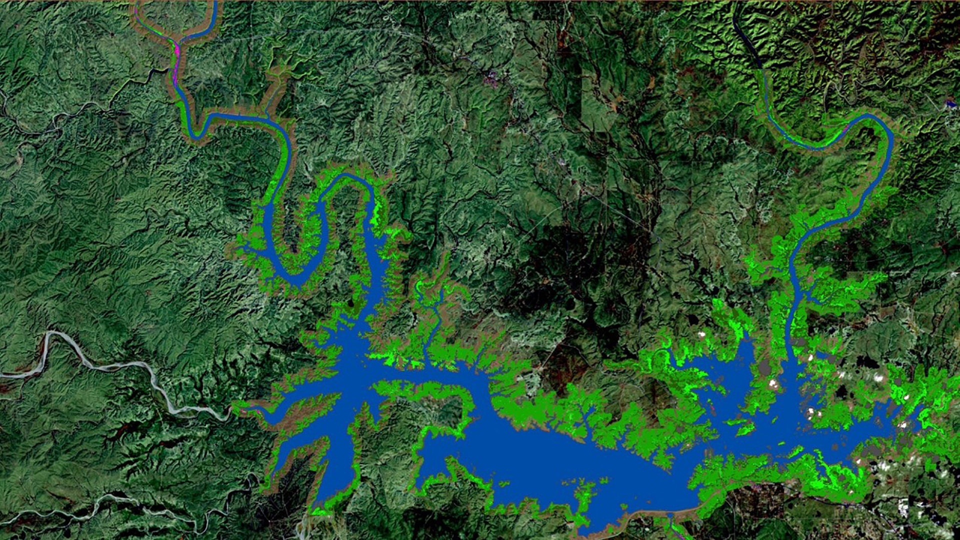
Portions of Amistad National Recreation Area (NRA) are threatened by the presence of an invasive grass species known as giant cane (Arundo donax), which drastically alters riparian habitats by out-competing native vegetation and depleting vital resources. Giant cane does not provide viable habitat or food for native species of wildlife, making it an important eradication target of land managers at the National Park Service (NPS). The NPS requires precise distribution maps of giant cane over the entire extent of Amistad NRA for effective land management, however their typical monitoring methods are ground based, labor intensive, and limited in scope. The Amistad Ecological Forecasting team created historic and current classified species distribution maps for the entire extent of Amistad NRA using Landsat 5 TM, Landsat 7 ETM+, Landsat 8 OLI, and Sentinel-2 MSI data for the years 1996 to 2018. Persistence maps were then constructed from these classified images to differentiate between long-lasting and ephemeral stands of giant cane. Finally, the team analyzed year-over-year change in the abundance of giant cane to highlight temporal trends and assess the efficacy of this classification approach. The products of this work will help the NPS prioritize their future land management efforts.
Project Video:
Crass Grass
- Location
- Virginia - Langley
- Term
- Spring 2018
- Partner(s)
- National Park Service, Amistad National Recreation Area
- NASA Earth Observations
- Landsat 5, TM
Landsat 7, ETM+
Landsat 8, OLI
Sentinel-2, MSI - Team
- W. Patrick Frier (Project Lead)
Michaela Britt
Kaitlyn Carter
Joseph Ladd - Advisor(s)
- Dr. Kenton Ross (NASA Langley Research Center)
- Project Materials Poster PDF