Rwanda Ecological Forecasting
Utilizing NASA Earth Observations to Classify Wetland Extent in Rwanda in Support of United Nations Sustainable Development Goals
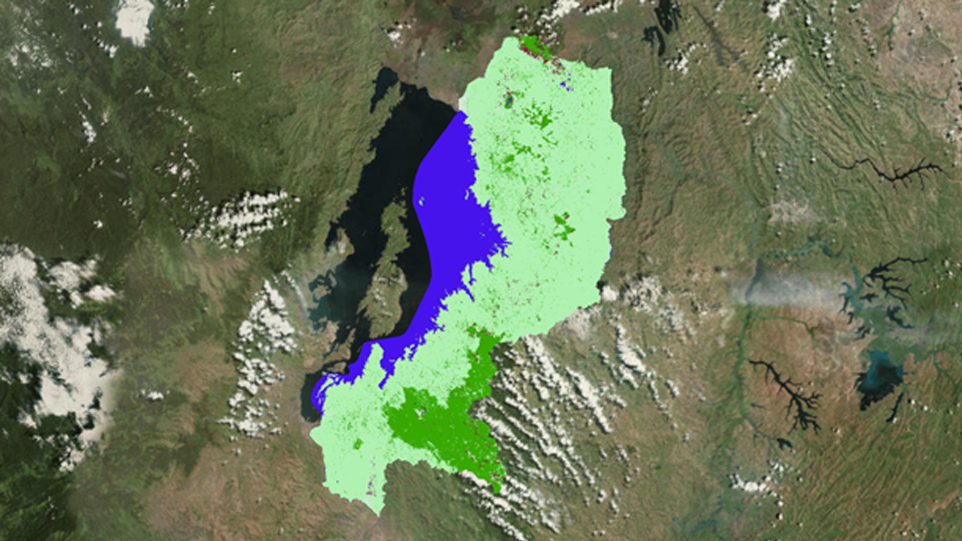
Balancing the demands of economic development and environmental protection is a challenge which requires policy-makers to be well informed about the extent and value of key natural ecosystems. Wetlands have long been known to regulate hydrological processes, reduce erosion and flooding, safeguard local biodiversity, mitigate changes in climate, and contribute to food security. Nonetheless, due to the coupled threat of increasing population and lack of land use classification, east African wetlands face eradication if a concerted effort to identify, map, and protect these areas is not rapidly undertaken. To advance the wetland conservation efforts of the Rwanda Environmental Management Authority (REMA) and the UN's Sustainable Development Goals (SDG), a time series and land change extent model were generated to provide a baseline inventory of Rwandan wetlands and pinpoint critical areas that should be targeted for enhanced research and protection. Wetlands were identified by a supervised maximum likelihood classification conducted in Google Earth Engine API using Landsat 5 Thematic Mapper (TM) and Landsat 8 Operational Land Imager (OLI) data. The TerrSet Land Change Modeler software was used to generate a forecast of the land changes predicted to occur by the year 2030. These predictive models will optimize REMA's conservation efforts of wetlands, and provide researchers with a replicable methodology that can be used to continue monitoring global wetland extent.
Project Video:
Golly GEE Wetlands! Forecasting Wetland Extent in Rwanda
- Location
- NASA Marshall Space Flight Center
- Term
- Summer 2017
- Partner(s)
- Rwanda Environment Management Authority
Regional Centre for Mapping of Resources for Development (RCMRD)
Group on Earth Observations, GEO-Wetlands Initiative
NASA SERVIR Science
Coordination Office at MSFC - NASA Earth Observations
- Landsat 5, TM
Landsat 8, OLI - Team
- Nicholas McVey (Project Lead)
Julia Bayer
Jennifer Gelmis
Dashiell Cruz - Advisor(s)
- Dr. Jeffrey Luvall (NASA Marshall Space Flight Center)
Dr. Robert Griffin (University of Alabama in Huntsville)
Emily Adams (NASA SERVIR Coordination Office)
Leigh Sinclair (University of Alabama in Huntsville, Information Technology and Systems Center)