Pacific Southwest Cross-Cutting
Utilizing NASA Earth Observations to Develop a Land Use Change Detection Tool for Habitat Conservation Plan Areas
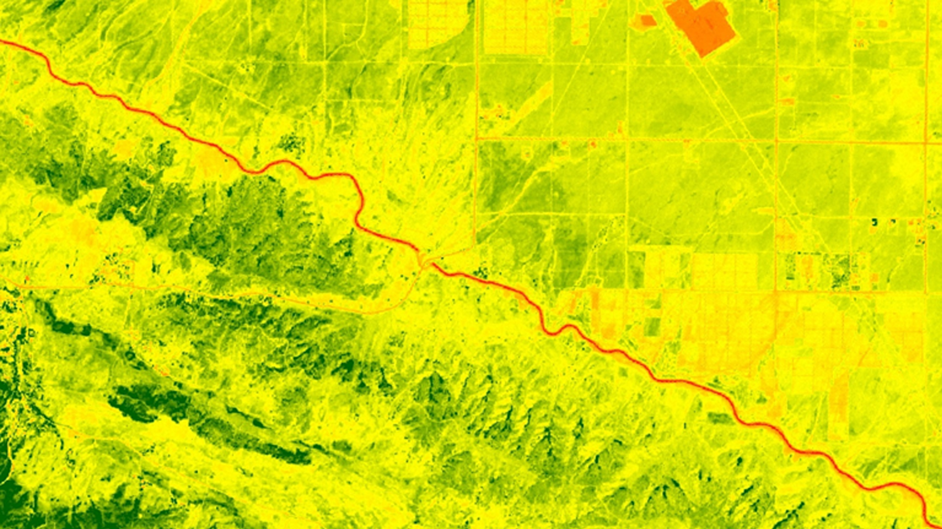
Habitat Conservation Plans (HCPs) were designed to protect and manage areas where desired economic development is in conflict with the needs of threatened and endangered species. Each plan is developed through collaboration between United States Fish and Wildlife Service (USFWS) and a landowner or other project proponent. Regulations restrict activities within HCP boundaries to minimize impacts to listed species while still allowing for land development. The USFWS does not have the capacity to closely monitor and assess the millions of acres of private- and publically-owned lands to ensure compliance with restrictions. In order to assist monitoring efforts by the USFWS, a methodology was constructed that uses remote sensing data and the Normalized Difference Vegetation Index (NDVI) to detect land use change. Past land use change from 1995 to 2017 in the Pacific Southwest HCPs was analyzed. This methodology used publically available satellite data from Landsat 5, Landsat 8, and Sentinel-2, and was implemented in the open source Google Earth Engine (GEE) API. The USFWS will be able to use this tool on the GEE platform to continue evaluating HPCs for disturbance, saving significant travel time and effort.
Project Video:
Surveying the Southwest: Land Use Change in Protected Areas
- Location
- NASA Langley Research Center
- Term
- Summer 2017
- Partner(s)
- US Fish and Wildlife Service, Pacific Southwest Region, Ecological Services Program
US Fish and Wildlife Service, Midwest Region, National Wetland Inventory - NASA Earth Observations
- Landsat 7, ETM+
Landsat 8, OLI/ TIRS
Sentinel-2, MSI - Team
- Sean Robison (Project Lead)
Liz Dyer
Katie Thomas - Advisor(s)
- Dr. Kenton Ross (NASA Langley Research Center)