Miami Beach Water Resources
Assessing the Feasibility of Using NASA Earth Observations to Monitor Trends in Runoff and Storm Water Discharge of the Biscayne Bay
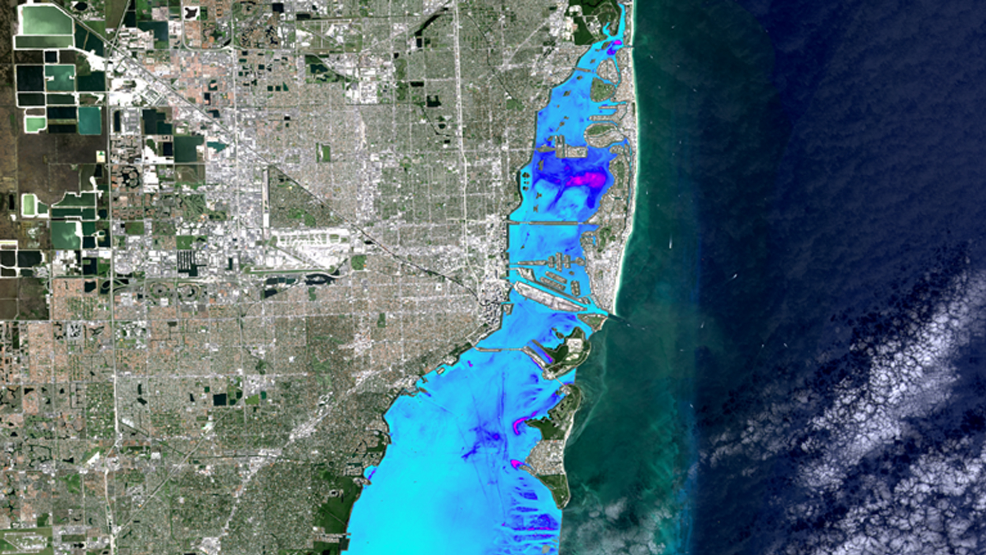
Submerged Aquatic Vegetation (SAV) is an important component of coastal ecosystems, and is vulnerable to increased turbidity in the water column. It provides stability and protection to sediment deposits, and offers food and shelter to economically valuable species of marine life. Recent urban development and population growth in the Miami area have resulted in an increase in stormwater discharge connected to changing water quality in Biscayne Bay. The project used Earth observation data from a suite of sensors including Landsat 8 OLI, Landsat 7 ETM+, Landsat 5 TM, and Sentinel-2 MSI in conjunction with in situ water quality monitoring data. Turbidity, chlorophyll-a concentration, Normalized Difference Turbidity Index (NDTI), absorbance due to dissolved and non-algal detrital material (ADG), and Total Suspended Matter (TSM) data were used to develop a tool to view both historic and current water quality parameters in Biscayne Bay. The results of this project will assist the City of Miami Beach Public Works Department in decision making and predicting future water quality trends in Biscayne Bay and the surrounding area.
Project Video:
Stormwater, Salinity, and Seagrass: Remote Sensing in Florida's Biscayne Bay
- Location
- NASA Langley Research Center
- Term
- Summer 2017
- Partner(s)
- City of Miami Beach, Public Works Department
- NASA Earth Observations
- Landsat 5, TM
Landsat 7, ETM+
Landsat 8, OLI/ TIRS
Sentinel-2, MSI - Team
- Pamela Kanu (Project Lead)
Danielle Quick
Randolph Colby - Advisor(s)
- Dr. Kenton Ross (NASA Langley Research Center)