Santa Monica Mountains Climate

Using NASA Earth Observations to Determine the Extent of Drought and Insect-related Dieback in Oak Woodlands within the Santa Monica Mountains, California
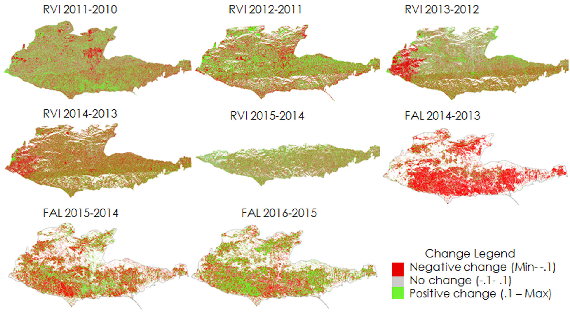
The Santa Monica Mountains stretch along the west coast of California between the coastal city of Oxnard and the populous urban hub of Los Angeles. Despite the close urban proximity, the Santa Monica Mountains still retain 80% native vegetation cover, including precious expanses of coastal sage scrub, chaparral, valley grassland, and oak woodland. While 30,000 ha of this land is protected by public and private conservation agencies within the Santa Monica Mountains National Recreation Area (61,000 ha total), the area has still suffered from the recent severe and prolonged drought in California. These effects have been especially detrimental to oak woodlands, which are more susceptible to pest infestations during times of abiotic stress. Because these woodlands are prized for their aesthetic value and ecosystem services, land managers will benefit from finding high-risk areas that will suffer more from drought effects. Current practices to assess changes in vegetation rely mostly on field studies, which are restricted by large scale landscapes, time, and resources. Incorporating remote sensing in the assessment of high-risk areas for drought-related dieback will allow land managers to develop larger scale solutions. The Santa Monica Mountains Climate team at JPL aims to discover the effect of drought on vegetation dieback from 2010 to 2016 using optical data from AVIRIS and radar data from UAVSAR.
Project Video:
From Drought to Dieback: Investigating Effects of Drought in the Santa Monica Mountains
- Location
- NASA Jet Propulsion Laboratory
- Term
- Spring 2017
- Partner(s)
- Resource Conservation District of the Santa Monica Mountains
National Park Service – Santa Monica Mountains National Recreation Area
California Department of Parks and Recreation – Los Angeles District
California Department of Forestry and Fire Protection (CAL FIRE)
Los Angeles County Department of Forestry and Fire Protection
University of California Cooperative Extension - NASA Earth Observations
- AVIRIS
UAVSAR - Team
- Natalie Queally (Project Lead)
Nick Rousseau
Emil Chang - Advisor(s)
- Dr. Natasha Stavros (NASA Jet Propulsion Laboratory)
Dr. Erika Podest (NASA Jet Propulsion Laboratory)