Chesapeake Bay Water Resources
Assessing Water Clarity to Identify Potential Areas of Submerged Aquatic Vegetation (SAV) in the Chesapeake Bay
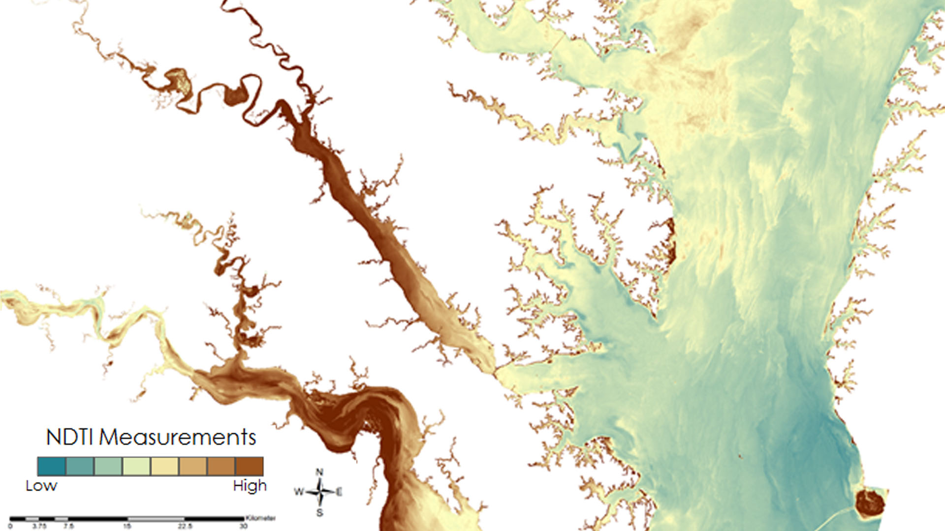
Submerged Aquatic Vegetation (SAV) is vitally important to the Chesapeake Bay, serving as one of the primary food sources for the organisms that inhabit the Bay. This project evaluated the efficacy of remote sensing applications as a tool to monitor water quality parameters, specifically turbidity, to indicate areas that can potentially support healthy seagrass populations in the Chesapeake Bay. The resources and methods included visual analysis of the Bay utilizing Landsat 5 Thematic Mapper (TM) and Landsat 8 Operational Land Imager (OLI). By correlating the Landsat-derived Normalized Difference Turbidity Index (NDTI) to the Virginia Institute of Marine Sciences' (VIMS) in situ monitoring data, a model was created that can be used to provide an estimate of water clarity throughout the entire bay. This model focuses on providing an additional resource for the Virginia Department of Environmental Quality (DEQ) for use in monitoring changes in water turbidity in the Chesapeake Bay and aid in monitoring efforts of SAV growth locations and Total Maximum Daily Load (TMDL) calculations of the Bay.
Project Video:
Satellites and SAV: Assessing Water Clarity in the Chesapeake Bay
- Location
- NASA Langley Research Center
- Term
- Spring 2017
- Partner(s)
- Virginia Department of Environmental Quality
US Geological Survey, Water Science Center - NASA Earth Observations
- Landsat 5, TM
Landsat 8, OLI - Team
- Danielle Quick (Project Lead)
Amanda Clayton
Cole Cowher
Collin Henson
Greg Hoobchaak - Advisor(s)
- Dr. Kenton Ross (NASA Langley Research Center)