Puerto Rico Agriculture
Utilizing NASA Earth Observations to Map the Spread of the Red Palm Mite in Puerto Rico for Detection, Management, and Conservation
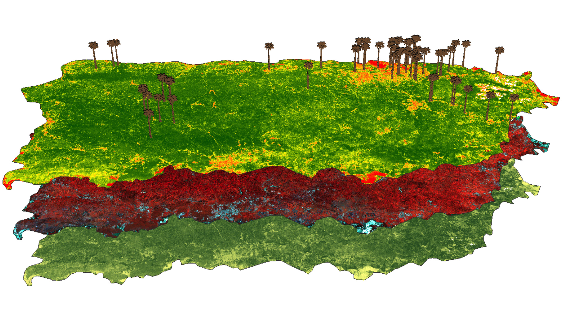
The rapid spread of the red palm mite, Raoiella indica, has devastated coconut palm, banana, and plantain crops throughout the Americas and the Caribbean since its introduction into the hemisphere in 2003. Red palm mites feed via the stomata on plant hosts' leaves, using specialized mouthparts, resulting in accelerated water loss, decreased crop yield, and a characteristic pattern of leaf yellowing and senescence that can be remotely detected using multispectral imagery and calculated spectral vegetation indices from Landsat 7 Enhanced Thematic Mapper Plus (ETM+), Landsat 8 Operational Land Imager (OLI), Earth Observing-1 (EO-1) Hyperion, IKONOS platforms, and aerial imagery. In conjunction with the United States Department of Agriculture (USDA) Agricultural Resource Service (ARS) and the University of Puerto Rico, the distribution of red palm mite infestation in Puerto Rico was tracked from 2002 to 2016, and maps were produced showing the geographic spread of the red palm mite infestation during this time. The high adaptability of red palm mites to multiple plant hosts, adverse environmental conditions, and diverse dispersal pathways, plus the absence of known biotic countermeasures, makes the mite an urgent environmental and economic threat throughout Southeast Asia, Oceania, and the Americas. Understanding past red palm mite invasions will help to prevent its spread into proximal agricultural areas and limit exposure and resulting crop destruction. The tracking methodology and tools established here can be applied to other geographical areas in an effort to mitigate current mite infestations and to monitor and prevent probable future invasions.
- Location
- NASA Goddard Space Flight Center
- Term
- Summer 2016
- Partner(s)
- University of Puerto Rico
USDA Agricultural Research Service - NASA Earth Observations
- Landsat 7, ETM+
Landsat 8, OLI
EO-1, Hyperion
IKONOS
Aerial Imagery - Team
- Dr. Sara Lubkin (Project Lead)
Julia Marrs
Sean McCartney
Alison Thieme - Advisor(s)
- Dr. Michael Cosh, USDA-ARS
Dr. Ronald Ochoa, USDA-ARS
Dr. John Bolten, NASA-GSFC
Project Video