Peru Climate III
Monitoring and Forecasting Shifting Climate and Land Change Impacts in Perú's Parque de la Papa for Enhanced Agricultural Management
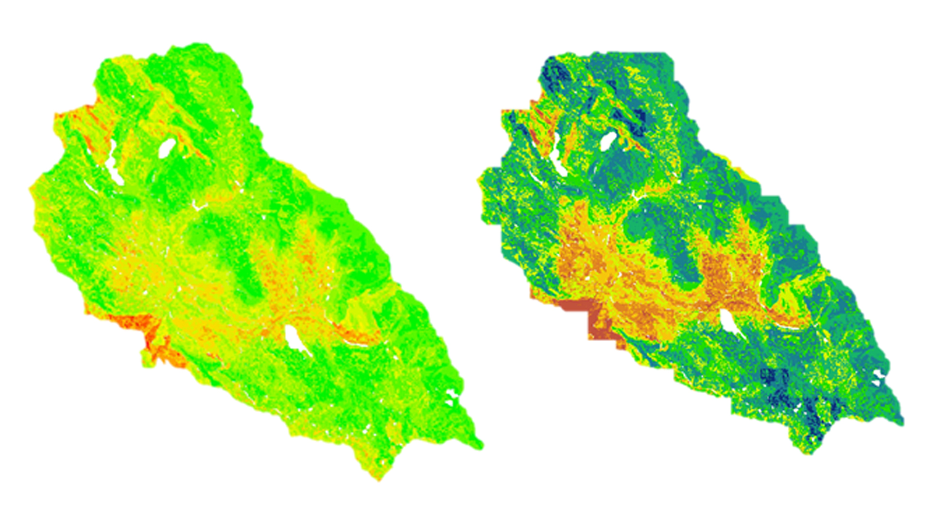
Agricultural systems in tropical montane regions are particularly vulnerable in the face of global climate change. Anecdotal evidence from Parque de la Papa, located in the Peruvian Andes, indicates that farmers following traditional practices have moved potato crops to higher elevations seeking suitable growing conditions for the potato varieties they have cultivated for centuries. The primary threat to native potatoes is increased mortality rates stemming from pests and diseases. In particular, rising temperatures have led to increases in the population and habitat range of the Andean potato weevil, Premnotrypes spp. The project used a mixed model approach combining quantitative and qualitative information to create a suitability model identifying areas that are currently suitable for potato planting and cultivation. Another goal of this project was to create a risk assessment of areas that will become unsuitable for potato cultivation in the future. This model was based on Landsat-derived land cover and land use, soil, and climate data in addition to local knowledge. It will be used to predict optimal areas for potato cultivation and will be given to the International Center for Potatoes (CIP) for use in a management plan to inform the farming efforts of the indigenous communities within Parque de la Papa.
- Location
- The University of Georgia
- Term
- Summer 2016
- Partner(s)
- International Potato Center (CIP)
Association Para la Naturaleza y el Desarrollo Sostenible (ANDES) - NASA Earth Observations
- Landsat 8, OLI
Terra, ASTER - Team
- Caren Remillard (Project Lead)
Shrin Esmaeili
Dorris Scott
Parul Singh - Advisor(s)
- Dr. Kenton Ross (NASA DEVELOP National Program)
Dr. Marguerite Madden (Department of Geography, University of Georgia)
Dr. Sergio Bernardes (Department of Geography, University of Georgia)
Project Video