Mobile Bay Ecological Forecasting & Water Resources II
Monitoring Marsh Conditions in Coastal Alabama Using NASA Earth Observations to Support the Alabama Coastal Foundation's Restoration and Conservation Initiatives
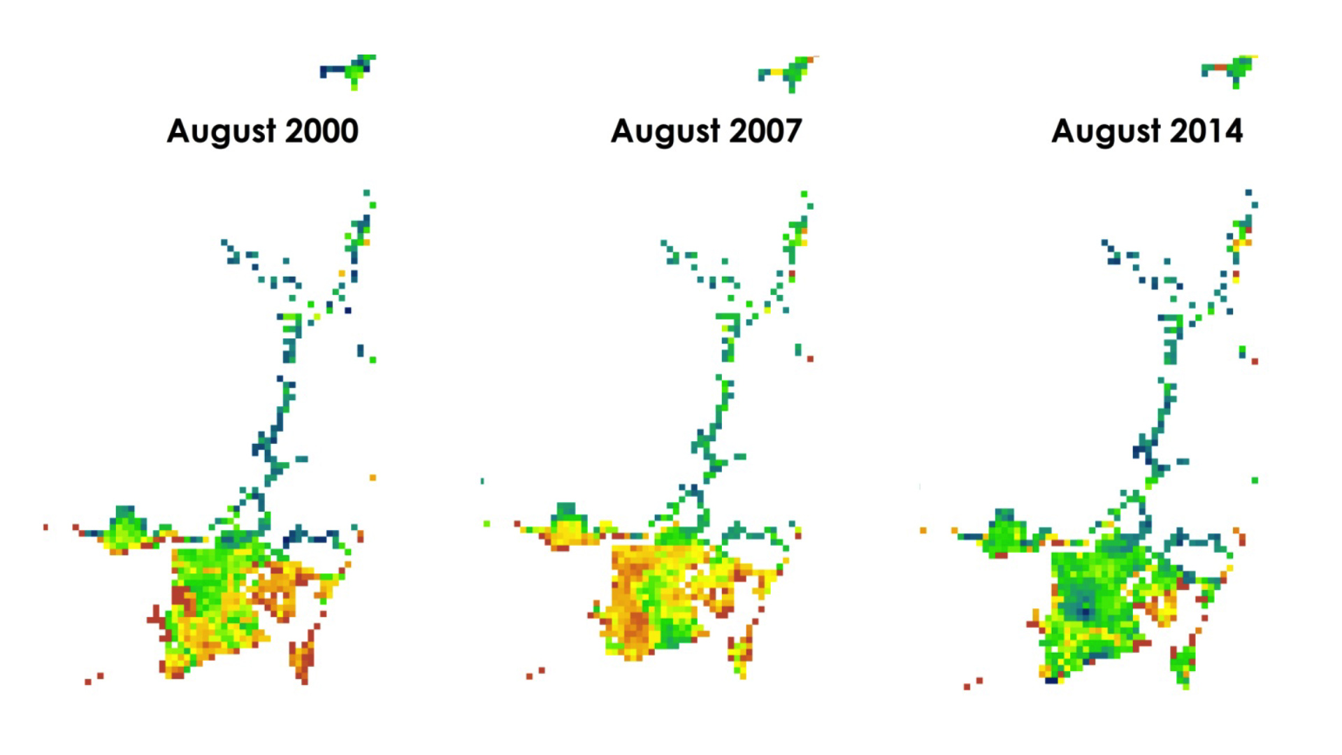
The marshlands fringing Mobile and Baldwin counties collectively comprise one of the most dynamic ecosystems in the Northern Gulf of Mexico. Coastal Alabama wetlands are an important ecological region providing a number of important ecosystem support services, such as breeding and nursing habitats, creating buffer zones for storm surge, and water filtration. However, many marsh areas have deteriorated both in health and extent due to a combination of anthropogenic and natural stressors, including nutrient pollution, turbidity, and urbanization. This study used NASA Earth observations to investigate the present and future health of wetlands in coastal Alabama. The datasets were derived from the United States Department of Agriculture Forest Service ForWarn Normalized Difference Vegetation Index (NDVI), which uses imagery captured by Moderate Resolution Imaging Spectroradiometer (MODIS). Additionally, data from Landsat satellites 5, 7, and 8 were used to provide higher resolution imagery over larger temporal scales to aid in land use and land cover classifications. The NDVI was then used in conjunction with data from the Coastal Change Analysis Program to classify marsh type, health, and extent over several decades. The data were then used for modeling of future marsh health using TerrSet Geospatial Monitoring and Modeling System Land Change Modeler software. Collectively, these analyses provided a holistic assessment of current and future marsh health for select watersheds over wide temporal and spatial scales. The Alabama Coastal Foundation can use these results to more efficiently direct restoration efforts to the most critically impaired watersheds.
- Location
- Mobile County Health Department
- Term
- Summer 2016
- Partner(s)
- Alabama Coastal Foundation (ACF)
Dauphin Island Sea Lab - NASA Earth Observations
- Landsat 5, Tm
Landsat 7, ETM+
Landsat 8, OLI/TIRS
Aqua/Terra, MODIS - Team
- Darius Hixon (Project Lead)
Austin Clark
Tyler Lynn
Manoela Rosa - Advisor(s)
- Kenton Ross Ph.D. (NASA Langley Research Center)
Just Cebrian Ph.D. (Dauphin Island Sea Lab)
Bernard Eichold, M.D., Dr. PH (Mobile County Health Department)
Project Video