Lake Victoria Water Resources II

Developing an Automated, Near Real-Time System to Monitor Eichhornia Crassipes over the Winam Gulf in Lake Victoria
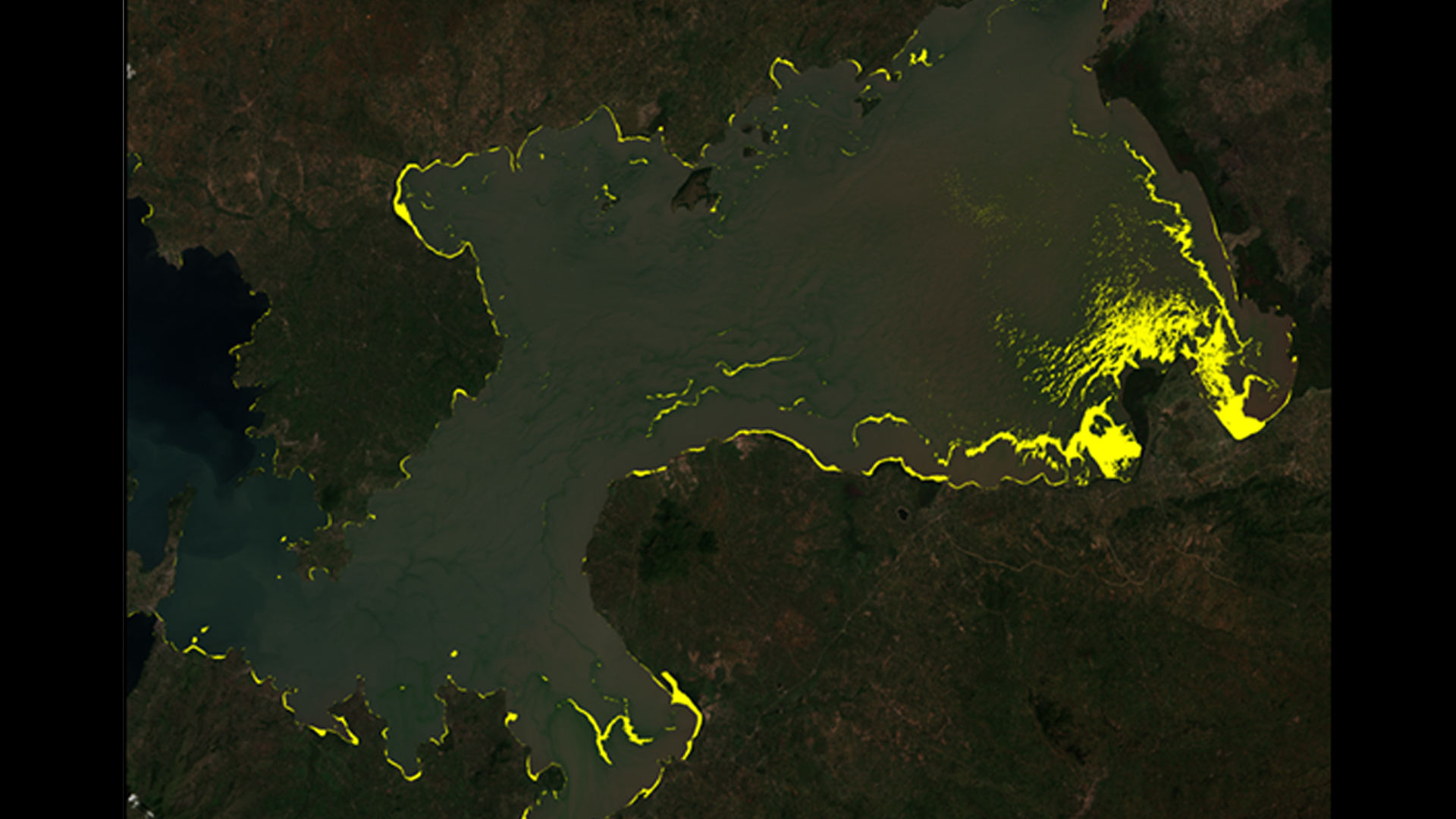
Lake Victoria has a surface area of 68,800 square km, making it the largest lake in Africa. The lake is surrounded by Kenya, Tanzania, and Uganda and is home to more than 30 million people. These people rely on the lake for all aspects of their lives including fishing, agriculture, and industrial applications. However, the increasing population has negatively impacted water quality due to sewage, as well as agricultural and industrial run off. Furthermore, the introduction of Eichhornia crassipes, or water hyacinth, has been detrimental to local communities by blocking fishing access and providing breeding grounds for diseases carried by mosquitoes and snails. Ongoing efforts between the NASA SERVIR Coordination Office at Marshall Space Flight Center, the SERVIR-Eastern and Southern Africa Hub, the Regional Centre for Mapping of Resources for Development (RCMRD), and the Makerere University Department of Geomatics and Land Management have been assessing and monitoring water quality parameters, such as chlorophyll concentration, temperature, and turbidity, for Lake Victoria using the Moderate Resolution Imaging Spectrometer (MODIS) sensor on the Aqua satellite. This project sought to include the use of Sentinel-2 Multispectral Imager (MSI), as well as the Operational Land Imager (OLI) sensor on Landsat 8, to assess water hyacinth presence in addition to current monitoring activities. This study focused on the Winam Gulf region of Lake Victoria in Kenya since this area experiences abundant water hyacinth activity and has been identified by RCMRD as an area of focus. As a continuation of the Lake Victoria Water Resources project from Fall 2015, this project used data previously collected to create an automated model to detect water hyacinth. This model employed Python scripting to continuously download and process new Landsat 8 images and automate the methodology for Sentinel-2 images. These end products will be utilized by partner organizations in their water hyacinth monitoring efforts.
- Location
- NASA Marshall Space Flight Center
- Term
- Spring 2016
- Partner(s)
- NASA SERVIR Coordination Office at MSFC
SERVIR-Eastern and Southern Africa Hub
Regional Centre for Mapping of Resources for Development (RCMRD)
Makerere University Department of Geomatics and Land Management - NASA Earth Observations
- Landsat 8, OLI/TIRS
- Team
- Jeanné le Roux (Project Lead)
Daryl Ann Winstead
Christina Fischer
Sara Amirazodi
Dwight Twigner - Advisor(s)
- Dr. Jeffrey Luvall (NASA at the National Space Science and Technology Center)
Dr. Robert Griffin (The University of Alabama in Huntsville)
Africa Flores (NASA SERVIR Coordination Office at MSFC)
Dr. Joe Ortiz (Kent State University)
Dulci Avouris (Kent State University)
Project Video