Bolsa Chica Ecological Forecasting
Analyzing the Success of the Bolsa Chica Wetland Restoration Using Multi-spectral NASA Earth Observations
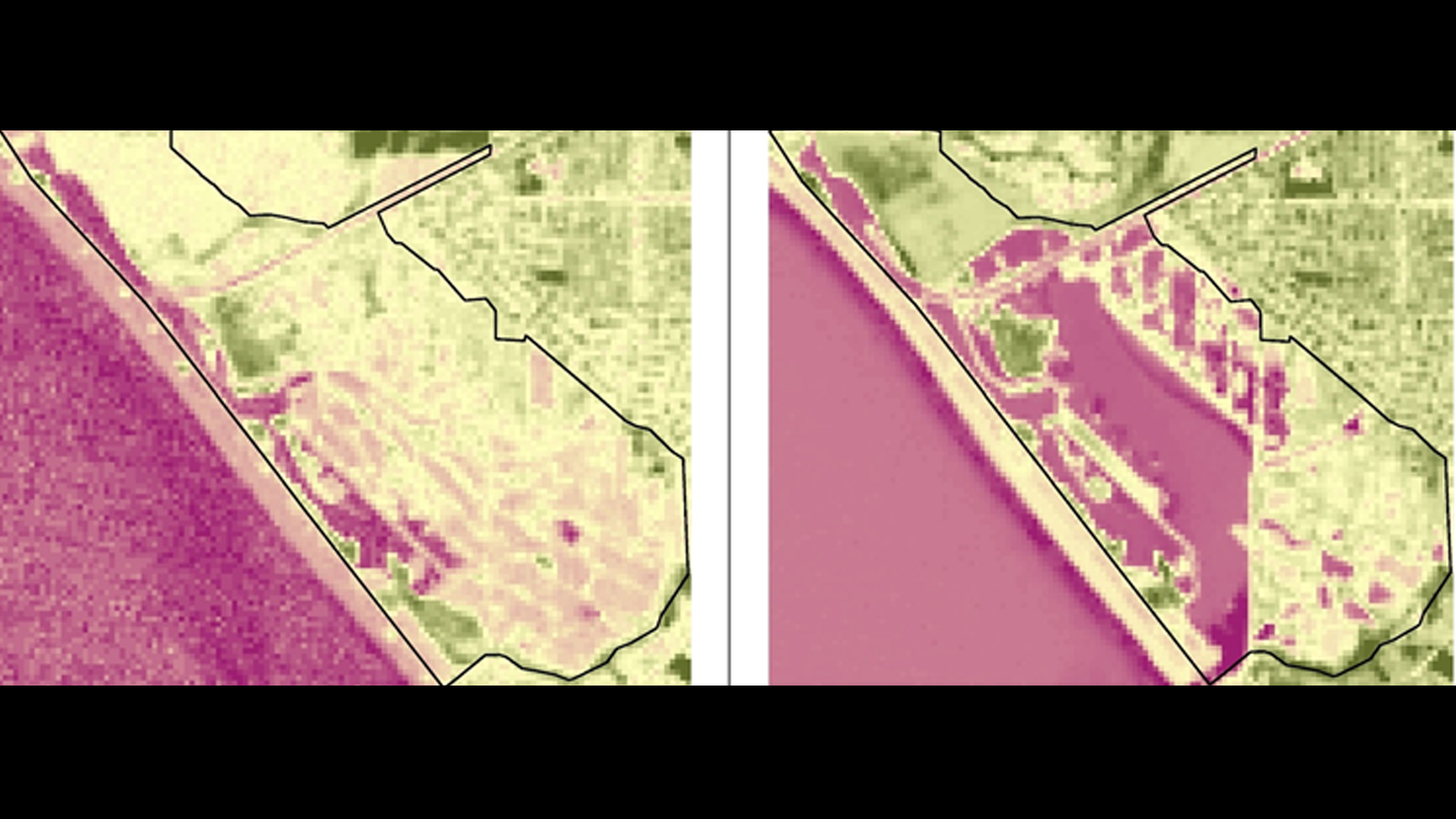
The Bolsa Chica Ecological Reserve in Huntington Beach, California, consists of 1550 acres of undeveloped coastal wetland and is home to several endangered species, including Rallus longirostris levipes and Sterna antillarum browni, which fly along the Pacific flyway. Since the 1800's, farming, land subsidence, resource extraction, and land development have impacted these wetlands, affecting the habitat's biodiversity. The Amigos de Bolsa Chica advocacy group has made a 40-year effort to preserve, restore, and maintain the wetlands through volunteer work and public outreach, impacting public policy and management practices. However, there has been no previous attempt to assess the success of the restoration using aerial imagery. This project utilized NASA Earth observations, National Agriculture Imagery Program (NAIP) imagery, USGS High Resolution Orthoimagery and Digital Orthographic Quadrangles, and field surveys to highlight the changes in habitat and tidal water extent from 2002 to 2014, with a particular focus on the changes that ensued from the opening of a channel connecting the site to the ocean in 2006. Using a before and after time series based off of our analysis and vegetation maps of the current site, the Amigos de Bolsa Chica will be able to: (1) enhance their education and outreach, (2) create more effective tools to engage the community, (3) strengthen their management of the wetlands and (4) better prioritize areas of future concern.
- Location
- NASA Jet Propulsion Labratory
- Term
- Spring 2016
- Partner(s)
- Amigos de Bolsa Chica
- NASA Earth Observations
- Landsat 7, ETM+
Landsat 8, OLI - Team
- Christine Elowitt (Project Lead)
Nick Rousseau
Steven Kerns - Advisor(s)
- Cedric Fichot (NASA Jet Propulsion Laboratory)
Benjamin Holt (NASA Jet Propulsion Laboratory)
Project Video