Western United States Water Resources II
Assessing Landscape Vulnerability to Drought and a Changing Climate in National Parks of the Western United States
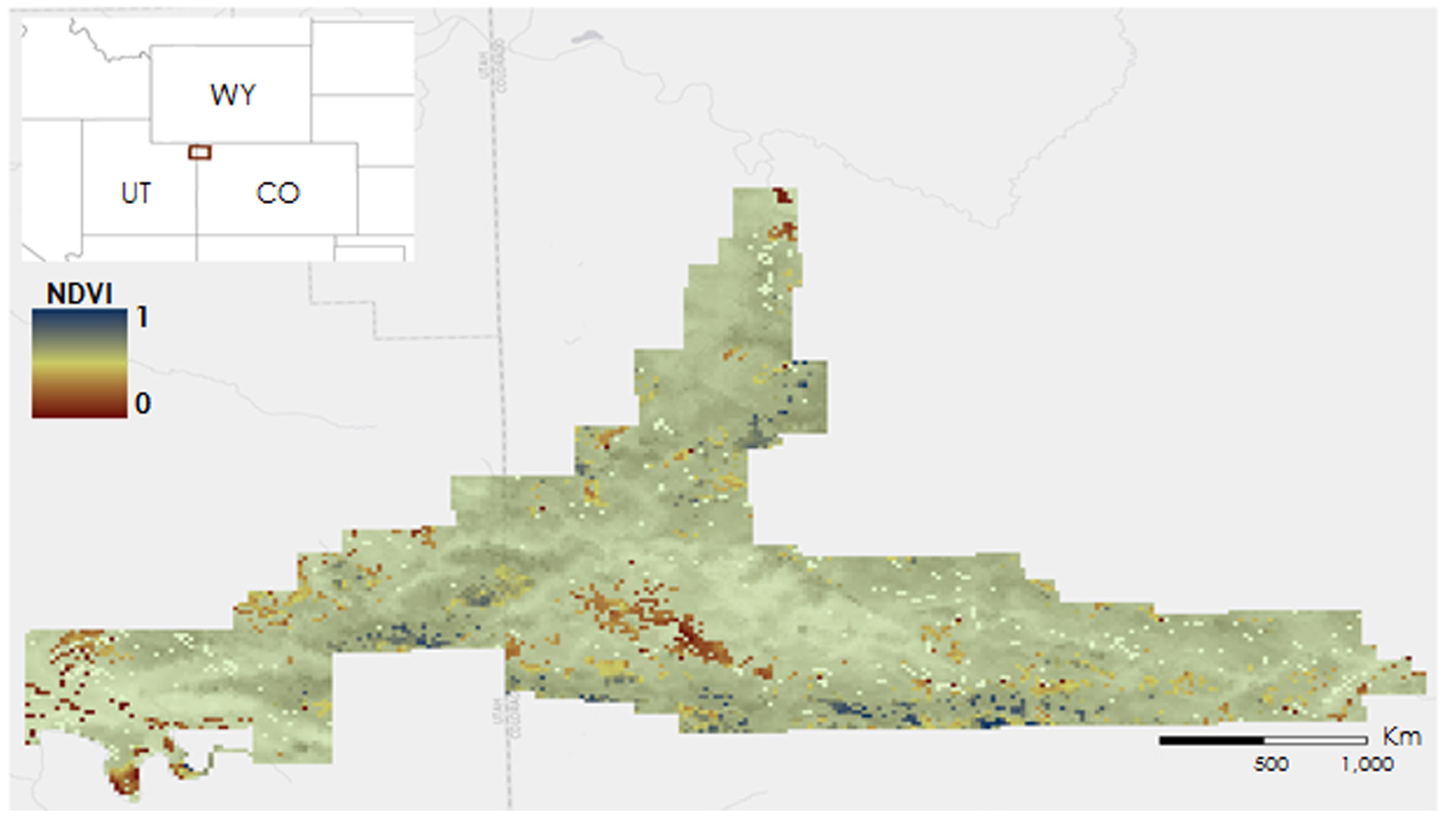
Increased surface temperatures and a trend towards more severe drought in the western United States can impact the vulnerability of vegetation across the region. Land managers specifically seek to estimate the threshold, known as a pivot point, at which ecosystems begin to lose productivity due to increased heat or decreased water. NASA Earth observations provide the National Park Service (NPS) and United States Geological Survey (USGS) with necessary data to monitor vegetation response at a regional scale. The sagebrush shrubland ecosystem in Colorado and Utah's Dinosaur National Monument was analyzed to determine how bioclimatic variables have impacted vegetation trends for the study area. These relationships were analyzed by the use of a stepping window written in R. The stepping window evaluated a five by five pixel matrix throughout the raster to output a correlation between annual change in vegetation and precipitation, temperature, and evapotranspiration. Based on the strength of the correlation, a multiple linear regression model was implemented. Vegetation data were acquired for a 15-year period using the Normalized Difference Vegetation Index (NDVI) from the ForWarn dataset. The model used mean temperature and precipitation from PRISM and the MODIS evapotranspiration datasets. Combining a moving window approach with remote sensing yielded a robust methodology for determining climate pivot points for western park units.
Project Video:
Saving the Western Frontier's Vegetation from Climate Change
- Location
- NASA Langley Research Center
- Term
- Fall 2016
- Partner(s)
- National Park Service, Inventory and Monitoring Program, Northern Colorado Plateau and Greater Yellowstone Networks
USGS, Southwest Biological Science Center - NASA Earth Observations
- Terra, MODIS
- Team
- Andrea Martinez (Project Lead)
Amanda Clayton
Christine Sadlik
Taryn Smith
Aubry Eaton - Advisor(s)
- Dr. Kenton Ross (NASA DEVELOP National Program)