Mississippi River Basin Disasters
Utilizing NASA Earth Observations to Enhance Flood Monitoring Throughout the Mississippi River Basin
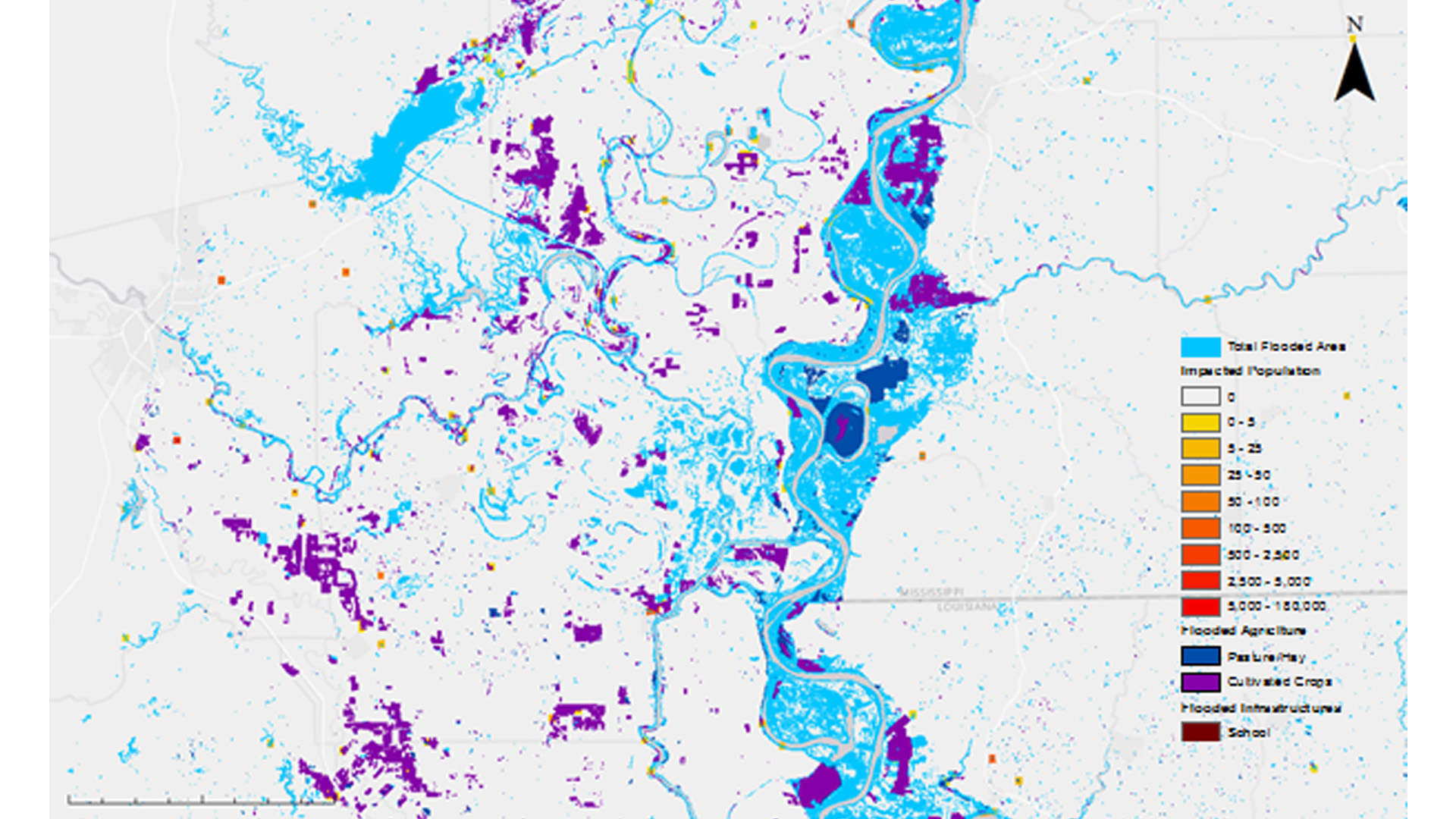
The Mississippi River Basin is an area prone to multi-level flood events of various intensities, as well as a home to millions of Americans. Stretching from Louisiana to Minnesota and draining 41 percent of the contiguous US, the basin covers 13 states and 1.245 million miles making it the third largest drainage basin in the world. This large area is susceptible to water level rises following changes in precipitation, snow melt, and water table levels, which can cause both small and large scale flooding. Disaster relief agencies, such as the Federal Emergency Management Agency (FEMA) and the United States Geological Survey (USGS) are interested in the creation of a more precise and comprehensive method to use in their decision making process for locating and prioritizing areas that require aid. The flood map algorithm created in this project will help identify the probability of flooding within a given area for use in flood monitoring and the decision making process of relief efforts. The resulting maps incorporate the Landsat 8 Operational Land Imager and Digital Elevation Model derived from Shuttle Radar Topography Mission v2 to determine the probability of flooding in an area. Additionally Landscan and Security Infrastructure Preparedness Data were also used to create an exposure map.
Project Video:
Deep Waters are Rising: Luckily We Have an Arc(Map)
- Location
- NASA Marshall Space Flight Center
- Term
- Fall 2016
- Partner(s)
- NASA Short-term Prediction Research and Transition Center (SPoRT)
USGS Hazards Data Distribution System
Federal Emergency Management Agency (FEMA) - NASA Earth Observations
- Landsat 8, OLI
SRTM
EO-1, ALI - Team
- Dashiell Cruz (Project Lead)
Chris Ploetz (Project Lead)
Mercedes Bartkovich
Olivia Callaway
Nicholas McVey - Advisor(s)
- Dr. Jeffrey Luvall (NASA at National Space Science Technology Center)
Dr. Robert Griffin (University of Alabama in Huntsville)
Dr. Andrew Molthan (NASA SPoRT)
Leigh Sinclair (University of Alabama in Huntsville/Information Technology and Systems Center)