Lake Victoria Water Resources III
Utilizing NASA Earth Observations to Identify Water Hyacinth Dynamics and Other Water Quality Parameters in Lake Victoria
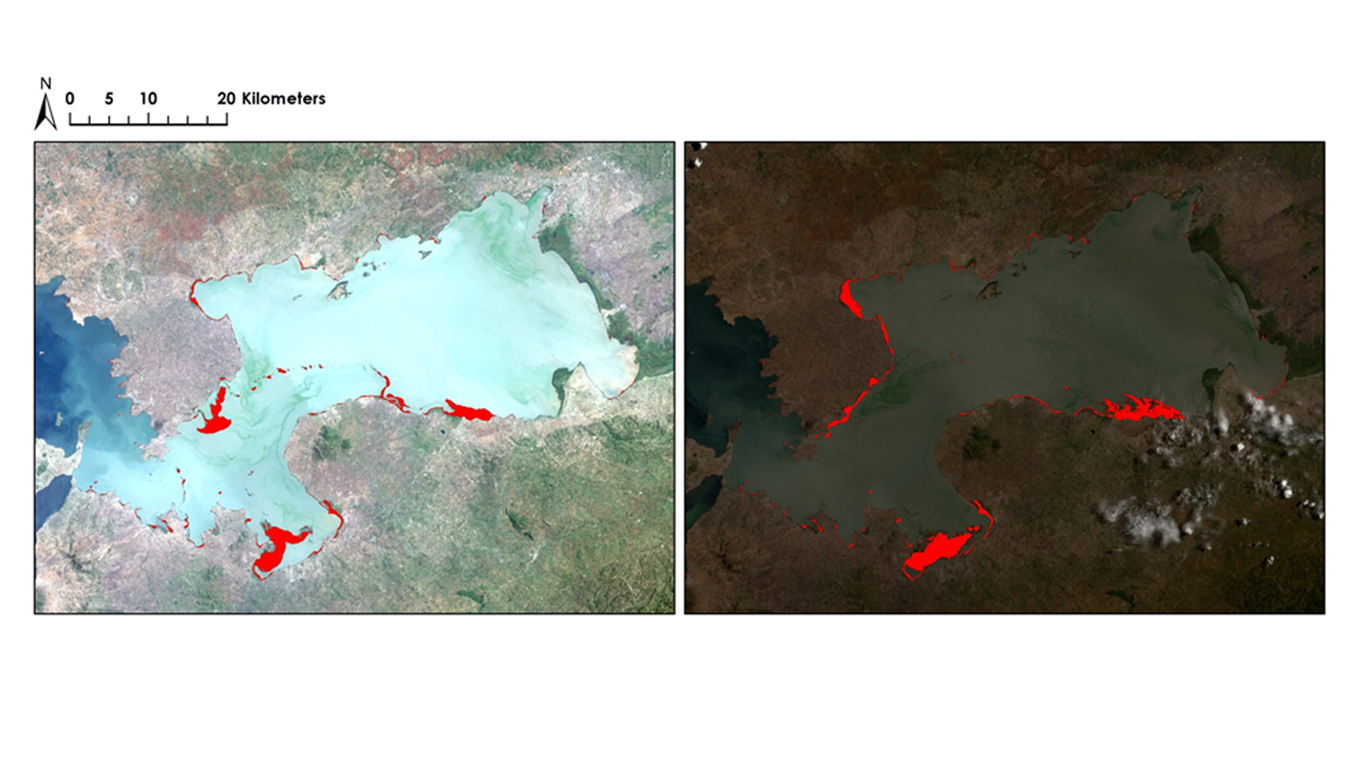
With a surface area of 68,800 km², Lake Victoria is the largest lake in Africa. More than 30 million people living around the lake in Kenya, Tanzania, and Uganda rely on the lake for everyday use. With populations increasing around the lake, run-off from various sources is negatively impacting the water quality in the lake resulting in the introduction of the invasive water hyacinth (Eichhornia crassipes). The NASA SERVIR Coordination Office at Marshall Space Flight Center, the SERVIR-Eastern and Southern Africa Hub, the Regional Centre for Mapping of Resources for Development (RCMRD), and the Makerere University Department of Geomatics and Land Management have been assessing and monitoring water quality parameters, such as chlorophyll concentration, temperature, and turbidity, for Lake Victoria using the Moderate Resolution Imaging Spectrometer (MODIS) sensor on the Aqua satellite. As a continuation of the Lake Victoria Water Resources II project from Spring 2016, this project focused on implementing an atmospheric correction and water extraction algorithm into the Surface Aquatic Vegetation Detection Toolbox (SAVDT) that was previously created. The SAVDT processes satellite imagery from Landsat 5, 7, and 8 or Sentinel-2 and results in an output shapefile that detects the location of aquatic vegetation on the surface of the Winam Gulf in Lake Victoria. This project also conducted an accuracy assessment on the SAVDT outputs using high-resolution data from World View 2 and 3. The completed SAVDT will be used to complement the partner organization's current efforts on researching and monitoring the water hyacinth.
Project Video:
Aliens Attack!: Mapping Invasive Aquatic Weed in the Winam Gulf
- Location
- NASA Marshall Space Flight Center
- Term
- Fall 2016
- Partner(s)
- NASA SERVIR Coordination Office at MSFC
SERVIR - Eastern and Southern Africa Hub
Regional Centre for Mapping of Resources for Development
Makerere University Department of Geomatics and Land Management - NASA Earth Observations
- Landsat 7, ETM+
Landsat 8, OLI
Sentinel-2, MSI
World View 2 & 3 - Team
- Daryl Ann Winstead (Project Lead)
Maggi Klug
Tony Ngabo
Ankur Shah
KKristen Barnard - Advisor(s)
- Dr. Jeffrey Luvall (NASA at National Space Science and Technology Center)
Dr. Robert Griffin (University of Alabama in Huntsville)
Africa Flores (NASA SERVIR Coordination Office)
Leigh Sinclair (Information Technology and Systems Center/University of Alabama in Huntsville)