Kenya Ecological Forecasting

Estimating Carbon Sequestration within Global Environment Facility Funded Protected Areas in Kenya to Aid Future Policy
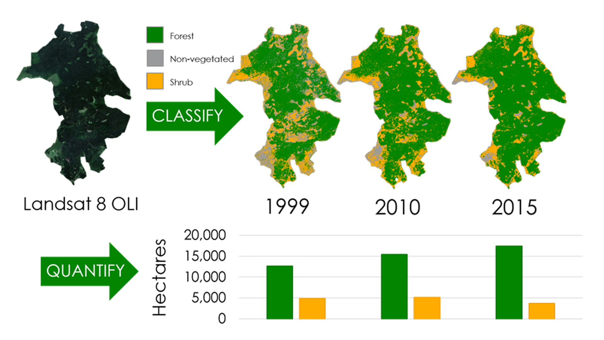
Global deforestation continues to pose a major environmental problem that threatens biodiversity and increases the number of species facing extinction. In Kenya and worldwide, agriculture is the main driver of forest conversion. Each year, Kenya loses 12,000 hectares (ha) of forest out of its total 4.34 million ha. In order to increase forest cover and protect biodiversity, the Global Environment Facility (GEF) funded projects to establish 12 protected areas (PAs) within Kenya from 1995-2008. Currently, GEF utilizes a global dataset to track only change in forest cover in the PAs. Creating maps of past and forecasted above-ground carbon estimates will enable GEF to gain a better understanding of how the PAs are both conserving biodiversity and addressing climate change mitigation through carbon sequestration. Using Landsat 5 TM, Landsat 7 ETM+, and Landsat 8 OLI imagery from 1995-2016, land cover in each PA was classified to map past changes in forest cover and above-ground carbon stock. Additionally, these maps were processed with ancillary datasets in TerrSet Land Change Modeler to forecast above-ground carbon stocks for 2020 and 2030, given current deforestation rates. Final maps of past and forecasted above-ground carbon estimates will aid GEF in future policy and program decisions.
Project Video:
Keeping Deforestation Out of Africa: Kenya's Protected Areas
- Location
- NASA Goddard Space Flight Center
- Term
- Fall 2016
- Partner(s)
- Global Environment Facility- Independent Evaluation Office
- NASA Earth Observations
- Landsat 5, TM
Landsat 4, ETM+
Landsat 8, OLI
SRTM - Team
- Madeline Ruid (Project Lead)
Erin Glennie
Perry Oddo
Alison Thieme - Advisor(s)
- Dr. Compton J. Tucker (NASA GSFC)