Grand Canyon Water Resources
Utilizing NASA Earth Observations to Assist the National Park Service in Monitoring Shoreline Land Cover Change in the Lower Grand Canyon
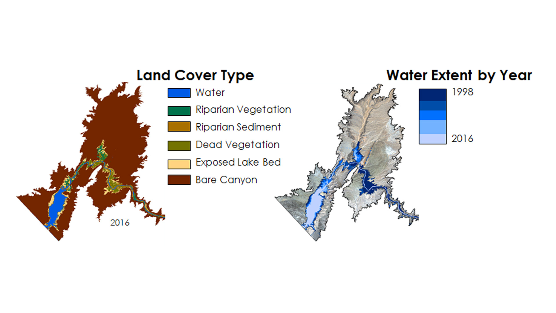
Sustained drought conditions have contributed to a significant decrease in the volume of the Colorado River in the Lake Mead reservoir and lower portion of the Grand Canyon. As a result, changes in riparian conditions have occurred in the region, such as sediment exposure and receding vegetation. These changes have large negative impacts on ecological health, including water and air pollution, aquatic, terrestrial and avian habitat alterations, and invasive species introduction. Scientists at Grand Canyon National Park seek to quantify changes in water surface and land cover area in the Lower Grand Canyon from 1998 to 2016 to better understand the effects of these changing conditions within the park. Landsat imagery was used to detect changes of the water surface and land cover area across this time period to assess the effects of long-term drought on the riparian zone. The resulting land cover and water surface time-series from this project will assist in monitoring future changes in water, sediment, and vegetation extent, increasing the ability of park scientists to create adaptation strategies for the ecosystem in the Lower Grand Canyon.
Project Video:
Exposed: Examining Declining Water Levels in the Lower Grand Canyon
- Location
- Wise County Clerk of Court's Office
- Term
- Fall 2016
- Partner(s)
- National Park Service, Grand Canyon National Park
- NASA Earth Observations
- Landsat 5, TM
Landsat 8, OLI
Sentinel-2, MSI
Terra, ASTER - Team
- Andrew Phillips (Project Lead)
Sydney Young
Austin Counts
Christine Stevens - Advisor(s)
- Dr. Kenton Ross (NASA DEVELOP National Program)
Dr. DeWayne Cecil (Global Science & Technology National Centers for Environmental Information [NCEI])
Robert VanGundy (University of Virginia's College at Wise)