Everglades Ecological Forecasting II
Utilizing NASA Earth Observations to Enhance the Capabilities of Everglades National Park to Monitor and Predict Mangrove Extent to Aid Current Restoration Efforts
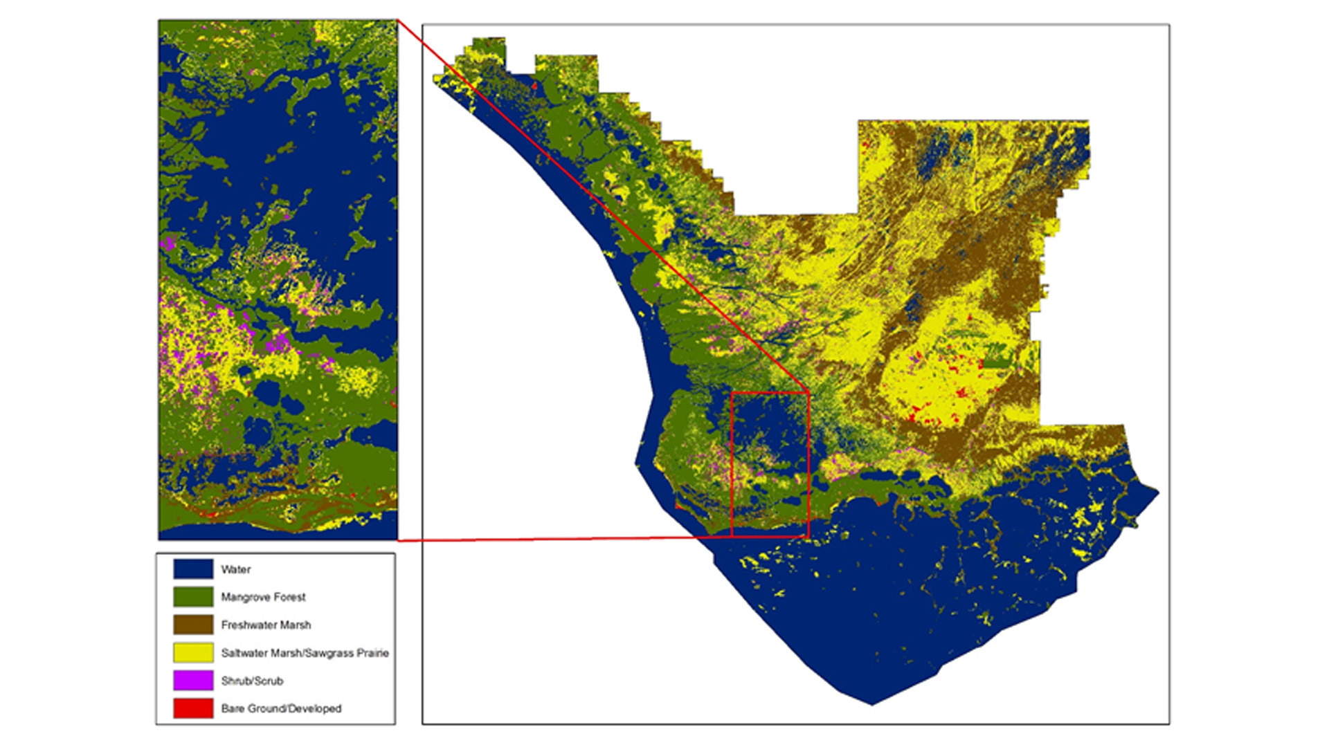
Mangroves act as a transition zone between fresh and salt water habitats by filtering and indicating salinity levels along the coast of the Florida Everglades. However, dredging and canals built in the early 1900s depleted the Everglades of much of its freshwater resources. In an attempt to assist in maintaining the health of threatened habitats, efforts have been made within Everglades National Park to rebalance the ecosystem and adhere to sustainably managing mangrove forests. The Everglades Ecological Forecasting II team utilized Google Earth Engine API and satellite imagery from Landsat 5, 7, and 8 to continuously create land-change maps over a 25 year period, and to allow park officials to continue producing maps in the future. In order to make the process replicable for project partners at Everglades National Park, the team was able to conduct a supervised classification approach to display mangrove regions in 1995, 2000, 2005, 2010 and 2015. As freshwater was depleted, mangroves encroached further inland and freshwater marshes declined. The current extent map, along with transition maps helped create forecasting models that show mangrove encroachment further inland in the year 2030 as well. This project highlights the changes to the Everglade habitats in relation to a changing climate and hydrological changes throughout the park.
Project Video:
Fixing the Root of the Issue: Mangrove Mapping in the Florida Everglades
- Location
- NASA Langley Research Center
- Term
- Fall 2016
- Partner(s)
- National Park Service, Everglades National Park (ENP)
Group on Earth Observations (GEO), Blue Planet Initiative (BPI)
Old Dominion University, Mitigation and Adaptation Research Institute (MARI) - NASA Earth Observations
- Landsat 5, TM
Landsat 7, ETM+
Landsat 8, OLI
Sentinel-2, MSI - Team
- Donnie Kirk (Project Lead)
Adama Ba
Amy Wolfe
Tyler Rhodes - Advisor(s)
- Dr. Kenton Ross (NASA DEVELOP National Program)
Dr. Marguerite Madden (University of Georgia)
Dr. Sergio Bernardes (University of Georgia)