Ethiopia Disasters
Utilizing NASA Earth Observations to Assess Agricultural Drought Severity in Ethiopia and Provide a Tool for Monitoring Drought at the Regional Level
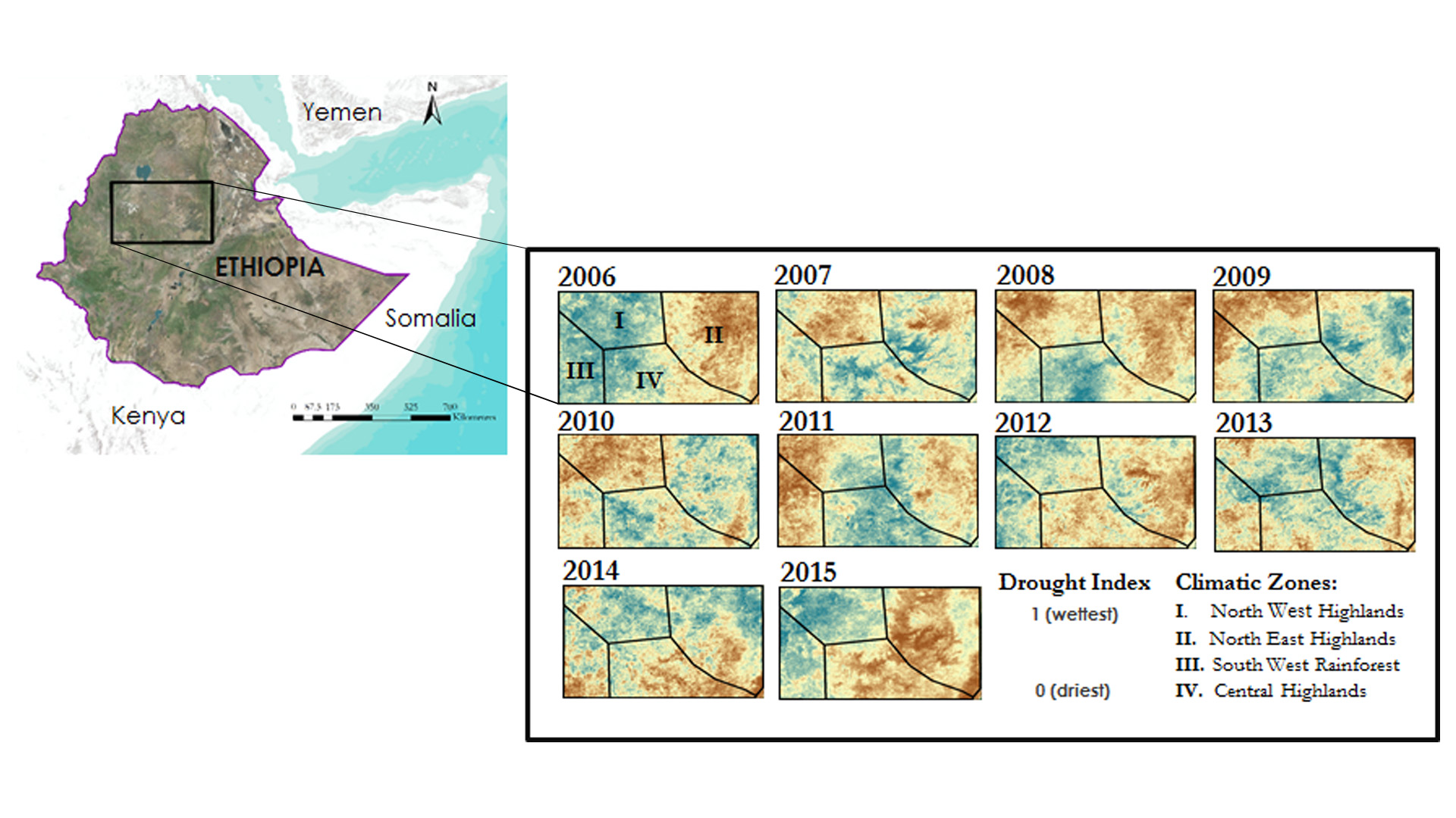
Ethiopia has been affected by several droughts over the last few decades, with the latest 2015 drought being the worst in half a century. Agriculture, being the predominant sector of the country's economy, is rain-fed and is therefore most susceptible to droughts. Developing a remotely sensed tool can help in reliable detection of drought. This project implemented a scaled drought index utilizing NASA's Aqua and Terra Moderate Resolution Imaging Spectroradiometer (MODIS), Tropical Rainfall Measuring Mission (TRMM) and Global Precipitation Measurement (GPM) Integrated Multi-satellite Retrievals for GPM (IMERG) data to assess agricultural drought and its spatio-temporal characteristics at a regional scale over the last 10 years. The index maps and decision support tools were provided to the project partners to supply timely information for humanitarian aid, and to build their capacity to monitor droughts in the future.
Project Video:
Drought, no Doubt: Assessing Agricultural Drought Severity in Ethiopia
- Location
- USGS at Colorado State University
- Term
- Fall 2016
- Partner(s)
- US Department of State Office of Space and Advanced Technology (OES/SAT) and Humanitarian Information Unit (HUI)
Mekelle University, Institute of Geo-Information and Earth Observation Sciences (I-GEOS)
USGS, North Central Climate Science Center - NASA Earth Observations
- Aqua & Terra, MODIS
TRMM
GPM, IMERG
SMAP
SRTM - Team
- Amandeep Vashisht (Project Lead)
Sarah Carroll
Rebecca Girma
Bethlehem Astelle
Cara Steger - Advisor(s)
- Dr. Paul Evangelista (Colorado State University, Natural Resources Ecology Lab)
Amanda West (Colorado State University, Natural Resources Ecology Lab)