Elkhorn Slough Ecological Forecasting II
Utilizing NASA Earth Observations to Understand the Effects of Sea Level Rise and Climatic Variation on Blue Carbon Sequestration, Marshland Extent, and Vegetation Health in California's Elkhorn Slough
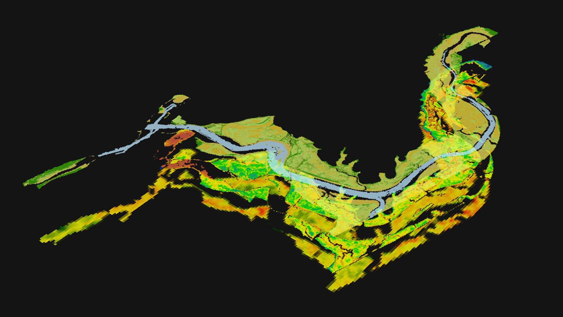
Elkhorn Slough is an ecosystem of high biodiversity found in Monterey Bay, California that protects coastline erosion, naturally filters water, provides critical habitat for unique species, and sequesters carbon. However, Elkhorn Slough is experiencing tremendous loss of its marshland extent and stress to vegetation due to threats of rising sea levels and climatic variation. These changes present an opportunity to identify spatial changes and patterns utilizing remotely sensed imagery and forecast the resilience of the slough under different climatic scenarios. This study used Landsat imagery to detect growth and loss within the slough from 1997 to present, and map the slough's evolution across time and space following large El Niño Southern Oscillation (ENSO) years. In addition, this study integrated Sentinel-2 and Airborne Visible and Infrared Imaging Spectrometer (AVIRIS) to compare current day marsh extent and health with in situ data provided by Elkhorn Slough National Estuarine Research Reserve (ESNERR). The Marsh Equilibrium Model (MEM) also incorporates inputs from in situ data to predict the Elkhorn Slough's resilience and adaptation to suspended sediment variations and sea level rise scenarios. These comprehensive historical analyses, in conjunction with the present-day assessment of marsh resilience from the model, offer spatial and temporal insights into Elkhorn Slough's ecological feedbacks. The results from this study will inform ESNERR of Elkhorn Slough's condition to help future management of this important ecosystem.
Project Video:
How Blue is the Slough? Forecasting Sea Level Rise in California's Elkhorn Slough
- Location
- NASA Ames Research Center
- Term
- Fall 2016
- Partner(s)
- Elkhorn Slough National Estuarine Research Reserve (ESNERR)
USGS, Western Geographic Science Center - NASA Earth Observations
- Landsat 5, TM
Landsat 8, OLI
Sentinel-2, MSI
AVIRIS - Team
- Melanie Feen (Point of Contact)
Hannah Friedrich
Stephanie Ly - Advisor(s)
- Dr. Juan L. Torres-Pérez (Bay Area Environmental Research Institute)
Dr. Sherry L. Palacios (Bay Area Environmental Research Institute)