Costa Rica Agriculture II

Analyzing Advantages of ECOSTRESS Data as a Tool for Drought Detection and Water Management Practices
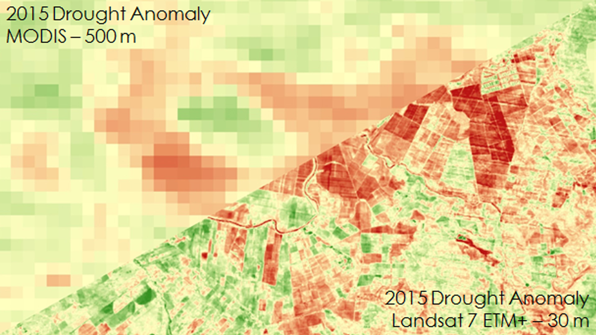
El Niño Southern Oscillation (ENSO) conditions in 2015 have caused inadequate and unpredictable measures of rain throughout Central America. Costa Rica is located near the geographic center of the Central American drought, and loss of harvest due to inadequate rainfall is driving farmers to seek methods for mitigating effects of drought. To optimize available water resources, remote sensing methods can be used for the implementation of site-specific management strategies. The Normalized Difference Vegetation Index (NDVI) and evapotranspiration (ET) are currently used to measure changes in vegetative landscape characteristics but yield different spatial and temporal results concerning drought detection. The derivation of these datasets from Landsat versus MODIS imagery introduces further disparity. This project addressed the drought detecting capabilities of NDVI and ET, and compared whether Landsat or MODIS, if either, is successful in providing a product that can identify vegetative trends from fine-scale landscapes in near-real time. The ECOsystem Spaceborne Thermal Radiometer on Space Station (ECOSTRESS) is scheduled to be launched to the International Space Station (ISS) in 2018 and will provide an ET product that advances the spatial and temporal coverage individually supplied by Landsat and MODIS. Using the Priestly-Taylor Jet Propulsion Laboratory (PT-JPL) model, this project used simulated ECOSTRESS data to assess the benefits ECOSTRESS will provide over existing datasets in both monitoring and mitigating vegetative responses to water and heat stress.
Project Video
Sixteen Days in the Dark: ECOSTRESS's Mission to Shed Light on Mega-Droughts
- Location
- NASA Jet Propulsion Laboratory
- Term
- Fall 2016
- Partner(s)
- EARTH University
- NASA Earth Observations
- Suomi NPP, VIIRS
Terra, ASTER/ MODIS
Landsat 7, ETM+ - Team
- David Comer (Project Lead)
Sol Kim
Ian Hemming
Katherine Cavanaugh - Advisor(s)
- Dr. Christine Lee (NASA Jet Propulsion Laboratory, California Technical Institute)
Dr. Joshua Fisher (NASA Jet Propulsion Laboratory, California Technical Institute)
Dr. Glynn Hulley (NASA Jet Propulsion Laboratory, California Technical Institute)
Dr. Simon Hook (NASA Jet Propulsion Laboratory, California Technical Institute)
Dr. Johan Perret (EARTH University, Costa Rica)