California Disasters II
A New Method for Providing Near-Real-Time Active-Fire and Post-Burn Support to Fire Responders Using Data Products Derived from NASA’s Uninhabited Aerial Vehicle Synthetic Aperture Radar (UAVSAR)
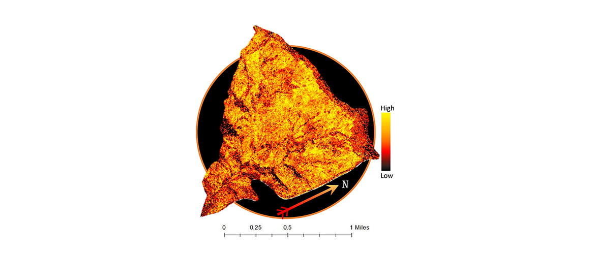
The need for efficient wildfire monitoring and assessment is paramount in California due to increasing ecological and economical losses caused by wildfire. The California Disasters II team at the Jet Propulsion Laboratory partnered with the California Department of Forestry and Fire Protection (CAL FIRE) and the US Forest Services Remote Sensing Activities Center (RSAC) to examine the potential of using radar-derived imagery from NASA’s Uninhabited Aerial Vehicle Synthetic Aperture Radar (UAVSAR) sensor for active fire assessment. Currently, remote sensing support for active fire response is limited to infrared-detecting satellites with relatively low spatial or temporal resolutions, or to airborne sensors that have limited availability and that may be interfered by cloud and smoke.
The UAVSAR instrument mounted on NASA’s Gulfstream III plane, however, has a high spatial resolution of 5m, can be flown day or night, and can penetrate cloud and smoke. The team studied wildfires throughout California from 2009 to the present and analyzed the ability of the UAVSAR sensor to detect burn scars and classify burn severity using a simple method with minimal computational demands. The results showed that the UAVSAR sensor is capable of detecting changes in vegetation due to wildfires. This preliminary study suggests that polarimetric SAR has the potential to become a powerful tool for active fire response.
- Location
- NASA Jet Propulsion Laboratory
- Term
- Summer 2015
- Partner(s)
- California Department of Forestry and Fire Protection (CAL FIRE), End-User, POCs: Chris Starnes, Deputy Chief, Operations Support, and Jana Luis, Division Chief, Predictive Services
US Forest Service Remote Sensing Activities Center, Boundary Organization, POC: Brad Quayle, Program Leader, Rapid Disturbance Assessment and Services Program - NASA Earth Observations
- Gulfstream III, UAVSAR
Landsat 5, TM
Landsat 7, ETM+
Landsat 8, OLI - Team
- Jerry Heo (Project Lead)
Christine Rains
Erika Higa
Mark Barker - Advisor(s)
- Dr. Sang-ho Yun (NASA Jet Propulsion Laboratory)
Dr. Mark Simons (California Institute of Technology)
Brent Minchew (California Institute of Technology)
Project Video