Navajo Nation Climate
A Drought Monitoring Tool for Customized Calculation of a Standardized Precipitation Index Value in the Navajo Nation
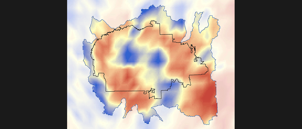
The Navajo Nation, located in the southwestern United States, has been increasingly impacted by severe drought events and regional changes in climate. These events are coupled with a lack of domestic water infrastructure and economic resources, leaving approximately one-third of the population without access to potable water in their homes. Current methods of monitoring climate and drought are dependent on national-scale monthly drought maps calculated by the Western Regional Climate Center (WRCC). These maps do not provide the spatial resolution needed to examine differences in drought severity across the vast Nation. To better understand and monitor drought regime changes in the Navajo Nation, this project produced a tool to calculate Standard Precipitation Index (SPI) values for a user-selected area within the study site, and supplies the geodatabase of historical climate information necessary to calculate these values.
The tool and geodatabase uses Tropical Rainfall Monitoring Mission (TRMM) and Global Precipitation Measurement (GPM) observed precipitation data, and Parameter-elevation Relationships on Independent Slopes Model (PRISM) modeled historical precipitation data. These products allow resource managers in the Navajo Nation to utilize current and future NASA Earth observations data for increased decision-making capacity regarding future climate change impact on water resources.
- Location
- Ames Research Center
- Term
- Spring 2015
- Partner(s)
- Navajo Nation Department of Water Resources
Navajo Technical University, Geographic Information Science Lab - NASA Earth Observations
- TRMM PR
GPM - Team
- Cheryl Cary (Project Lead)
Amber Brooks
Clayton Sodergren
Vickie Ly - Advisor(s)
- Dr. Juan Torres-Perez (Bay Area Environmental Research Institute, DEVELOP National Program)
Andrew Nguyen (DEVELOP Center Lead ARC-SGE)
Project Video