Coastal Mid-Atlantic Water Resources II
Using the METRIC Model to Estimate Evapotranspiration in the Coastal Mid-Atlantic Region
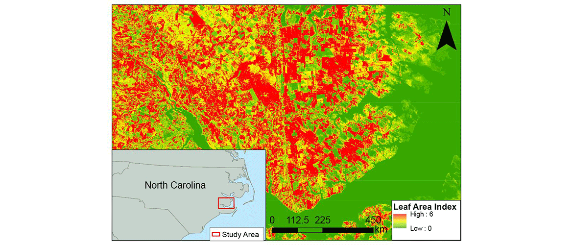
Crop irrigation accounts for a considerable amount of water use in the Coastal Mid-Atlantic region. A better understanding of how often farmers need to irrigate their fields could decrease water waste and lower economic costs. The METRIC model is a powerful tool that calculates evapotranspiration (ET) based on localized data. Executable in ESRI ArcGIS software from a Python script, the model was used as a decision support tool that can provide farmers with information regarding ET rates, allowing them to make more informed irrigation decisions.
METRIC was used to calculate ET through a series of equations where local input variables were acquired from Landsat 8 sensors, a United States Geological Survey (USGS) survey based Digital Elevation Model (DEM) from GTOPO30, and local AWOS stations. While METRIC-derived ET estimates are beneficial for irrigation purposes, it also provides state officials with a useful proxy for drought monitoring. Utilizing data from NASA Earth observations in the Coastal Mid-Atlantic region contributes to a large-scale, more-complete, understanding of water consumption behavior in an area.
- Location
- NASA Langley Research Center
- Term
- Fall 2014
- Partner(s)
- Virginia Secretary of Natural Resources
Virginia Secretary of Technology
Virginia Secretary of Agriculture & Forestry
Virginia Department of Environmental Quality
Digital Harvest - NASA Earth Observations
- Landsat 8 OLI/TIRS
Aqua MODIS
TRMM PR
Terra ASTER - Team
- Kent Sparrow (lead)
Nathan Qian
Jelly Riedel
Cassandra Morgan
Stephen Kochaver
Zakaria Boston
Oyinlayifa Porbeni - Advisor(s)
- Dr. Kenton Ross (NASA DEVELOP National Science Advisor)
James Favors (NASA DEVELOP International Lead)
Project Video