California Health & Air Quality
Identifying Methane Emissions Patterns from Dairy Farms Using Aircraft Remote Sensing Observations and Image Classification
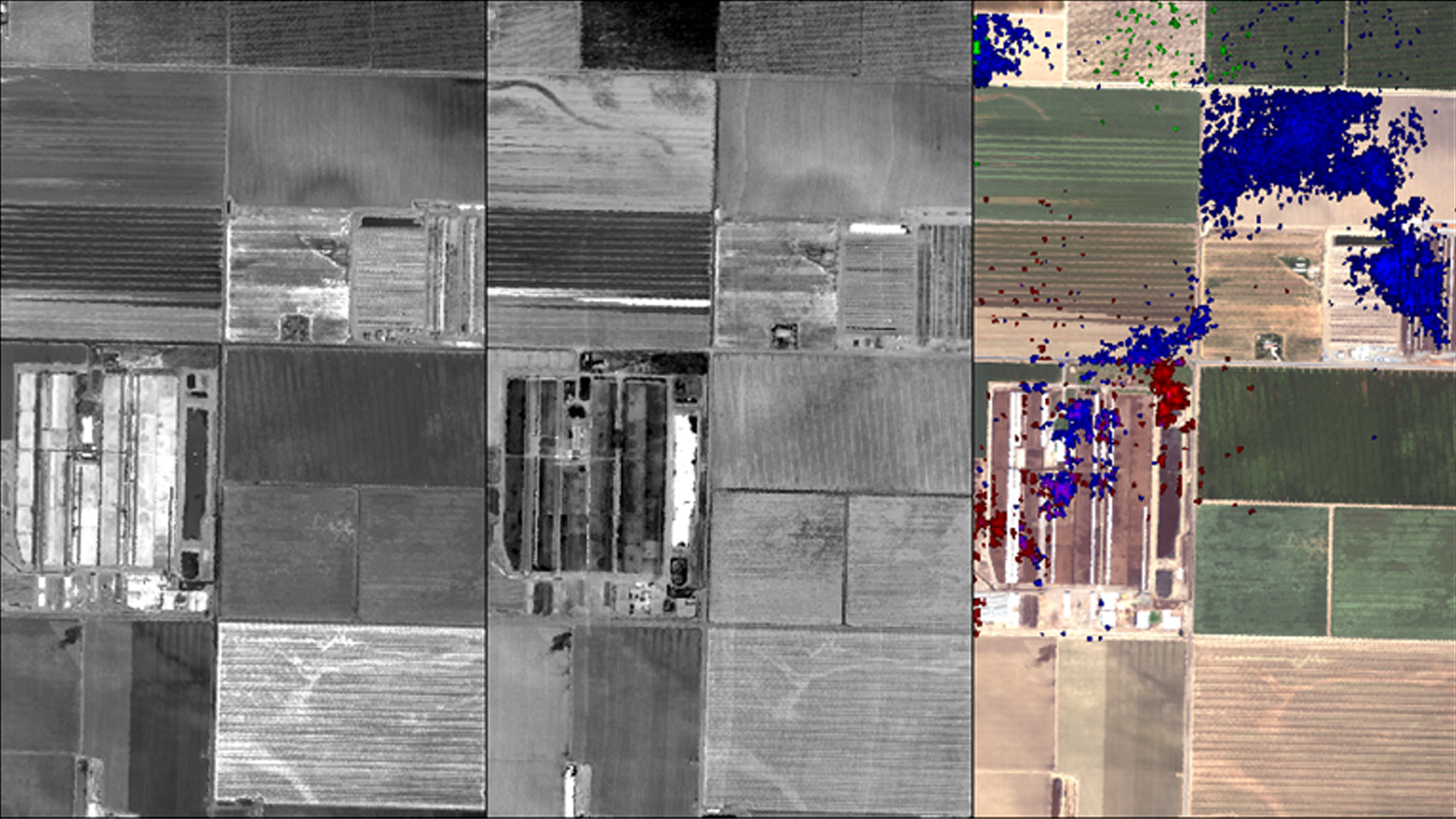
Methane (CH4) is a potent greenhouse gas (GHG) with a lifetime of less than 10 years and a global warming potential that is 25 times greater than carbon dioxide (CO2) over a 100 year time period. Between the energy, industrial processes and product use, agriculture, and waste sectors, the majority of CH4 emissions in the United States come from the agriculture sector. Within this sector, enteric fermentation by domestic livestock and manure management are the largest sources of emissions. California is the leading dairy producer in the United States and thus, enteric fermentation and manure management make substantial contributions to the state's CH4 budget. Furthermore, a number of studies suggest that EPA bottom-up methodologies are underestimating CH4 emissions in many regions across California. Total number, location, size, and manure management infrastructure of dairy farms throughout the state is also uncertain. Given these uncertainties, in addition to dairy production's large contribution to CH4 emissions, its industrialization, and the need to more accurately account for and understand CH4 emissions, we located and inventoried dairy farms across California's Central Valley using RapidEye imagery and image classification techniques. We used the resulting classifications to create a spatial dataset of dairy farms and that were used to help interpret AVIRIS-NG and HyTES CH4 plume data collected over the dairy farms. This will ultimately provide insight into an important source of CH4 and help policy makers, dairy farmers, and management officials make more informed decisions on how best to mitigate CH4 emissions within the state of California.
Project Video:
Got Methane?
- Location
- NASA Jet Propulsion Laboratory
- Term
- Summer 2017
- Partner(s)
- California Environmental Protection Agency, Air Resources Board
University of California, Riverside - NASA Earth Observations
- AVIRIS-NG
HyTES
RapidEye - Team
- Jacob Arndt (Project Lead)
Kelsey Foster
Erika Higa - Advisor(s)
- Kristal Verhulst (NASA Jet Propulsion Laboratory, California Institute of Technology)
Charles Miller (NASA Jet Propulsion Laboratory, California Institute of Technology)