Southeastern Arizona Water Resources II
Using NASA Earth Observations to Assist the National Park Service in Assessing Snow Cover Distribution and Persistence Changes in the Sky Islands
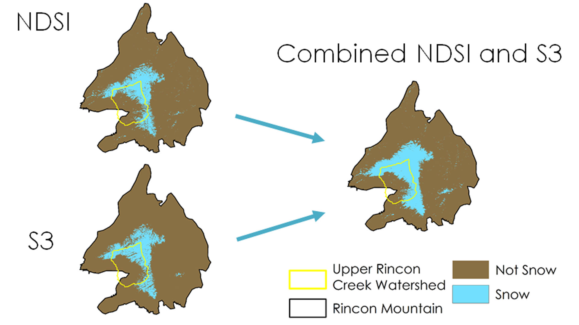
Southeastern Arizona is home to unique mountain ranges known as the Sky Islands. Sky islands are biodiversity hotspots and host various ecosystems, ranging from arid deserts to temperate forests. These mountain ecosystems rely on slow-melting snowpack to sustain themselves during dry periods. However, the changing climate and its contribution to decreasing snow cover is of growing concern. Currently, the National Park Service (NPS) monitors water presence, but a synoptic record of snow presence does not exist due to the remote and rugged topography of the region. As a result, it is difficult to study how the changing climate has affected water resources in the Sky Islands and what effect this has on wildlife and vegetation. This project used NASA Earth observations such as Landsat and MODIS data to aid the NPS in understanding the role of snow cover in the Arizona Sky Islands. Historical snow cover maps were created to address the current gap in information regarding snow presence. With a more complete understanding of the impact of snow cover, the NPS will be able to analyze past snow cover changes to improve future land management decisions.
Project Video:
How's it Snowing?
- Location
- Mobile County Health Department
- Term
- Spring 2017
- Partner(s)
- National Park Service, Intermountain Region
National Park Service, Saguaro National Park - NASA Earth Observations
- Landsat 5, TM
Landsat 7, ETM+
Landsat 8, OLI
Sentinel-2, MSI - Team
- Tyler Lynn (Project Lead)
Charles Barrow
Saranee Dutta
Elaina Gonsoroski - Advisor(s)
- Bernard Eichold, M.D., Dr. PH (Mobile County Health Department)
Joseph Spruce (NASA Langley Research Center)