Northern Great Plains Water Resources II
Utilizing NASA Earth Observations to Detect Changes in Annual Snowpack Coverage in Intermountain National Parks
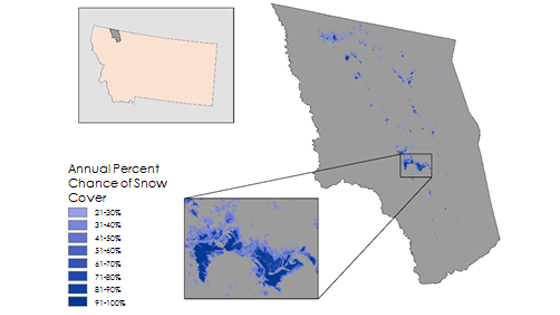
National Parks in the Intermountain region of the United States Northern Great Plains are experiencing changes in Persistent Ice and Snow Cover (PISC) due to changes in climate. Part of the mission of the National Park Service is to discover and protect cultural heritage sites; mapping changes in PISC is a crucial step in identifying archaeological sites exposed by the receding ice and snow. This project focused on three National Parks in the Intermountain region: Glacier, Grand Teton, and Yellowstone. Multispectral, 30 m resolution imagery from Landsat 5 TM and Landsat 8 OLI were composited and cloud-masked. A supervised classification was performed to identify areas of persistent ice and snow, vegetative cover, and bare ground using Google Earth Engine and the Intermountain Classification Engine for Glacier Recession in Parks (ICE GRIP) tool developed by the team. The resulting classifications highlight areas where PISC decreased between the months of August and September from 1984 to 2016 and delineate areas of interest to the National Park Service for the search and preservation of archaeological sites. Vegetative change and glacial extent were validated with National Agriculture Imagery Program (NAIP) imagery.
Project Video:
A Not So Ice-olated Incident
- Location
- Wise County Clerk of Court's Office
- Term
- Fall 2016
- Partner(s)
- National Park Service, Intermountain Region, Cultural Resources
- NASA Earth Observations
- Landsat 5, TM
Landsat 8, OLI - Team
- Kimberly Berry (Project Lead)
Alexander Black
Michael Brooke
Brooke Colley
Aubrey Hilte - Advisor(s)
- Dr. Kenton Ross (NASA DEVELOP National Program)
Dr. DeWayne Cecil (Global Science & Technology National Centers for Environmental Information [NCEI])
Robert VanGundy (University of Virginia's College at Wise)